Day 20 – Tuesday, March 29: Double Spring Gap Shelter to Fork Mountain Trail (Gatlinburg, TN), 6.4 miles, 203.1 total AT miles.

Note: I need wifi. I’ll update with pics over breakfast.

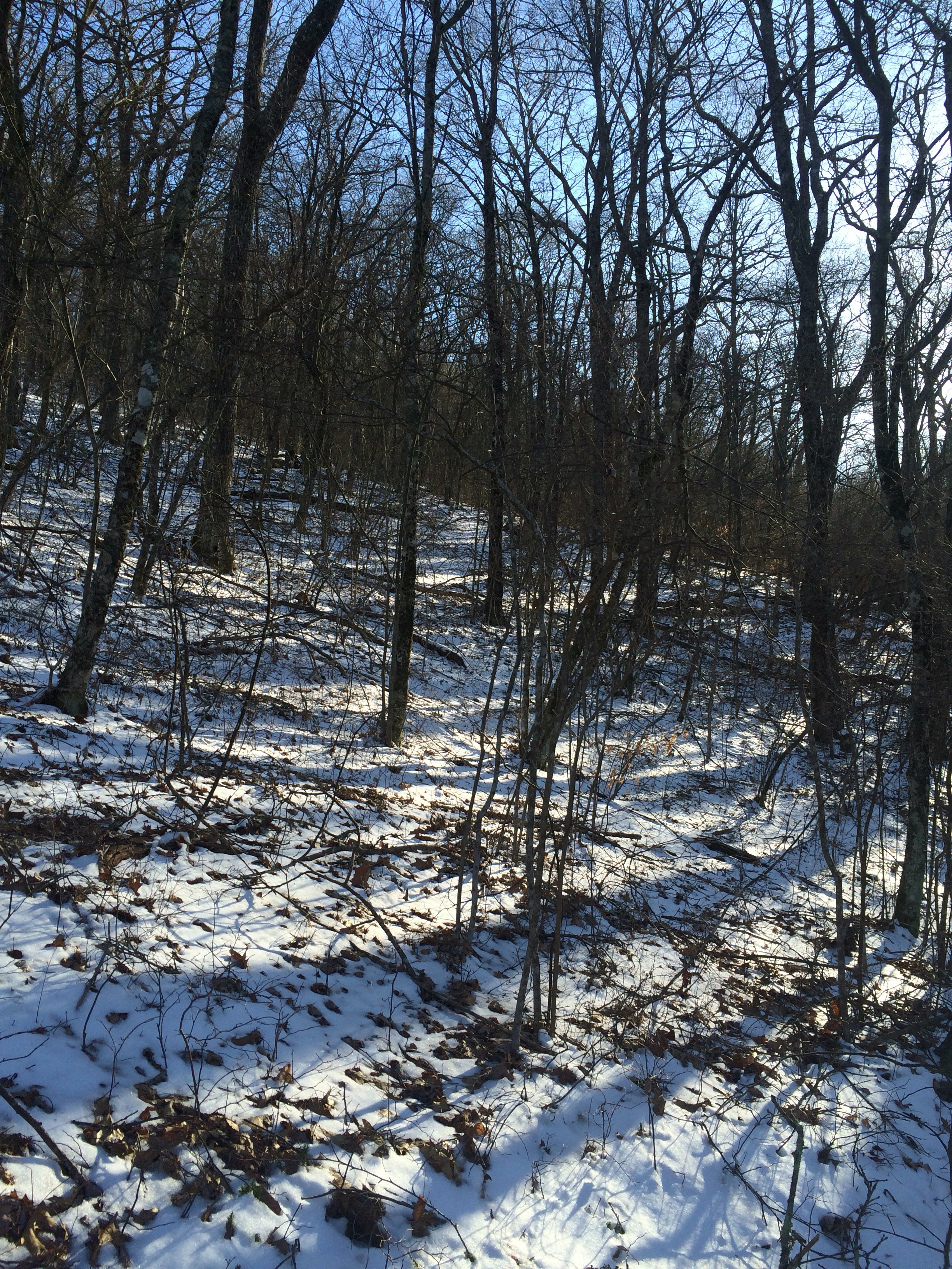
My alarm went off at 5:00 to remind me I committed to summit Clingman’s Dome for sunrise. The problem was that I wasn’t going to leave my sleeping bag. The thermometer on my bag (in my tent) read 30 degrees. There was a sheet of frost/ice on my rainfly – it was stiff to the touch. I slept on til 7:00, hoping sunrise would warm things up a bit.

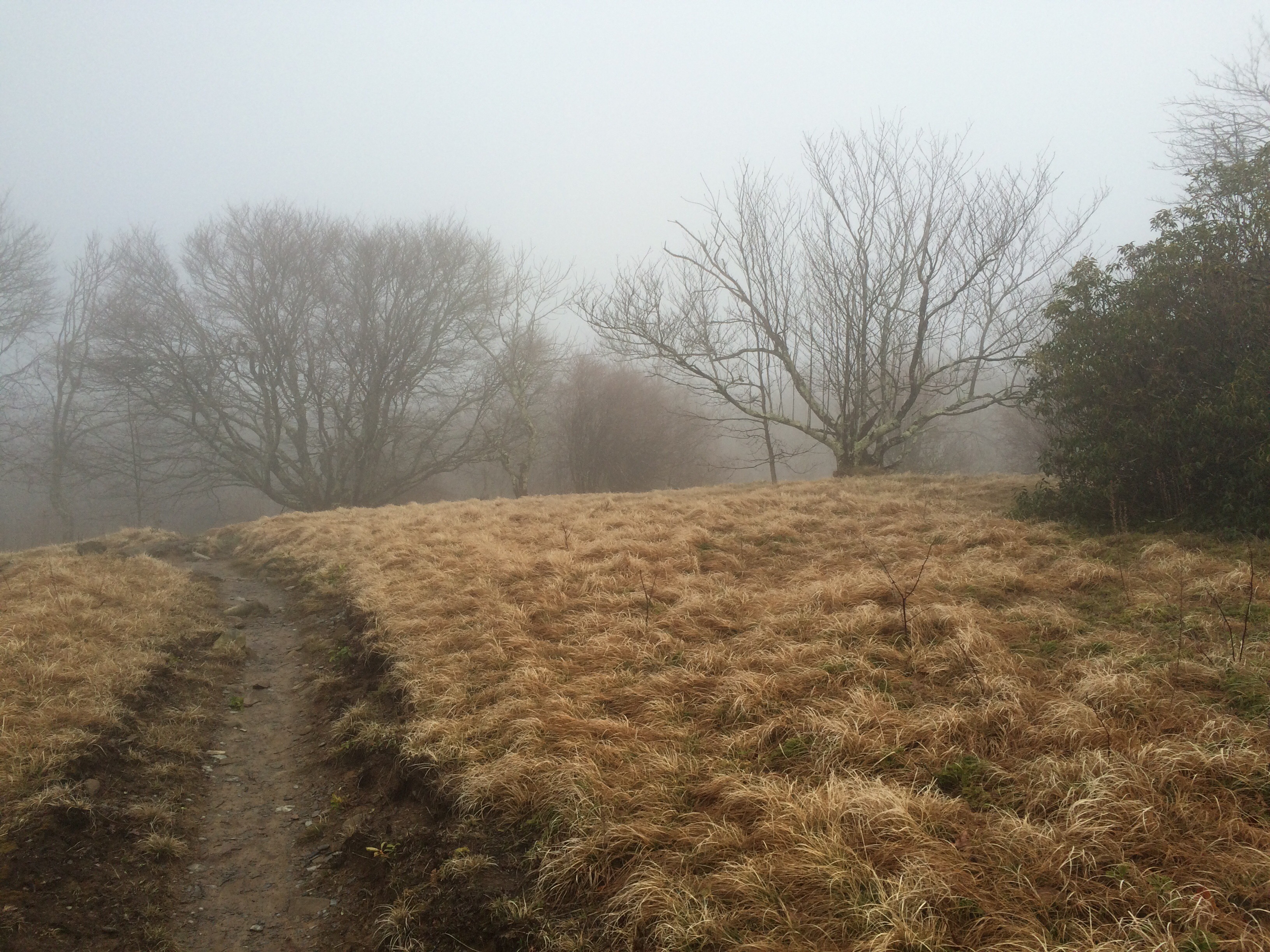
The problem with sleeping in gaps between mountains is that sometimes the sun rises parallel to the ridge you’re sleeping on – meaning that, while it was full-on bright outside, the sun still had to rise above Clingman’s Dome to illuminate Double Spring Gap.


I emerged from my tent to break camp wearing everything I own – that includes full rain gear AND socks covering my gloved hands. It should have taken me 30, maybe 45, minutes to ready myself to hike – this morning took 2 hours. I’d do something, then pace around for 5 minutes trying to warm myself up. I finally left camp to summit Clingman’s Dome at 9:00.

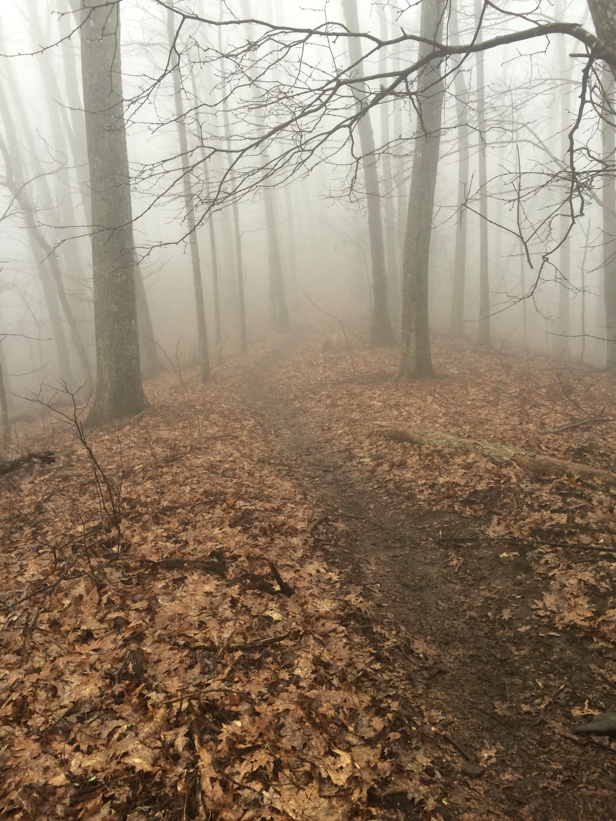
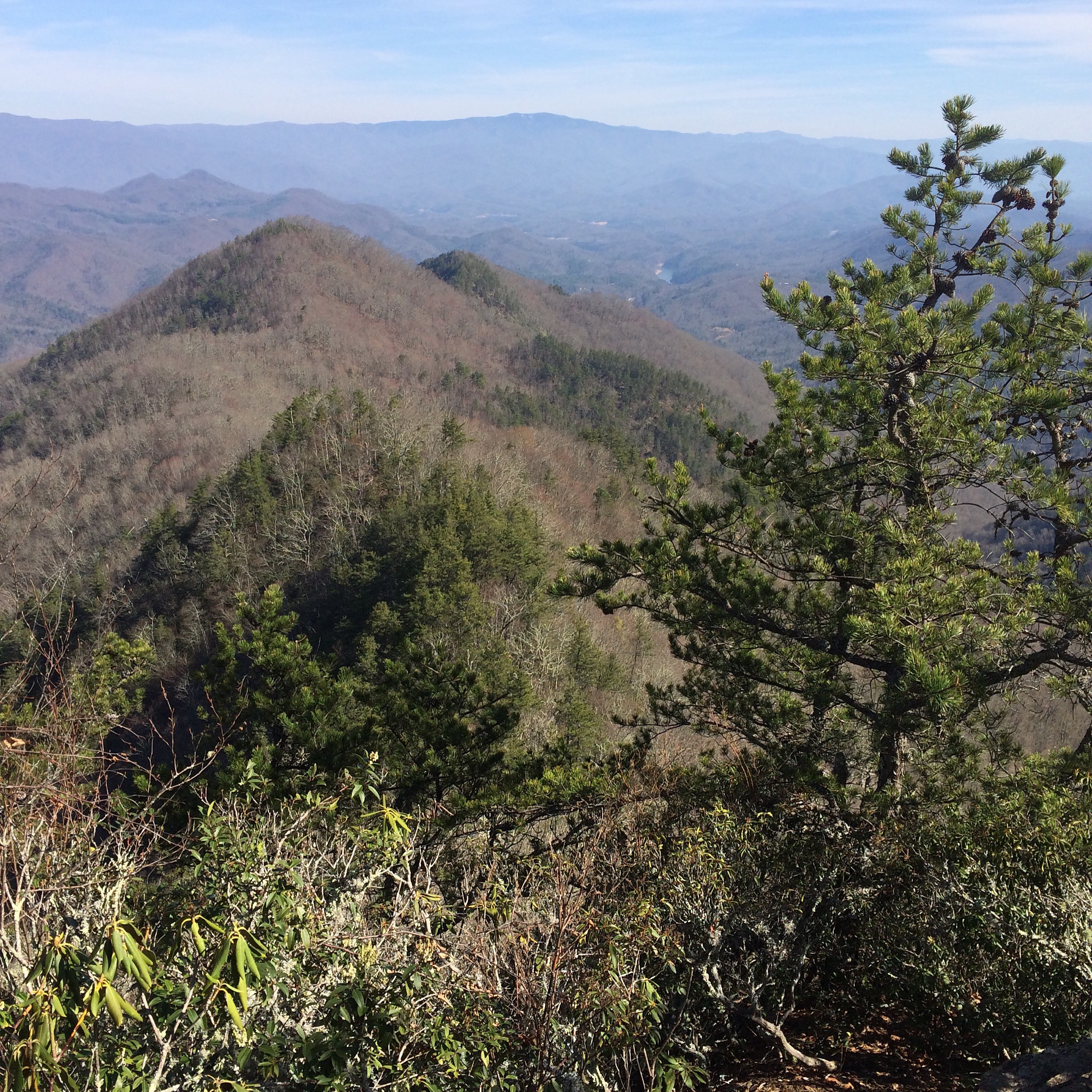
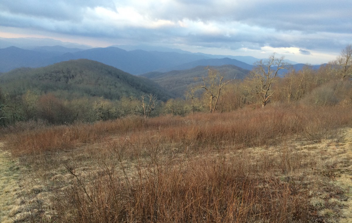
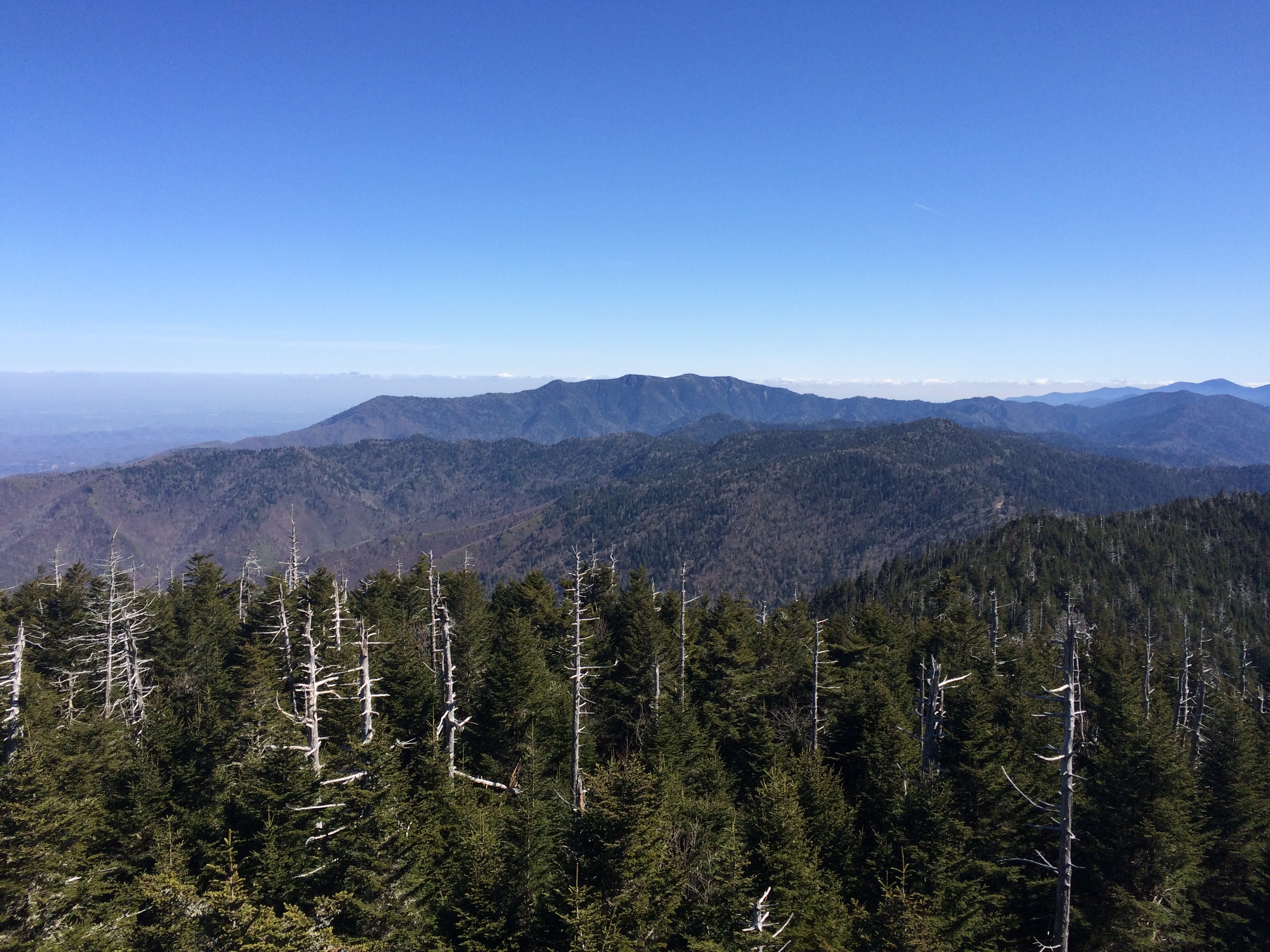
The hike up to Clingman’s was well-maintained and very hikable. When I got to the top, I understood why. The AT runs parallel to the trail visitors take to hike from the parking lot to the top of the mountain. I ran into so many folks deviating from the beaten path, if only for a half mile, just to officially walk on the AT. It was kinda cool.

Approaching Clingman’s Dome.

When I got to the dome, I dropped my pack and spread my saturated-but-thawing tent in the sun to dry. Keep in mind, I’m knee-deep in tourist central. I raced to the top of the tower to take the obligatory photo and promptly returned.

Looking north from the top.

After a trip to the privy and gift shop, I was elated to find Savage and Canuck waiting by my pack. They were ready to make it to Gatlinburg for a resupply. Unfortunately, they still had not heard from Kool-Aid or Kodak – still hoping all’s well.

It was 2:00 by the time we were ready to go. We set off with greater ambitions, but decided to use daylight to our advantage and hitch out of Clingman’s Dome at the first place possible – Fork Mountain Trail.

We hitched a ride with some college students from Chicago, kind enough to take the three of us to Gatlinburg. They dropped us off at the N.O.C. – yes, the same outfitters I had lunch at a week ago. This was their flagship location. I was able to snag a new dry bag for my tent (the wet, icy tent soaked through its stuff sack and saturated my bag) as well as a Mountain House Pad Thai meal – a trail classic, reserved for special times.

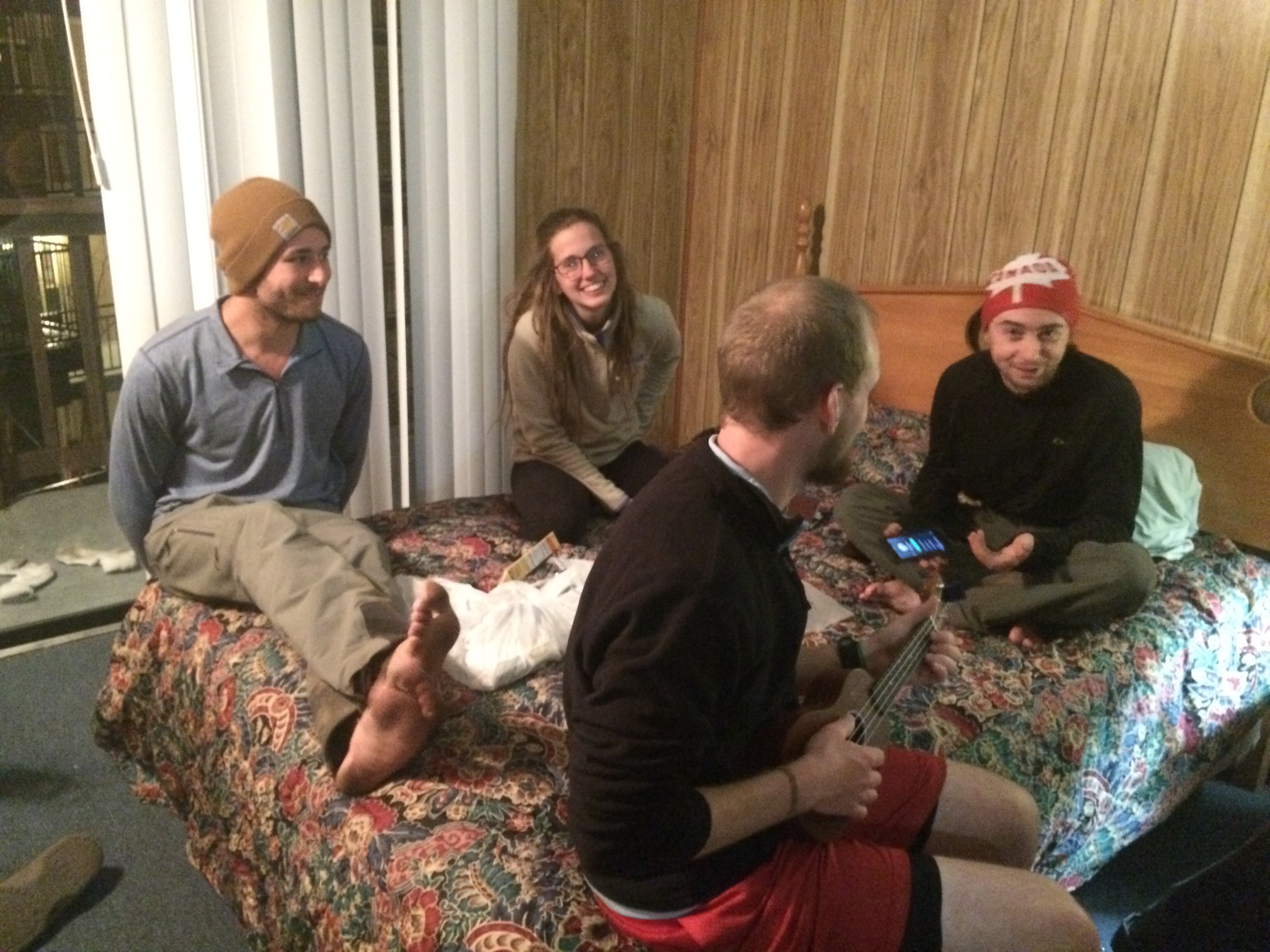
While at the Gatlinburg N.O.C., I reviewed the shuttle schedule and saw some familiar names slated for an early morning departure – Medicine Man, Moon Boots, Shaggy, Owl. We had friend in town! That settled it – we checked in to the Grand Prix Hotel (my grandparents probably thought it was nice in the 60s) and headed off to find our friends.

We actually ran into them around 5:00, just in time for dinner. The eight of us (we picked up a Swiss-German, Clutch) feasted. After a moderately successful resupply at Walgreens (our only option), we headed back to the hotel room to relax.


It’s late and I’m packed up, ready to go first thing. Shuttle leaves N.O.C. at 10:00. A townie told me there’s a proper Southern breakfast a few blocks up the street – given my new appetite, I’m already stoked.

Tonight in the hotel room, before Savage and Canuck went to bed and I to the balcony to type this thing, the three of us marveled at the fact that, aside from a food resupply, we didn’t really need to be in town. I mean, I did need a dry bag for my tent, but I could have made do until Virginia (hammock season). I didn’t even need to do laundry – still plenty of clean(ish) socks and undies to get me through to Hot Springs, NC, still another 4 hard-hiking days ahead.

The point is that I’m learning. The fires have been put out. I’m totally confident in my gear and can’t wait to lighten my load once springs hits. That’s still weeks, WEEKS, away.

In all, I am still having an amazing time. Today was the first day I met a large group of tourists. The questions they asked were the same questions I asked myself eleven months ago when I committed to doing this thing – “Why?” or “What about bears??”.

I am having the time of my life.

Breakfast: Sorry, I was too cold to eat

Snack (Clingman’s Dome): beef jerky, breakfast mix, 2 packs dried instant oatmeal

Lunch: half gallon of lemonade, pork rinds

Dinner: combo fajitas, side steamed broccoli

Late-Night Snack: half-pound of Canuck’s peanut M&Ms

Money:

Grand Prix (total room fee, $15)

Walgreens (resupply $44.15)

Dinner (Bailey’s fajitas $12.98)

N.O.C. $42.90

Day 19 – Monday, March 28: Spence Field Shelter to Double Spring Gap Shelter, 13.4 miles, 196.7 total AT miles.

I didn’t sleep well. I woke up shortly after midnight to howling winds and driving rain. The storm persisted in keeping me restless until it finally blew over at around 6:00. I decided to go ahead and get started.

Thankfully, I stayed dry despite the best attempts of the storm. The same could not be said for Canuck. His hammock’s first night in the rain failed the test. Chalk this one up to user error – Canuck left the tent takes for the rainfly back in Fontana and resorted to using sticks. He ended up completely drenched, huddled on the shelter floor.

It was another very cold and very foggy day. I started hiking right at 8:00. The trail today was tough. As it approaches Clingman’s Dome, it seems to strictly follow the same ridge line, ever ascending (and then sharply descending) in elevation. Instead of walking around mountains, today I walked on top of them.

The trail was also a mess. The heavy rains left puddles and slick mud in abundance. In little time, my boots and gaiters were thickly covered in black mud. It was slow going – I ate snacks as I hiked.


Despite temps in the low 40s and a fierce wind, the landscape today was stunning. Today was the first day I spent the majority of my time at or above 5,000 feet – pretty high for the Appalachians. I once again hiked in the clouds.


By the time I rolled into Derrick Knob Shelter for lunch and water, it was noon – I only hiked 6 miles in 4 hours. The steep ups and downs coupled with the muddy trail were really slowing me down.

As I was returning from “spring”, I ran into Canuck and Savage. They left substantially after me and were making great time. I reiterated my desire to summit Clingman’s and moved on. Still no word from Kool-Aid and Kodak at this point.


I filtered.
 
Just as I was about to leave the shelter, the most amazing thing happened – the clouds parted and for the first time in a few days, I saw blue skies. It already felt warmer! I powered on.

I finally got to see what all the fuss was about – the Smokeys are amazing. It’s the diversity of trees that gets me. For nearly the past 200 miles, I’ve been hiking in oak forests, the trees still bare from winter. Today it seemed like each mountain hosted it’s own little ecosystem dedicated to a different type of forest.

Despite my best efforts, I was not that quick making it to Silers Bald Shelter 6 miles up trail. I pulled in at 3:00 to eat again and check out my options.


Finally, the Great Smoky Mountains, as seen from Silers Bald.
 
I could continue trying to summit Clingman’s or I could stop in two miles at the last shelter before the summit and go for it first thing. It was windy and hovering in the 50s. My feet hurt.

I pulled into Double Spring Gap Shelter at 5:00 and quickly set up my tent. I filtered water, ate dinner, and, just as I was getting ready for bed, a hiker entered camp and asked if anyone knew a “cool dad”. I smiled and waved. She told me the others weren’t too far behind and will try to meet me tomorrow (she thinks).

The sun is just now setting and I’m already in bed. I’m beat. I think the cold, wet weather and gnarly trail really took a lot out of me today. I’m hoping for an early start – Clingman’s Dome is less than 3 miles way. I’d love to catch the sunrise from the watch tower.

The temperature tonight is getting to near freezing and the winds haven’t let up. I’m anticipating hiking out tomorrow at 6:00am and wearing everything I own. It’s going to be a brutal “up and over”, but I’m hoping it’ll be worth it.

And 8 miles after Clingman’s, I’ll hit Newfound Gap – and the pickup point for Gatlinburg, TN. In order to make it to Hot Springs, NC in five days, I’ll need an additional two days worth of food.

I’m going to try my best to make it in and out of Gatlinburg as quickly as possible – it’s all up to timing. I’d prefer to get back on the trail tomorrow evening with enough time to make camp. I’d also really like a burger.

Breakfast – coffee, 2 mini pasta/potato burritos from last night

Snack – three packets of dry instant oatmeal

Lunch – almonds, beef jerky, dried cranberries, sunflower seeds, 1/4 chocolate orange

Snack – beef jerky rolled up in flour tortillas with yellow mustard, dried cranberries, one whole (real) orange

Dinner (here we go) – I mixed a beef stroganoff Pasta Side with some generic instant mashed potatoes, the rest of that turkey summer sausage and a handful of bacon bits. I ate the whole pot. Then another 1/4 of the chocolate orange and coffee.

Day 18 – Sunday, March 27: Fontana Dam Shelter (the Fontana “Hilton”) to Spence Field Shelter, 17.3 miles, 183.2 total AT miles.

Happy Easter everyone! Today was an all-around, great day to be hiking the AT. The morning started early – I woke at 6:30 and made a mad dash to the privy. When I returned to my tent, I started breaking camp. The sun was just starting to rise. I silently left the tentsites, stopping by the shelter to wish Canuck (the only other one up) a nice day.

Leaving Fontana.

Leaving Fontana, the AT followed the shoreline until I reached the dam. While the visitor center was closed, it wish really cool to walk across the dam and into the Great Smoky Mountains. It had been overcast all morning, but as soon as I dropped my permit at the gate and started gaining altitude, I found myself hiking in the clouds.

  
It was stunning – for about 15 minutes. By the time I heard the wall of rain approaching from the distance, I was too late. I got caught with my pants down, struggling to strap on my gaiters in the middle of the rainstorm.

While the heavy rain was short-lived, it continued to sprinkle throughout the remainder of the day. I’m truly finding that the best way to tackle the rain is in my shorts with gaiters protecting my socks and boots (I still wear my rain jacket).

The ascent into the Smokeys is steep, but wasn’t exceptionally rough. I really felt great today. My legs and back have felt really good – I made really good time today. This is the third day without a knee brace and the right knee is doing fine – still hurts just a little if I land wrong or slip, but really not even an issue anymore.

As I stopped to refill water from a trickle of a spring, a few of the hikers I rented with last night passed by for the shelters ahead. Just as I was wrapping up, Canuck appeared. We actually hiked within a few minutes of each other most of the day.


The scenery was truly stunning today. I haven’t hiked in forest like this in the Southeast – today reminded me of the Pacific Northwest. For the greater part of the day, I stayed walking in clouds. At times, the visibility was reduced to about 100 feet – it was awesome.

Having been off-trail for 36 or so hours, I was surprised to see that the forest floor had come alive with tiny green shoots pushing through the dead leaves. I really am walking into spring – things are changing every day. Pretty incredible!

  
A couple of miles before Mollie’s Ridge Shelter, Savage caught up to me. She said she left Kool-Aid and Kanuck behind at the Hilton and started hiking about 45 minutes after me. Within a few minutes, we caught up with Canuck and a Ridgerunner, Grey Beard. A Ridgerunner is often an ATC volunteer who makes sure hikers stay safe and the campgrounds stay clean.

We’ve know for a while now we’d be likely staying in shelters, as they’re essentially mandatory in the Smokeys. Grey Beard confirmed our suspicions and attempted to allay our concerns regarding Norovirus. Wash your hands, folks.

The three of us stopped for a quick snack and Mollie’s Ridge, then again at Russell Field Shelter. The three of us made it Spence Field Shelter at 5:45 – that’s 17 miles in just under 10 hours. Not bad.

When I walked into the shelter area, I was surprised to see folks setting up their tents. Savage saw me and confirmed that the shelter was full – unless we wanted to squeeze into the shelter, we HAD to tent. Thank God. I really don’t want to stay in a shelter in the Smokeys. No Noro.

After I set up camp, I gathered water and scrubbed up for dinner. I made a filling dinner at least and chatted with other hikers before retiring to my tent. Kool-Aid and Kodak never came in – hope all is well.

There’s a good chance for heavy rain tonight and into the morning. I’m hoping to get a good night’s sleep and start early again tomorrow.

There’s a few logistical issues that I’ll need to figure out in the coming days. Hot Springs, NC is 90 miles ahead – that’s 5 to 6 days strong hiking with no problems. Gatlinburg is only about 25 miles up trail, but hitching into Gatlinburg to ensure I have enough food to reach Hot Springs will probably mean I’ll end up staying there. Or I could just roll the dice and press on. I might have enough food.

I’m not opposed to getting off trail to buy food and supplies in Gatlinburg, but it’s pretty well-known that resupplying in these mountain towns has a way of sucking you in. I’ve been wanting to be out here for longer than 4 or 5 days at a stretch. I’ll get there.

Tomorrow, I’ll more than likely summit Clingman’s Dome in the early afternoon. It’s the highest point on the AT at 6,667 feet. While, it’s probably gonna be completely socked in with clouds, I still want to climb the tower.

And big news – today, totally unbeknownst to me, I crossed into Tennessee at Doe Knob (mile 174.2). The trail apparently had been straddling the NC/TN border for most of the day and I had no idea. That’s three states down – feeling pretty good.

Breakfast: breakfast mix (I’m getting really sick of almonds)

Snack: beef jerky

Lunch: the rest of today’s breakfast mix

Snack: half a Snickers, beef jerky

Dinner: It started with turkey summer sausage and broccoli and cheese noodles. I used too much water, so I added instant potatoes. I ended up spreading my food paste on tortillas. It really wasn’t that bad. I saved a few for breakfast.

Day 17 – Saturday, March 26: Fontana Dam to Fontana Dam Shelter (the Fontana Hilton), 1.2 miles, 165.9 total AT miles

I woke first this morning and took a long shower. By the time I was done, the rest of the guys were mulling about, packing scattered gear into packs and organizing food bags.

I went to the lobby and utilized the only good wifi location to make some calls and upload a few posts. It’s nice to be in contact with loved ones – even a few minutes on the phone really lifts my day.

I sat with the guys from the adjoining room and watched as they, and many others, caught the shuttle to the trailhead to enter the Smokeys. At noon, we (Kool-Aid, Canuck, Kodak and Savage) walked to the Pit-Spot, a gas station/”country pantry” for a quick resupply (and breakfast). We then quickly snagged a shuttle to the trailhead.

The beautiful Fontana Lodge .

While I was excited to enter the Smokeys, I have to admit – I’m a little banged up from the hike so far. I’m old, far from my prime.

And being in town (or, in this case “town”) isn’t as relaxing as you might think. Imagine having to do all of your errands in one day – then imagine doing them on foot OR relying on the kindness of strangers for a hitch to get from place to place.

So when Kool-Aid suggested stopping at the Fontana “Hilton”, the supposed best shelter on the AT, and tenting for the night, I was right on board. And I’m very thankful I stopped. While I feel like I’m hiking strong, my body is very sore and tired. I got a good look at myself after my shower this morning and I am dropping weight – not a lot, but it’s a little noticeable.

We made camp at 1:00. Savage, Kool-Aid and I decided to hitch back the the Pit-Stop for pizza and snacks while Kodak and Canuck watched camp. We immediately caught a ride from a friendly section hiker.

Upon returning to camp, I devoured the pizza and found myself making a second dinner. After some great conversation, I said goodnight.

I’m happy I took some time to rest and recupperate. This hike is a whole lot harder than I expected. You know, when I was working at Elliott’s in Seattle, I considered my walk to work enough training for this thing. I was dead wrong. This trail is kicking my ass.

Tomorrow will be no exception. I’m planning on an early rise for Easter Sunday – I want to get started as the sun comes up. My plan is to hike a decent couple of days, with a potential resupply in Gatlinburg. If not, I’ll press on to Hot Springs by week’s end.

So, I’ve been doing a lot of thinking. I’m hesitant to say exactly what the outcome/s are or have been. I think it’s enough to say I’m happy. I’m learning how to be present – to enjoy the moment without worrying about tomorrow or lamenting yesterday. It doesn’t come natural. That’s enough of that.

Food! An efficient resupply is obviously a big deal. For me, the issue is making sure I have enough protein. Protein is heavy compared to carbs and I often find myself protein deficient/carb heavy right before I head into town.


Four to five days of food. Also a nice shot of my stove, bear bag rope and camp shoes.
 
So when I say four to five days worth of food, it’s really four to five days worth of protein. I snagged three bags of instant potatoes from the hiker box this morning – carbs are easy to come across. Right now, I’m consuming 90 grams of protein and 4,000 calories per day. I eat a lot.

Breakfast: Sausage dog with sauerkraut and onions.

Snack: Powerbar vanilla protein bar, Lanch PB and cheese crackers.

Lunch: 8″ pepperoni pizza

Dinner: Beef Stroganoff, s’mores.

Snack: Gooey Butter Cake (not as good as the 5 Spot), handful of almonds.

Day 16 – Friday, March 25: Cable Gap Shelter to Fontana Dam, 5.5 miles, 164.7 total AT miles

I woke early and packed quickly, excited at the prospect of heading into town. As I packed, I did a quick inventory of my gear and decided I would send a few things home when I reached Fontana.

The descent into Fontana Dam was rugged and foggy from all the rain during the night. Before leaving camp, I decided to take two ibuprofen and not use my knee brace today. I’m glad I did – I think somehow the knee brace was doing more harm than good. While I still had to take it easy, I was able to move a little quicker without the brace limiting my range of motion.

  
After a series of switchbacks, I emerged onto Fontana Dam road at noon. I quickly caught a shuttle and checked in to the lodge. I hiked down to the “town” to do laundry and resupply. Fontana isn’t a real town, more than a resort with stores. There is no cell phone reception anywhere and the “campus-wide wifi” isn’t strong enough to make outgoing phone calls.

  
As the other guys poured into the Lodge, we found out pretty quick that our next door neighbors were the group Savage had been hiking with the past few days. Pretty cool – our group now included Medicine Man, Moon Boots, Shaggy and Owl.

We all sat down to a nice dinner and mingled with other hikers afterward.

I’m very tired, but ready to go – I received my mail drop that included enough food to get me to Gatlinberg as well as my zoom lens. While I haven’t had luck uploading pics from my camera to the website (I need GOOD wifi), I’ve been taking a lot of nice pictures. I promise.

I can’t wait to start the Smokeys tomorrow. I’m planning on hiking in about 10 miles and tenting (hopefully) at the first shelter. There are rumors of bear sightings.

Breakfast: nothing

Lunch: Ray’s Dill Pickle Potato chips and French’s Creamy French Onion dip

Dinner: No burger. I went for the meatloaf plate with and extra side of fries.

Late nite snack: Chex Mix

Money:

Shuttle: $3.00 plus $2.00 tip

Laundry: $4.00

Fontana Village General Store: $32.20

Lodge restaurant: $15.90 plus $5.00 tip

Post Office: $28.01. Canuck finally received his hammock and was about to donate his very nice Marmot tent to a hiker box. Instead, I paid for his room and shipped the tent to my storage unit in Seattle.

Room: $15.56 (times two)

Day 15 – Thursday, March 24: Sassafras Gap Shelter to Cable Gap Shelter, 15.2 miles, 159.2 total AT miles.

I woke up frequently throughout the night. It wasn’t until I finished typing and tried to settle down for bed that I realized my tent was in an extremely awkward position for sleeping. I ended up sleeping like a macaroni noodle – my body bent at the middle with arms and head falling to one side of the tree and legs to another.

I still got up at 6:00, ready to go. I packed quickly, hoping to catch the sunrise on Cheoah Bald. I raced uphill, pausing only once to shed layers as I was sweating. I reached the top and was greeted with both a beautiful sunrise and a blast of cold wind racing over the bald. I redressed quickly.


I paused to take a few photos, eat breakfast and brush my teeth. A few of the hikers I met last night eventually made their way to the top of the bald and headed north.

I was content being towards the end of the pack today as my knee was already starting to hurt. I knew there’d be a couple of tricky descents today – starting right away with a 1400 foot descent into Locust Cove Gap. My knee started hurting but I hiked on.

I had another tricky descent into Stecoah Gap at a road crossing and was met by about 15 thru-hikers taking a morning break. Fontana Dam/Smokey Mtns is similar to Blood Mountain/Neel’s Gap in that they both act as bottlenecks on the trail. Due to limited camping options before major town stops, hikers sort-of bunch up on the outskirts of town, in hopes they’re up early and in their hotel/hostel as soon as possible.

Descent into Stecoah Gap.

As I sat and had a quick snack, I realized everyone had the same plan – to sleep at Cable Gap Shelter about 8.5 miles ahead. Great. This bubble of hikers I had wandered into moved a lot quicker than me.

Just as I was getting ready to leave, Canuck and Kodak popped out of the woods. I set off, trying to get a head start, but was passed within the hour by every single hiker I took a break with.

I don’t know how I missed this last night, but I soon found myself in the middle of Jacob’s Ladder – arguably the steepest ascent I’ve met so far. It’s 600 feet gained in .6 miles in one straight line. I paused halfway up and let people pass. After I made it to the top, I stripped off my boots and put some tape on my left heel – I was starting to get rubbed a little raw.

I stopped at Brown Fork Gap for water – 3 liters, just enough to get me to Cable Gap without stopping.the next 6 miles into camp were great hiking. I was back in shorts and enjoying the gentle grade. I felt like I was making good time.

After Jacob’s Ladder just before Brown Fork Gap.

About two miles away from Cable, the sky started getting dark. I started hiking faster. At a road crossing less than a mile from camp, the sky opened up. I was quickly forced into full rain gear and pack cover for the last mile in.

As I came into Cable Gap at 5:00, I quickly realized my suspicions about being in a hiker bubble were correct. The shelter was full and at least 20 tents had already been set up at various terraced levels around the gap. It was still pouring.

I set my pack down outside of the shelter (standing room only) and grabbed my tent and poles. I figured the sooner I got my tent up, the sooner I could getting dry. I put it up as fast as I can. I tried to save time and focus on the rain fly instead of the tent stakes. Bad move – a gust of wind started to carry it down the mountain.

I finally got it up and secure from the wind and driving rain. I walked back to my pack at the shelter. I grabbed my sleeping pad and two camp towels back up to my tent. I wiped down the inside as best I could, spread out my sleeping pad, and collapsed. I laid there for about 20 minutes, listening to the rain. I eventually brought my other gear up to the tent and got ready to cook dinner down at the shelter.

Shelters are interesting. A half-full shelter with people you know is kinda fun. A shelter full of strangers looks awful. As a row of hikers sat cooking on the edge, the lucky tenants of the shelter sat silently in the shadows, their backs against the wall. I ate quickly and said little.

While the predictability of hiking in a small group is comfortable, I do enjoy these times when a large group of hikers gets stuck somewhere for the same reason. And everyone’s headed into Fontana Dam tomorrow.
There’s little I need to buy in the way of food – I’m getting a mail drop at the perfect time. I do need to get some smaller compression sacks for my tent and clothes. And I’m looking forward to a burger.

I’ve been thinking about a burger ever since I ate that healthy lentil dish at the N.O.C. and everyone else gorged themselves on tasty food. I really want a burger.

I’m also interested in weighing myself. I feel like I’ve been eating enough carbs and protein to maintain this level of activity. If I have lost anything, it assuredly will be very little.

Tomorrow’s hike is only 5.5 miles down to Fontana Dam. I’ll take the rest of the night off and enter the Smokey’s Saturday afternoon. I might take the opportunity to visit Gatlinburg, TN sometime next week for a resupply if necessary. That’s all I know now.

I’m looking forward to warmer weather and more time between stops in town. It seems like it’s harder to stay clean in the cold – I’m bundled up in the same clothes for days on end, changing only socks and underwear infrequently. Sometimes I’ll catch a whiff of myself – it’s terrible. But we all smell like this. Everyone has dirt under their fingernails. It’s fun.

Despite my knee (which felt better as soon as I stopped all the descents) and the wet weather, I’m truly having a great time. I still pause and smile at the top of every mountain I summit. I need to put getting up early back into practice – I really enjoyed hiking towards the sunrise this morning.

Today was a music day – I didn’t really ponder much of anything. I do feel noticeably better, and have a better day on the trail, when I’m up early. We’ll see how that goes.

I know the norovirus outbreak was reported back home in Atlanta – for us hikers, informational leaflets are posted at trail heads and in privies. All I can do is stay as clean as possible AND as far away from everyone as possible. 

It’s getting late for me. The rain has finally stopped but the wind has picked up. Despite the fact I’ve had to rig my tent to keep it up, I’m still surprised that it keeps me dry. I might hold onto it for a little while.

Breakfast: breakfast mix

Snack: beef jerky

Lunch: breakfast mix

Snack: beef jerky x2

Dinner: about three cups of couscous with salmon, bacon and powdered mushroom gravy

Day 14 – Wednesday, March 23: Wesser Bald Shelter to Sassafras Gap Shelter, 12.6 miles, 144.0 total AT miles.

I woke up warm and cozy in the shelter – it really wasn’t that bad. As I visited the privy, Kool-Aid and Canuck backtracked a mile to the fire tower on Wesser Bald to watch the sunrise. I returned to the shelter to pack while Kodak slept.

The four of us had a lengthy breakfast and got started around 9:00. I wasn’t looking forward to the hike today. I’ve got two resources I use to check where I’m going, paying close attention to elevation changes.

I’ve got the A.T. Guide – a paperback book of elevation charts and trail town maps. This is what I was looking at this morning:


The two circled spots represent today’s start and finish. My dirty thumb is the N.O.C. I also use the Guthook’s AT Guide app on my iPhone. It is GPS enabled and tracks me – in this case, I’m the blue dot on the right (in my tent at Sassafras Gap), the N.O.C. is in the valley, and the orange icon on the left represents the shelter I woke up in this morning (at Wesser Bald).

  
Note: The above screenshot looks huge using my WordPress app. Moving on.

So I use both of these resources to plan my day, look for water, prepare for tough hikes, etc. I was not looking forward to today’s hike – I feel like I may have said this a lot, but today was, by far, the hardest day yet.

About a 1.5 miles from camp, I caught an amazing view of the day to come.


I’m camped somewhere on that ridge line in the background.
 
The descent into the N.O.C. was really hard on my right knee. I took it slow. In no time, I was passed by my hiking buddies and stayed at the end all day.

The N.O.C. itself was smaller than I imagined. I was able to have a hot lunch at the restaurant and buy some necessities at the outfitter. It felt good to scour the store and not come away with any major purchases.

At 3:00, I started the 6.5 mile, 3000 foot climb up. There were few breaks in the terrain.


Straight up Cheoah Bald. The trail was rocky like this for a large portion of the hike.
 
The sun was setting as I wound my way down into Sassafras Gap. It was packed. I seriously hadn’t seen this many tents packed into a campsite since that thunderstorm at Lance Creek, the day before I summited Blood Mountain.

Fitting then that I run into Alex, the hiker who attacked Blood Mountain in the dark, the fog and the rain at 5:00am with Savage and me about ten days ago.

It’s cool seeing a familiar face who shared a brief, but completely spectacular, experience. Apparently Alex saw Savage today, who’s now a good day ahead of us – she’s still planning on meeting us at Fontana though.

After my no-cook snack dinner, I hung out by the campfire with a group I had never met before – all good folks. I met a couple this morning, and again tonight, where he had to get off the trail because of knee problems last year. Really puts those early huge mile days into perspective.

Tonight, the four guys I’ve been hiking with are spread out all over this makeshift camp. I’m planning on waking early and hiking out a mile to have breakfast on the summit of Cheoah Bald to catch the sunrise.

It was a full moon tonight – an orange one at that. Folks have been catching a tandem moonset/sunrise combo lately. I’ve seen pictures – it looks amazing. I really hope I’m up early enough to see it for myself.

I had to set up my tent in the dark, on a hill, at the base of this big tree. The tree is preventing me from rolling downhill, you see. I’m kind of tacoed in here, but it works.

Breakfast: breakfast mix

Lunch: The Sherpa with Chicken – rice, lentils, broccoli, mushroom, onion. It was awesome.

  
Dinner: too late/dark to cook so two bags of beef jerky, breakfast mix, the rest of the chocolate bunny, one bag of peanut M&Ms.

Money:

$9.95 plus $5.05 tip for lunch at the N.O.C

$44.43 for some stickers and a patch, a stabilizer for my fuel canisters, some Darn Tough hiking socks (A.T. Edition), some tiny soap sheets, and a pack of butt wipes.

Day 13 – Tuesday, March 22: Siler Bald Shelter to Wasser Bald Shelter, 17.4 miles, 131.4 total AT miles.

Note: I added a couple of pics to Day 12. Decent reception tonight, but still kinda slow on the upload.

I’m usually pretty efficient in the mornings when I want to be, but the fact that I slept with most of my gear last night to prevent it from freezing got me off to a slow start.

I ended up with what’s called a “yard sale” outside my tent. In order to get organized for the day ahead, I had to throw all of my gear out of my tent and repack it properly. Thankfully, nothing froze and I was able to stay very warm all night long despite the sub-freezing temperatures.

Leaving Siler Bald.

Today’s miles were ambitious, especially with the late start. I got on the trail ahead of the pack at 9:00. Even at that late hour, I still started out the day in full winter gear.

Today was pretty tough on my knees. I gained elevation rapidly and hiked at over 5000 feet for most of the day. The majority of the peaks I crossed today are known as balds – but not in the sense that they are naturally tree-free at the top. Most have a small, grassy clearing and a few have derelict fire towers perched atop.

My first stop of the day was at Wayah Bald, about six miles up trail. By this time, Canuck had caught up with me and we hiked to the top to find trail magic. Kicho, an older gentlemen who had thru-hiked the AT decades ago, set up a serious snack buffet. Despite the fact I already ate breakfast on the trail, I still stopped and had a few treats.

I was packing up to leave when Kool-Aid and Kodak wandered in. We confirmed our plan was still to meet at Wesser Bald and camp on the top. As I left Wayah Bald, I caught some amazing views from the stone observation tower located right on the AT.


The descent down Wayah Bald was fairly steep. It seemed like just as I was finally making good time, the ascent up Copper Ridge Bald slowed me down again. I followed the ridge for about a mile and hit Rocky Bald.

The views would have been nice, but the valleys were starting to fill with smoke – I could smell campfire in the air. After another steep descent, this time into Tellico Gap, I stopped a utility worker and asked what was going on with all the smoke. He told me the county was doing a controlled burn in the area.

My last two miles, that steep ascent up Wesser Bald, was tough. I knew there was an old fire tower at the top and was hoping for enough room to set up camp. It was Canuck, again, who caught up with me. We decided to press on to the shelter less than a mile away.

By the time we go there, it was already getting dark. I noticed the shelter was empty. I went for it. After all that talk of hating shelters, I found myself thankful that I didn’t have to set up my tent. I plopped right down and made a tasty dinner.

Kool-Aid and Kodak arrived at sunset and the four of us spread out on the wooden floor. I’m apprehensive about this. If I thought a mouse might enjoy it, I hung it in my bear bag. I’m sleeping with my water system again – not for fear of it freezing, but because I don’t want a mouse chewing on it.

It feels good to have finally figured out my water system. It’s a pretty simple setup. I put untreated water in the Platypus that sits in the brain of my pack. I cut the drinking tube and inserted my Sawyer Mini. So, as I drink, I’m drawing dirty water through the filter and into my mouth. There’s several ways to set up such a system – I just went for simplicity.

Pretty simple. Probably one of the most popular rigs.

Tomorrow looks tough. There’s a six mile descent to the Nantahala Outdoor Center (N.O.C.), a nature complex complete with river rafting, a restaurant, and an outfitter. I’m pretty sure I don’t need to buy anything. Maybe a little Thermarest folding cushion for my butt when I sit. We’ll see.

Upon leaving the N.O.C., there’s an eight mile ascent to Sassafras Gap Shelter and Cheoah Bald. I’m beginning to recognize that I need to slow my pace a little. While I’m still making good time, these mountains are too much for consecutive 15+ mile days.

I did a lot of thinking while hiking today. I didn’t figure anything out.

I’m looking forward to using the privy first thing to moron morning – one of the few benefits of sleeping in a shelter. I’m constipated.

Don’t worry.

Breakfast: Almonds, sunflower seeds, dried cranberries and granola. I’m calling this “breakfast mix” from now on. I purchased a Granite Gear accessory pocket for my hip belt. Now I can eat on the go. It was like two cups in all.

Lunch (trail magic): Little Debbie Raisin Creme Pie, two oranges, a banana, two fun size snickers.

Snack 1 and 2: beef jerky

Dinner: Parmesan Salmon couscous, 1/3 of a dark chocolate Easter Bunny (thanks Amanda!), coffee

Day 12 – Monday, March 21: Winding Stair Gap to Siler Bald Shelter, 4.2 miles, 114.0 total AT miles.

Note: Bad cell reception so no pics tonight. It’s a shame too. I ended up adding a few pics to Day 9 and 10 this morning at the hotel. That might have to become the norm until cell coverage improves.

I woke up in the hotel room to the strong odor of body funk. Despite the fact we had all showered and washed our clothes, the lingering odor of four days in the woods was all I could smell.

I uploaded pictures and handled my finances over breakfast. I went back to my room and started to pack up. Last night, Kodak gave me a “gear shakedown” to help me find ways to eliminate weight by getting rid of redundant items or gear I’m not using.

I had some tough decisions to make. I already did this in Hiawassee, GA, but still felt my pack was too heavy. After careful consideration, I had to say goodbye to my Alite chair among other things. I’m thankful I did – I sent a package home that weighed nearly three pounds.

It’s kind of crazy to think about the amount of knowledge I’ve gained in this short time with regards to gear and organization. Not that I know what’s best or anything like that, just that I now know what’s necessary versus what’s helpful. For example, backup water filter (Sawyer at a few ounces) – necessary. Alite folding camp chair (at just over a pound) – helpful.

Right now my pack weights 42 pounds – that includes three liters of water and a five day food supply. And I’m satisfied with that.

I’ve also learned that organization is key. What was once a ridiculously hyper-prepared first aid kit AND an over-stuffed toiletry kit have been condensed into one bag. I can now easily throw my toiletry/first aid kit into the food bag when I hang it at night.

Fun fact: Bears are supposedly attracted to the scent of lotion, deodorant, toothpaste, etc. This means they get hung with food at night.

Savage left at 10:00 to hit the post office and then start hiking. I hung around with Kool-Aid, Kodak and Canuck while waiting for a package from Seattle to arrive. The guys left at 1:00 to head to the post office and I relaxed in the lobby of the hotel. At 2:30, I got my envelope and immediately hit the road, taking a public transit van to the trailhead.

Today’s hike only called for just over 4 miles to Siler Bald Shelter. We decided last night that we wouldn’t push it today – there’s plenty of miles in the days ahead. Plus, the temp is supposed to drop into the 20’s tonight – I’d rather be tenting in a spot with a guaranteed fire ring.

I started hiking at 4:00 and made it to camp right at 6:00. I did get a surprise when I started ascending Siler Bald. What was a few flurries in Franklin was about an inch of snow at higher elevations. While I didn’t get a chance to hike in the falling snow, it certainly was a nice treat.


Nearing Siler Bald.
 
After a hearty dinner, I’m already in my sleeping bag. I didn’t sleep well in the hotel and am looking forward to a good night’s rest.

I just checked my thermometer – it’s 33, 34 degrees inside my tent. Speaking of which, I need to repair my tent tomorrow. One of the zippers broke on the rainfly. It’s still water tight, I just can’t use one of the doors. As soon as I have an opportunity, it’s going back to REI.


Tenting in the snow at Siler Bald. I’m freezing.
 
Over these next three days, I need to cover about 15 miles per day to reach Fontana Dam – the gateway to the Smokeys. This morning, I paid for my thru-hiking permit to gain entry to the Smokeys. Due to bears and the sheer volume of folks hiking and camping, the Smokies have some very strict guidelines – one of them being you must sleep inside a shelter, if possible.

This troubles me. I haven’t slept in a shelter for a few reasons – I enjoy the illusion of privacy my tent affords. Plus I can stay up late and write. I don’t have to worry about mice or snoring and so on.

There’s that, plus there’s been a norovirus outbreak among hikers in NC, so bad that the shelter rules have been relaxed in the Smokeys (according to rumor, so who knows).

I’m glad to be back on the trail. Going to town is nice, but it’s stressful. I’ve yet to stay in a hotel in a central location – Kool-Aid and I ended up walking four miles round-trip just to go to the outfitter and Walgreens. Throw in a couple trips to Ingles and we essentially spent our off-day doing a little urban hiking.

I’ve got (another) new water system. It’s pretty slick – I’ll try to take some photos of it.

Breakfast: blueberry waffle, OJ, coffee
Lunch: half a chicken sandwich from last night
Snack: almonds and beef jerky
Dinner: pasta with chicken gravy, salmon and bacon. I’ll admit, it sounds like a dog food flavor, but it was pretty tasty.

Day 11 – Sunday, March 20: Franklin, NC, Zero Day

I just did the usual town stuff – nothing special. It’s late and I still have to pack. I’ll add up my expenses after I find my receipts. Today went too fast y’all. I’m beat.

Most importantly, the 22 miles didn’t hurt my knee – it felt fine this morning when I woke up.

I have to go to the post office tomorrow morning and wait at the hotel for a package. I should start hiking again tomorrow afternoon and expect to make it 5 or so miles before camping for the night.

It’s about 55 miles from Winding Stair to Fontana Dam. I already have a reservation for a room at the Fontana Lodge for Friday.

Gotta go – it’s late and I’m tired.