Day 51 – Friday, April 29: Dismal Falls to Pearisburg, VA, 24.5 miles, 634.6 total AT miles.

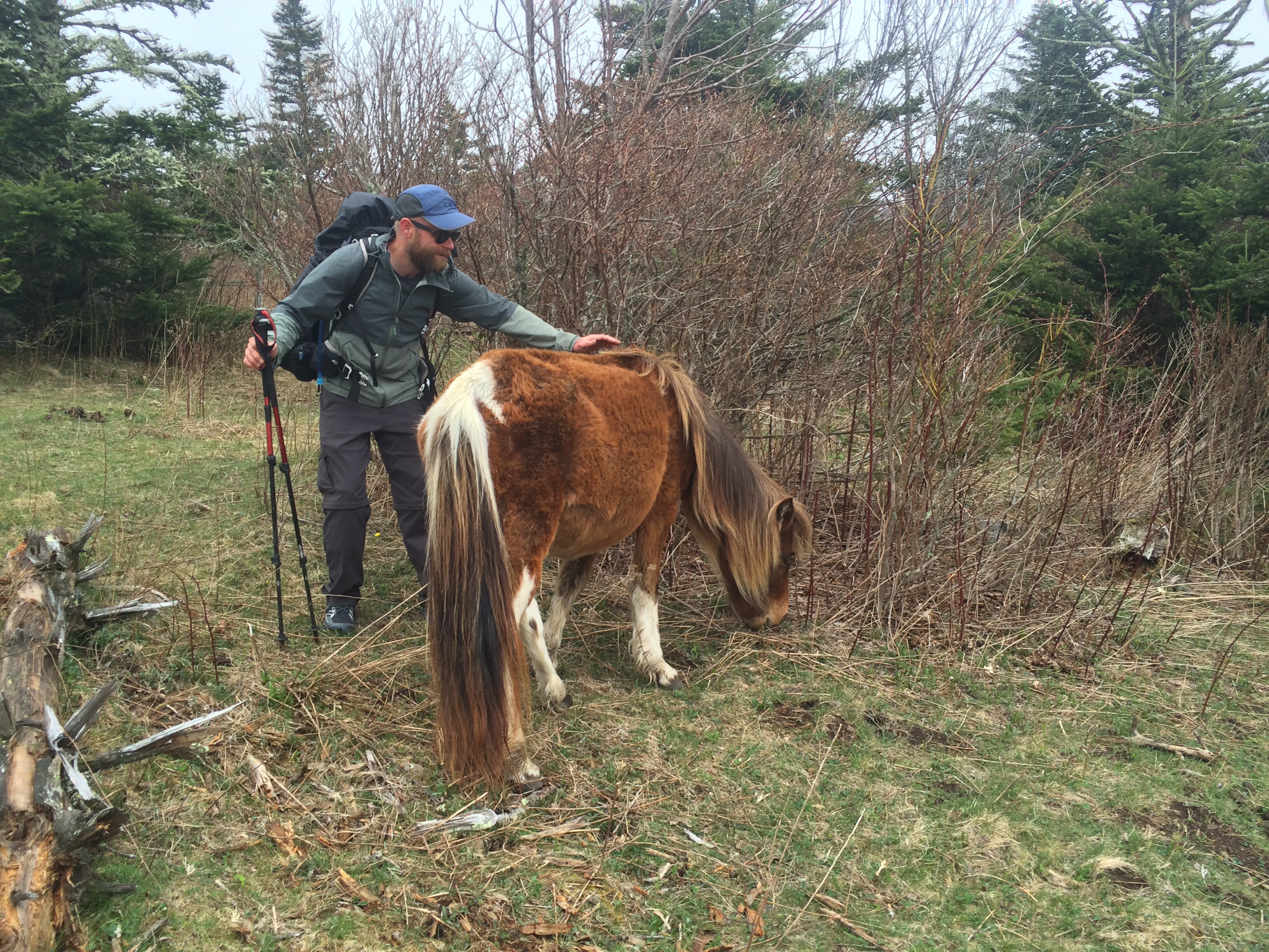
4aasssI woke up feeling good and smelling dampness in the air. Expecting rain clouds overhead, I looked at the sky from my vestibule and was surprised to see clearing morning skies. Not one to tempt fate, I quickly packed before making the decision to hike.

I mulled about, exploring the surrounding cliffs (and going to the bathroom), before returning to camp. Moon Boots was awake, as were Savage and Push. I looked toward the falls just in time to see Monster dive in for a morning bath. Within a few minutes, the skies parted and the sun started to shine.

I was honestly a little happy to not start off hiking again. I was sore and needed the break – plus, we couldn’t have chosen a better spot to take a half day off.

Moon Boots, Get Weird, Champa and I decided to take breakfast orders and hike a one-mile roadwalk to Trent’s Grocery. In order to get to the road, however, I had to cross the river ahead of the falls. I could either ford the stream (in the process, getting my freshly-taped heel wet) or I could tightrope walk along a large log. I was the last to cross and jumped up onto the log.

  
I couldn’t do it. It was too wet and I just couldn’t get any traction with my boots. I could see myself slipping, falling right in. I made several attempts – none more than a few feet before jumping back onto shore. I small crowd of my hiking buddies gathered on the other side of the river.

Needing more traction, I took off my shoes and tiptoed across in my wool socks. It was still very difficult. For something seemingly so easy, my heart was racing. I was honestly scared even though falling in would have meant nothing more than having to change clothes. I almost fell in half-way, but regained my balance and eventually made it. Everyone clapped – I had to sit down to catch my breath. Terrifying.

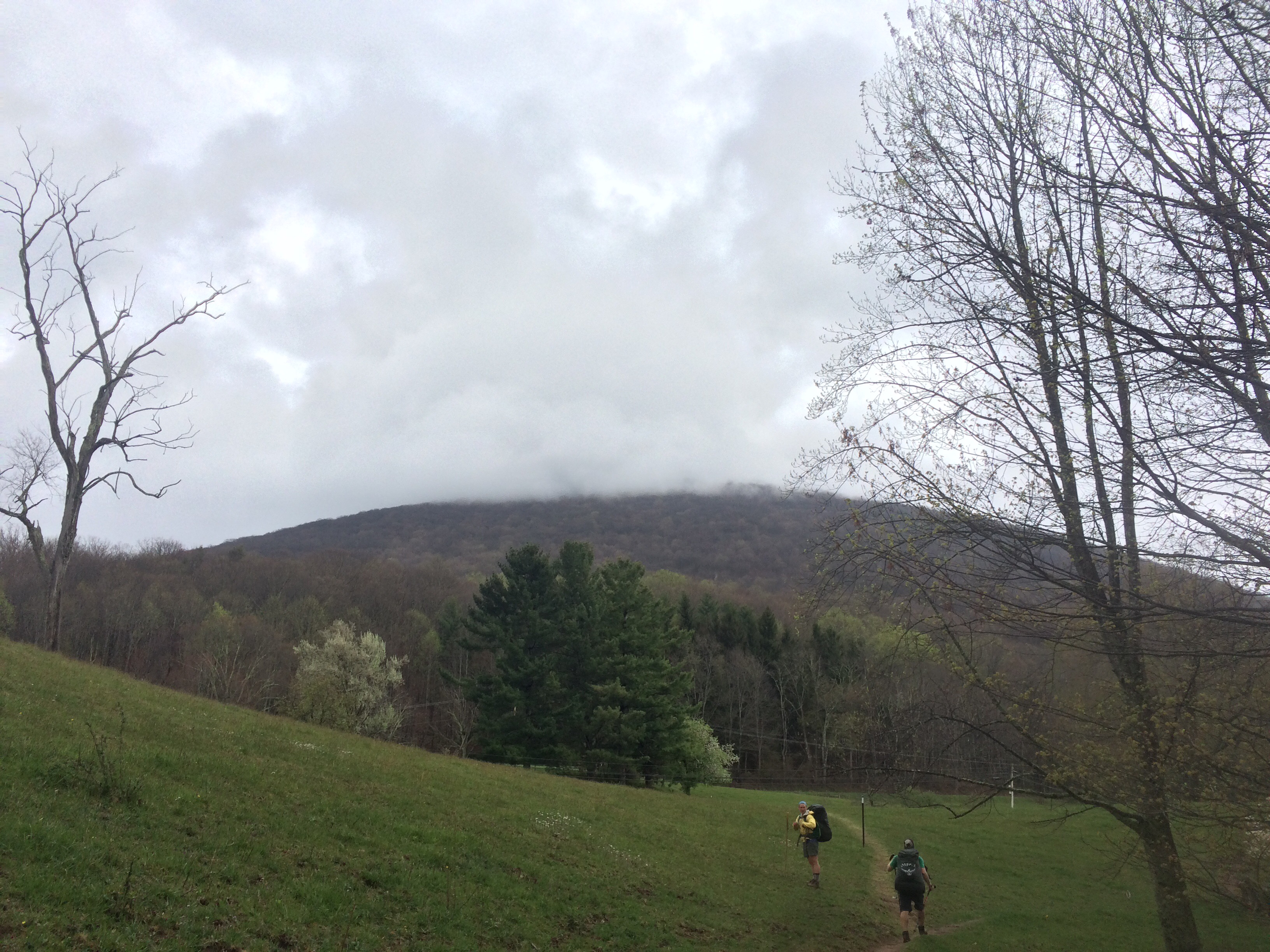
After the quick trip to Trent’s, I again made the log crossing (in wool socks and still just as scary) and finished breaking camp. I supplemented my hot breakfast with some pasta I got from a section hiker at Partnership Shelter last week. With a full belly, I set off for hills surrounding Pearisburg.

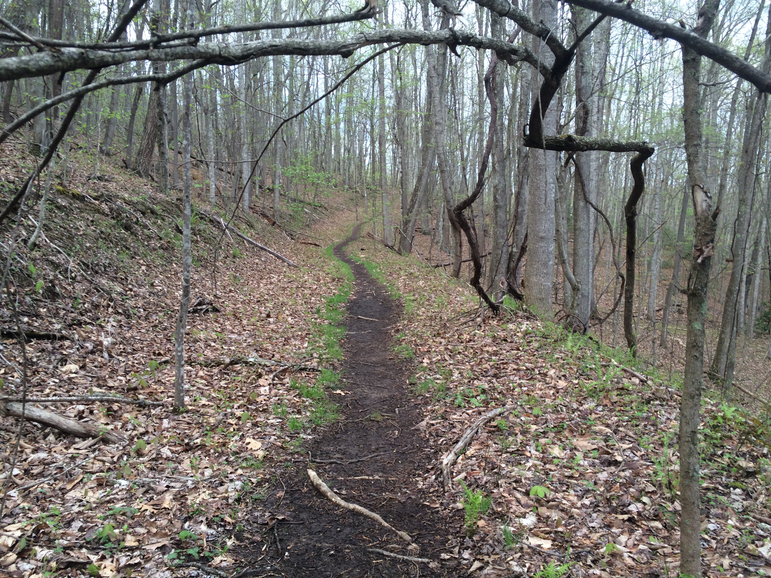
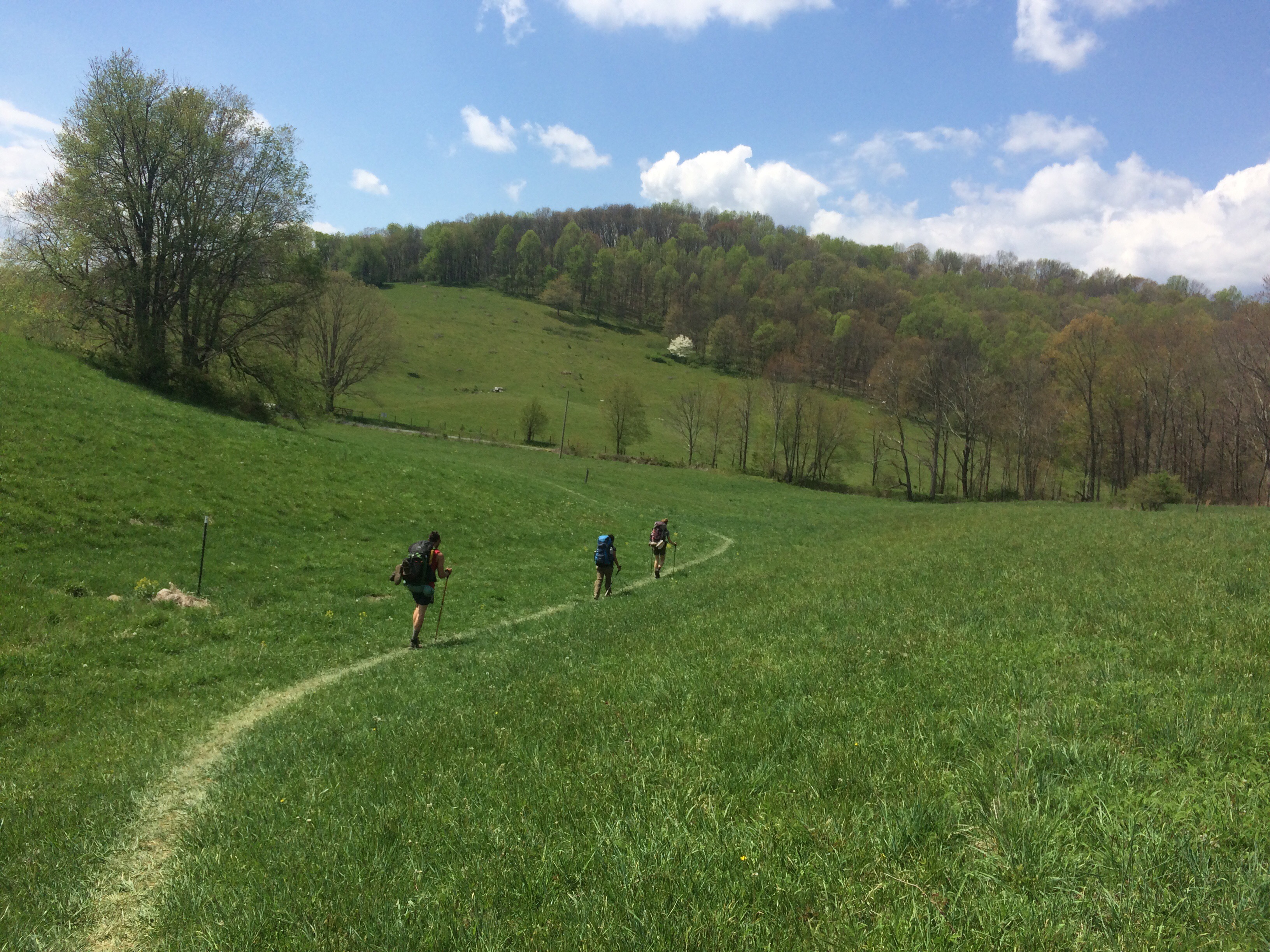
I don’t think I could have asked for easier terrain – wide, smooth paths covered with shady Rhododendrons. But something was wrong – I just couldn’t get moving. I felt weak and hot, I was sweating too hard for no reason.

  
Michael and Push soon passed me followed shortly by Moon Boots and Monster. It took nearly three hours, but I finally made it the six miles to Wapiti Shelter. I found everyone having lunch by a pond. I felt miserable – totally drained is a more accurate way to put it. I ate a hot lunch and moved on.

Heading north from Wapiti, the AT gains elevation at a pretty steep clip. Within 30 minutes or so, Savage caught up to me. She was the last to leave Dismal Falls this morning and had been swimming in the pond when I arrived for lunch.

I told her I just wasn’t feeling that well. She told me she’d rather have an easy day and would rather hike at my crawling pace. I was appreciative – hiking alone can sometimes be demotivating.

I trudged on, covered in sweat and cursing every step. The blister on my heel was killing me. Even though I spent most of the afternoon hiking in silence on sharp rocks, Savage kept politely encouraging me.

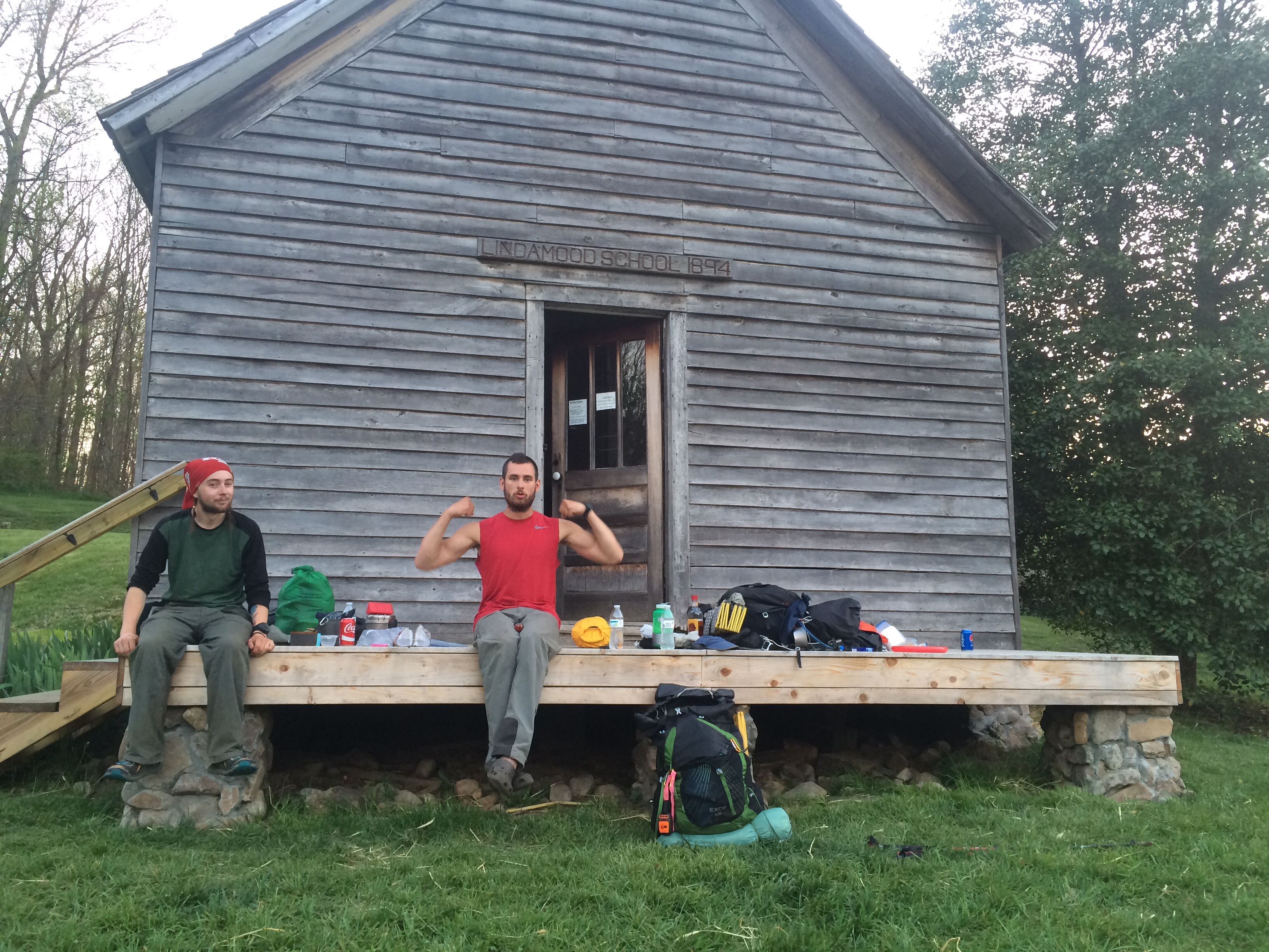
Just before 8:00, we made the nine miles to Docs Knob Shelter and decided to have dinner. I was still full from breakfast and lunch – still I cooked my last hot meal and ate. Juan was also having dinner – Oriole and him were staying there the night and planned on reaching Pearisburg tomorrow.

We decided we’d hike as far as we could. I switched on my headlamp and started moving. I felt miserable. About 30 minutes up trail, I asked Savage to hold up. I was getting dizzy. I told her I needed to throw up. She gave me permission, promising not to watch.

All I remember is thoroughly disgracing the AT with the contents of my stomach – most of which was the undigested remnants of breakfast. I cleaned myself up and took a few minutes to get back together.

I instantly felt great. I hiked over to Savage to tell her what came up. She was surprised – not that I had gotten sick, but that I kept that free meal from the section hiker AND chose to eat it. It had been removed from it’s packaging and sealed in a ziplock when I got it. I should have known better. Who knows how old it was or how much moisture had gotten in.

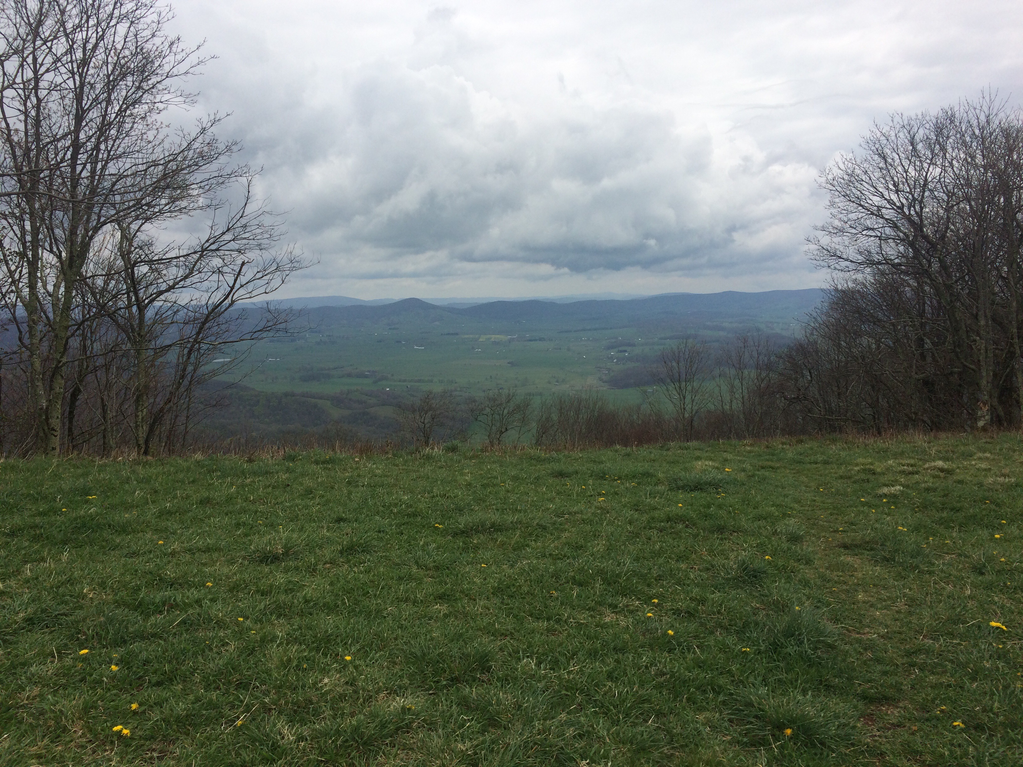
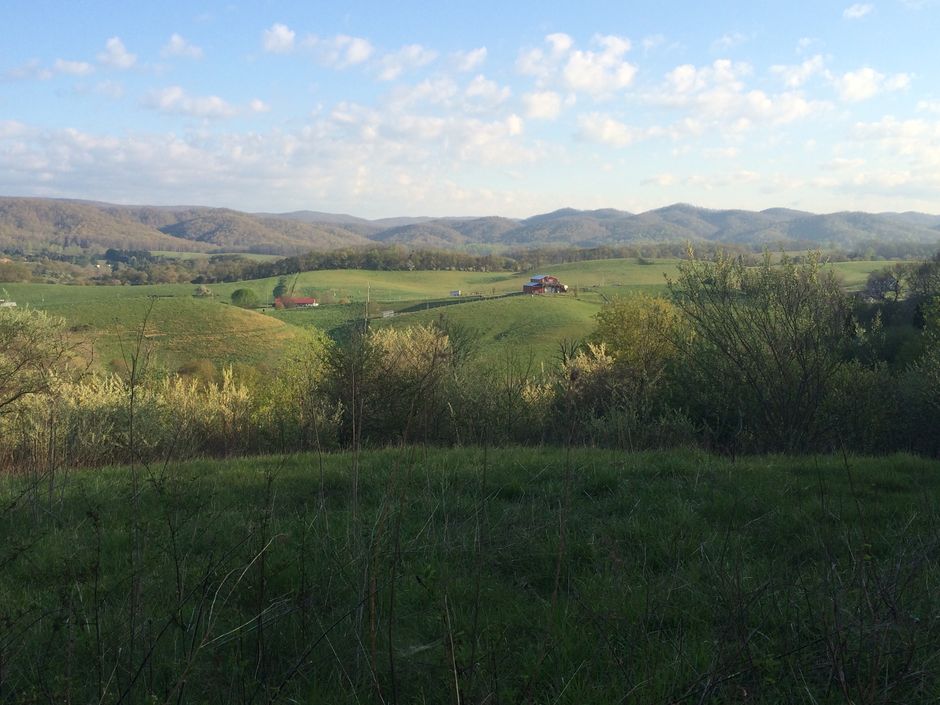
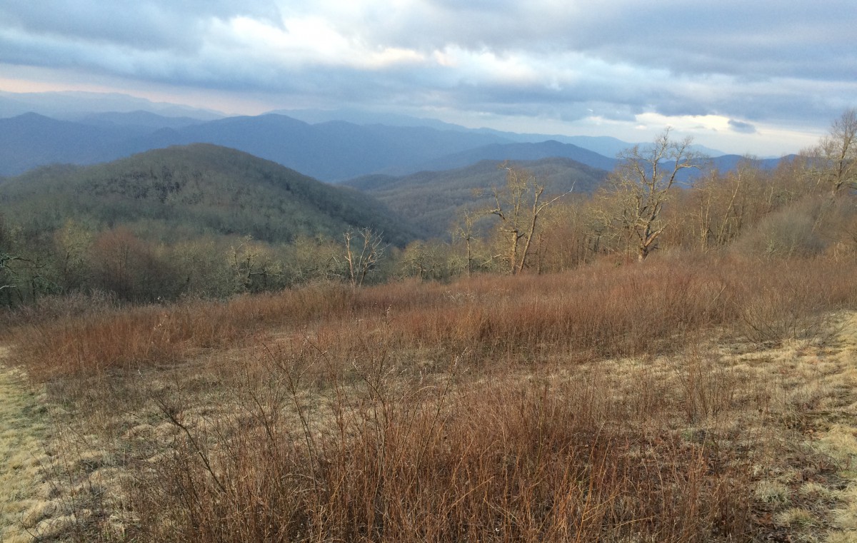
Lesson learned – we hiked on in full headlights. About five miles outside of Pearisburg, we came across a power line clearing that afforded a nighttime view of the surrounding valley. It was truly beautiful.

At about that time Moon Boots texted to let me know he and Canuck had just made it to Pearisburg. They got a room and told us we could sleep there if we made it to town. Monster, Push and Michael decided to camp just before the descent into town – still miles ahead of us. We hiked on with a renewed vigor.

The descent into Pearisburg was steep and rocky. I was finally feeling good and starting to make good time. As we approached the road crossing, Savage told me to hurry. She knew I wanted to make Pearisburg in 9 to 10 days – if I made to the road crossing by midnight, we would have covered the 165 miles from Damascus.

At 11:58pm, I tapped my trekking pole on the white blaze by the road, thus signifying our arrival. We made it! It was a rough day – I only felt good for the last seven miles. But I’m glad I kept going.

Savage and I walked into town and straight to the Holiday Lodge. Not only had Moon Boots and Canuck got us all a room, they also ordered us a pizza. What a great end to what was looking like a truly horrible day.

I’m sitting by the bathroom typing as my hiking buddies sleep. I’m truly thankful to be surrounded by people willing to help me out. I’m generally not one who accepts help readily – I don’t like to be put into a position of weakness. I needed help today and it came from folks I’ve only known for few weeks.

I’m having the time of my life.

Breakfast: the rancid free meal, labeled “Turkey Tetrazini – add two cups”.

Lunch: Alfredo Fettuccini Pasta Side with tuna

Dinner: Alfredo Fettuccini Pasta Side spiked with instant mashed potatoes

Second Dinner: 4 slices of pizza, 3 breadsticks, 2 cans of Sprite from the vending machine outside

Day 50 – Thursday, April 28: Laurel Creek to Dismal Falls, 27.1 miles, 610.1 total AT miles.

I woke at 5:30am and started packing – I knew I had a long day ahead. I had a little light rain overnight and it threatened to continue as I packed.

I retrieved my bear bag – another awesome hang, but not picture worthy.
Savage left early and first, ascending out of camp at 6:30. I stayed to drink a cup of coffee with Monster and Moon Boots as they ate breakfast.
Yesterday morning, Moon Boots and I met a section hiker (Michael) as we were leaving camp. We saw him periodically through the day and ended up tenting with him last night. Turns out, he’s looking to make big miles and liked the idea of making it to Pearisburg by tomorrow night.
I walked over to his tent and told him of our plan to make it to Trent’s Grocery – a country store and grill located about 25 miles up trail. He said he’d keep up – I offered to grab him a burger if he didn’t make it by the time they closed.
Moon Boots and I started the ascent out of camp at 7:30 at a fairly speedy pace. Push left shortly after Savage – we were playing catch-up as we hiked through Rhododendron tunnels on our way to Trent’s.
I passed two other thru-hikers, Champa and Get Weird, as I crossed the trail boss trail. I was about ten feet behind Champa when I looked down and saw what I thought was a fishing lure – it was actually a bright orange lizard. Champa paused to check it out – apparently, they’re quite frequently seen.

  
Moon Boots and I hiked on, heading towards I-77 when Monster caught up to us. This was totally expected – he’s well over 6 foot tall and carries a 60 lb. pack. He rarely uses his trekking poles. He’s literally a monster.
While the elevation profile called for a relatively easy hike to Trent’s Grocery, water management would be an issue. I left camp with enough to make it the 11 miles to Helveys Mill Shelter – my next viable water source.
With the interstate in sight, the three of us stumbled across some much needed trail magic. In the center of the AT lay a dozen grocery bags, each packed full of Mountain Dew, Coca-Cola and bottles of water. I added water to my Playpus and chugged a Mountain Dew before crossing the interstate.
My first days in Virginia were marked with graded mountains and green valleys. As we crossed the bridge, I noticed the terrain had subtly changed – the climate was drier and the mountains much rockier.

  
After a short, steep push, the three of us arrived at the shelter and paused to eat lunch. I skipped on making a hot lunch in favor of conserving water – the hike down to the spring was steep and fairly long.
I spread my tent on the AT to dry in the sun as the three of us ate heartily. After a nice 30 minute break, we set off. The next nine miles ahead to Jenny Knob Shelter were without a water source as well. I still had two liters in my Platypus – more than enough to make the hike.
As we hiked, I observed an interesting pattern form that I can only attribute to Monster’s military background. He could have easily made the hike alone, burning up miles on the easy terrain and leaving Moon Boots and I (but just mostly me) in the dust. Instead, he liked to frequently re-arrange the hiking order, often suggesting Moon Boots or I lead. In the end, the three of us kept up with and motivated each other to hike fast through what was a pretty boring section.
It was a good thing we stuck together too – before we even realized it, we were crossing the 600 mile mark.
  
At 2:00, we made it Jenny Knob Shelter. The three of us peeled off the AT and headed straight for the spring – I had just run out of water. And I wanted my hot lunch. Even though Trent’s Grocery was only nine miles away, I could feel myself in need of nourishment.
After lunch, I took off my boots to change socks (my feet were pretty sweaty) and noticed that the minor discomfort I had begun feeling on my right heel was actually a blister. It was located in exactly the same spot (just a different foot this time) as the one that plagued me before I got new boots in Damascus. I threw on some Band-Aids and athletic tape before moving on.
Our pace slowed as we made the gradual descent from Jenny Knob to Trent’s Grocery. I told the guys to move on as I wanted to take it easy on my heel – that and I wanted a quick snack. I soon emerged from the woods and entered a small pasture – a sure sign I was getting close to a road crossing.
  
I re-entered the woods and came across Moon Boots and Monster at the beginning of a suspension bridge that spans Kimberling Creek. We paused to take a few photos when I heard a “hey Dad” come from the woods – it was Canuck, racing to catch up. The four of us crossed and immediately turned left onto VA 606 heading for Trent’s.
  
Trent’s Grocery is more like a convenience store with a grill. I went to set my pack down on the bench and saw Savage and Push’s packs leaning against the building. I walked inside and said hi – they had been waiting on us for maybe a half an hour.
I ordered dinner to go (including that promised burger for Michael) and bought a few snacks before sitting down. While they were waiting, Savage and Push scouted out possible camping sites. We had two choices: either pay $7 to camp at Trent’s “Campground” (the property behind the grocery) or hike on Dismal Falls – ranked as one of the prettiest side-trail campsites on the AT.
I knew it was decided before we even began debating. I told Push I’d see them at Dismal Falls and started hiking. Even though it was only two miles away, it was nearing late afternoon.
As I was hiking down VA 606 towards the trailhead, I saw three hikers approaching me. Champa and Get Weird were hiking with Michael, all on their way towards Trent’s. I handed the burger off to Michael who, upon hearing we were headed two miles up trail, turned around to follow suit.
The late afternoon push was well worth it. Dismal Falls is easily one of the nicest campsites I’ve had so far. Moon Boots and I camped on two small grassy areas – only about 20 yards from the falls.

  
After gorging on my to go sandwiches (and a whole bunch of snacks), I went to my tent to write.
Awesome day hiking! I thought it was cool to see seven hikers (now including Michael) hike a literal marathon and only be about an hour apart the whole day – no one let up or stopped short.
Tomorrow calls for rain – in fact, a light rain has been falling while I type. We discussed the weather as a group. If it’s nasty tomorrow, then we’ll all just make the push to Pearisburg. If it’s nice, then we’ll hang out at the falls until noon or so, tenting late at night a few miles outside of town. Either way, I’ve only got 25 miles to go.
I lost one of my North Face camp shoes today. It was stuffed in a side pocket and must have fallen out somewhere along the way. I don’t have high hopes of it being found. It’s the same color grey as most of the boulders and rocks in this area – it’s likely gone for good.

Breakfast: coffee, almonds, beef jerky, Blueberry Crisp Clif Bars
Snack: Mountain Dew
Lunch: 3 beef jerky tortilla roll ups, dried figs

Snack: 4 packs of Star Wars fruit snacks

Dinner (from Trent’s): orange Gatorade, two grilled chicken sandwiches ($8.48) then, two Blueberry Crisp Clif Bars and the rest of my almonds

Day 49 – Wednesday, April 27: Lynn Camp Creek to Laurel Creek, 23.1 miles, 583.0 total AT miles.

Note: This is the second night in a row with zero service. Other hikers said they got cell service today during the ridgewalk – I got stuck in the rain and didn’t check.

Shortly after I finished writing last night, a hiker walked through camp and said it was going to start raining at 11:00pm – he just got an updated weather report.

I closed the vents on my rainfly and fell asleep. I woke up to the sound of heavy rain hitting my tent – I could hear thunder in the distance. I nodded off, but woke again at 1:00am, the downpour still soaking the earth. I didn’t have any leaks – everything was dry.

I woke up again at 6:00, this time for good. I sat up and immediately started packing. I felt good and was pretty motivated to start hiking bigger mile days. I put my hand down on the floor of my tent and was a little surprised. There was a layer of water, maybe a half an inch, between my tent and the footprint.

I stuck my head outside my tent. What I thought was nice flat land the night before now showed itself to be bowl-shaped. Everywhere around my tent had standing water from the overnight rains. I finished packing and got everything out of my tent.

The only water that ever gets in (and this has happened a few times), is directly under my sleeping pad. I had the same problem this morning – it’s really very minor compared to stories you hear. I wiped it up before taking down my tent.

I did nail that bear hang.

  
I grabbed a quick breakfast and started hiking at 7:00 with Moon Boots. Despite the heavy rains, the trail was surprisingly in good shape. After the quick up and over Lynn Camp Mountain, things got tough.

We started the ascent of Chestnut Knob at 9:00am. While the trail was well-graded, we faced a continuous uphill hike for four miles. I was hiking at steady pace, not wanting to waste too much energy on the uphills. I stopped for water and a quick snack about halfway up.

As the switchbacks near the crest of Chestnut Ridge, the trail goes from forest to bald – I was about halfway done. As the trail followed the ridge higher in elevation to the summit, I kept a lookout for Chestnut Knob Shelter at the summit.

At 11:00am, Moon Boots and I found Push making lunch at the shelter. The shelter was very nice and had a great view of the farmland in the valley below.

  
Before I sat down to cook, I took out my soaking wet tent and hung it from my trekking poles to dry. I cooked quickly and ate. It looked like it was threatening to rain again. I could feel the humidity rising from the valley below. The air was cool, but not cold.

As I was leaving, Canuck and Savage showed up. They sat down to eat and I took off, heading for the eight miles of ridgewalking ahead. I felt like I was making good time. The trail consistently stayed away from the ridge line, instead following it about 20 yards to the side.

  
About an hour in, it started raining. It never got too heavy – I continued hiking in a t-shirt and gym shorts. I caught up with Moon Boots and the two of us realized we were approaching a road crossing.

At the trailhead we met E.T., a now-retired former thru-hiker. He gave me an apple. While I was throwing away trash, Canuck showed up – we ended up splitting his last Gatorade.

The three of us left just as the rain was finally letting up. I was wet, but not in that bad of shape. The trail deviates from the ridge and descends quickly towards Jenkins Shelter. I stopped with Canuck at the shelter for a quick snack before pressing on towards Laurel Creek.

The trail again climbs and runs alongside another ridge – although this time at a much lower elevation. It was a nice hike into camp. I emerged from the woods to find Monster, Moon Boots and Push all gathering water and/or bathing in Laurel Creek.

I filled up for the night and made my way to the campsites. In time the six of us that decided to try for bigger miles sat at the picnic table to make dinner. Juan, who missed the sign for Jenkins Shelter (he meant to continue hiking with Sweet Potato and Oriole), joined us.

My plan is to hike 25 miles tomorrow, stopping at Trent’s Grocery, and off-trail country store that apparently sells burgers. That would leave 26 miles on Friday to reach Pearisburg. There’s admittedly no rush – I just want to push myself before taking a day off.

I hiked all day in my short gym shorts and t-shirt, even in the light rain. I felt great.

Breakfast: Blueberry Crisp Clif Bar, Little Debbie Banana Marshmallow Pie

Snack: almonds, figs, LD Ban M Pie

Lunch: Cheddar Bacon Pasta Side with chicken, spiked with instant mashed potatoes, Star Wars fruit snacks, beef jerky

Snack: Apple, LD Ban M Pie, nearly an entire bag of dried cranberries

Dinner: Fettucini Alfredo Pasta Side with tuna, spiked with instant mashed potatoes, LD Ban M Pie, almonds, beef jerky, the rest of the cranberries, almost all of the figs 

Day 48 – Tuesday, April 26: Lindamood School to Lynn Camp Creek, 18.9 miles, 559.9 total AT miles.

I woke feeling surprisingly alert and refreshed after yesterday’s hike. I started packing up, still inside the schoolhouse. I ventured outside to find Moon Boots and Canuck waking up as well.

After a quick trip to the semi-restored, yet fully-functional, boys privy, the three of us set off for town. The trail this morning was stunning – we exited the forest and hiked through grassy farmland on our way to The Barn in Atkins.
The four miles into Atkins went by too quickly. Little did I know we would have even better pasture crossings in the miles ahead.
  
The three of us walked into The Barn to order breakfast, first grabbing a booth, then a large table as other hikers arrived. The same eight hikers (myself included) that had lunch yesterday in Marion now sat to eat breakfast in Atkins. It’s not always Pasta Sides in the woods.
While I ate, I uploaded my blog and discussed plans moving forward to Pearisburg. I expressed interest in hiking in on Friday night – that would mean hiking 93 miles over the next four days, including today. For me, that seemed a little ambitious, but I think I’m up for the challeng
We departed separately, all heading for the same campsite I’m tenting at tonight. I was at the end of the line. The trail crosses under I-81 after leaving Atkins – and right before the trail left the roadside and entered the woods, two deer ran right in front of me. Little did I know, there’d be weirder animals ahead.
I paused to check my external battery and try to get some music playing through my speaker, when Push caught up to me – she stayed at a trail angel’s home with a few other hikers last night. Despite today’s apparently jagged elevation profile, the trail was well-graded and made for easy miles. We enjoyed intermittent music through the speaker (as cell coverage prohibited) as we hiked.
At the bottom of Little Brushy Mountain, we ran into Moon Boots and Savage relaxing by stream next to the Crawfish Trail. I grabbed some water and sat for a few minutes to rest. I still felt great – it was noon and I’d covered nearly 10 miles.
The four of us set off together to climb Walker Mountain – another nicely graded climb. Moon Boots stayed ahead. When I found him at the top of the mountain, he was sitting next to a sign. I knew at some point today I’d pass the 1/4 mark – and was very pleased someone had hung a sign to commemorate the event. High fives and “hell yeahs” all around.
  
The four of us descended Walker Mountain and quickly found ourselves exiting the woods and entering one of the most beautiful pastures I’ve ever seen – rolling green hills and big blue skies. The weather was perfect, mid 70’s with a nice breeze.

  
We hiked through a thin wooded area, fenced in on both sides by private farms. I personally speculated how old this section of trail must be, seeing as how the only reason this bit of land exists is to provide an easement for the AT.

As we approached a road crossing, we ran across Lumbermack, a former thru-hiker, now retired and out providing trail magic for the day. I enjoyed a quick snack and pressed on – through another perfect pasture.
We entered the woods again and started descending towards the Holston River. I was following Moon Boots when, all of the sudden, he jerks his head left, points at a tree and yells, “What the hell is that?”
I didn’t see it at first, but when I did, I was dumbfounded. Something furry was clinging to a tree (and nearly perfectly camouflaged). I got off trail and moved closer to inspect it and snap a picture. It was decided that it was a woodchuck – I had never seen one before and still don’t know if that’s what it was.
  
Today was going pretty good so far – hot breakfast, beautiful pastures, weird animals and trail magic. But it was getting hot. 

Luckily, we soon found ourselves on the banks of the Holston River. The four of us relaxed in the water and cooled off. It was extremely refreshing – just what I needed.
After a quick ascent up Brushy Mountain, we bypassed the Knot Maul Branch Shelter and found Monster, Juan, Sweet Potato and Oriole at Lynn Camp Creek. I set up my tent and made a quick dinner.
We sat around until 8:00 being entertained by Juan and Savage trying to figure out “Home” by Edward Sharpe and the Magnetic Zeros on the banjo and ukulele. (It’s good to know other folks have as hard a time getting this song out of their heads as I do).
At sunset, I set out to hang my food – usually an easy task made difficult tonight by a lack of suitable trees. It was tough, but Savage and I managed to hang our bags over the creek – it’s one of my finer hangs. I’m actually proud of it.
I retired soon thereafter and started writing. So if I really want to be in Pearisburg by Friday night, I’ll need to put up some big miles for the next three days – I’ll need 75 miles in all. My goal for tomorrow is to make it 24 miles to Laurel Creek. The elevation looks okay – my only concern is about the eight miles of ridge walking tomorrow. If it’s rocky (as they’re prone to being around here), I’ll be moving slowly.
Trail rumor has a fifty percent chance of rain for the next three days, supposedly starting at some point tonight.
Today was a great day to be hiking the AT – this small section definitely ranks towards the top as far as I’m concerned. So far, Virginia has been great.
Breakfast: The Barn – 8oz sirloin steak, hashbrowns, side of biscuit and gravy, coffee, orange juice $14.25 with $5.75 tip
Snack (trail magic): Cola, Little Debbie Fudge Round
I skipped lunch – just wasn’t hungry
Snack: Almonds, beef jerky, Little Debbie Banana Marshmallow Cake
Dinner: Cheddar Chipotle Pasta Side with chicken spiked with cheddar-bacon flavored instant mashed potatoes, Star Wars fruit snacks, Blueberry Clif Bar

Day 47 – Monday, April 25: Partnership Shelter (Marion, VA) to Lindamood School, 8.8 miles, 541.0 total AT miles.

For the first time on this trip, I slept well in a hotel – I woke up refreshed and hopped in the shower. I finally (finally) had decent cell coverage and spent the morning updating my blog. After a quick breakfast, Moon Boots and I walked to the Walmart so he could resupply – I ended up buying some hiking shirts and a new town shirt (from the boys department – I found that boys size XL fits best).
  

After quickly reorganizing our packs back in the room, Moon Boots and I met up with Canuck and headed back to the Walmart – I spent about half and hour at the Verizon store looking to get a phone upgrade. I decided against it after realizing I don’t know half the passwords for my apps. I’ll have to work on this in Pearisburg.
The three of us met up with Savage and the other hikers (Monster, Oriole, Sweet Potato, and Juan) we’ve been hanging out with for the past few days. Before grabbing the city shuttle to the trailhead, the eight of us grabbed a quick sushi lunch.
I refilled my water bladder at the Mount Rogers Recreational Area HQ and ended up buying a Woodsy Owl patch (to match my ridiculous tattoo) before hopping back on the trail.
Today’s plan was to push the 10 miles to Atkins, VA. I struggled on the ascent up Glade Mountain – the trail was rocky and difficult to navigate. On the way to the summit, I noticed I was definitely out of big mountain country.


The descent towards Atkins reinforced this realization – I was hiking in markedly different terrain than I had become accustomed to. I caught glimpses of farm land and grazing pastures through the trees.
As I approached Chatfield Shelter, I found myself walking in a beautiful Rhododendron forest – the trail followed a creek for several miles, crossing it numerous times.

  
Savage, Monster, Oriole, Sweet Potato and Juan decided to stay at the shelter – I pressed on to catch up to Moon Boots and Canuck. I was four miles away from Atkins and moving fast. I wanted to get to The Barn, a hiker-friendly restaurant, before it closed at 8:00.
As I made my approach, I found Moon Boots and Canuck lounging on the front porch of an old schoolhouse. It had been partially restored and was stocked with trail magic for hikers. While I wanted to make the extra miles to get to town, I couldn’t resist staying a night at the school.

  
I’m really glad I did. The three of us listened to music through my new Bluetooth speaker and played frisbee until the sun went down. After a quick meal on the front porch, we all went to bed. I decided to sleep inside (with the “ghosts”) and write.
I did a lot of thinking again today about my life after the AT – still no conclusions, just a lot of good ideas.
I’m hoping for big miles tomorrow – I’d still like to make Pearisburg by Friday night or Saturday morning.
Breakfast: 3 slices of cold Little Caesars pepperoni pizza
Lunch: Yummy Yummy (a sushi place) – one seaweed salad, eight chicken wings, 6 seafood dumplings: $16.96 plus $5.00 tip
Dinner: Chipotle Cheddar Pasta Side with chicken

Day 46 – Dickey Gap to Partnership Shelter (Marion, VA), 15.1 miles, 532.4 total AT miles.

I woke full of energy at 6:45 and was ready to start hiking by 7:30. I walked out the road to see if I had cell coverage – no dice. As far as I knew, Savage and Moon Boots were too far ahead for me to catch and Medicine Man, Canuck, Shaggy and Clutch too far behind to warrant me waiting around. I quickly ate and hit the trail.

If you look at a topographical map of the AT in Virginia, you’ll see that the trail largely follows ridge lines. This can be good or bad. Some ridge lines are cake walks – wide trail with a gentle grade. Others, like the one I was traversing this morning, where rocky and hard to navigate.

I stopped four miles in at the trail crossing leading to the Trimpi Shelter to have a quick snack. I met a few hikers leaving the shelter and asked if they had seen Savage or Moon Boots. They didn’t know Moon Boots, but said Savage had tented there last night with a hiker named “Push” – it had to be Maria, the same girl I made the 33.1 mile “push” into Damascus with.

I was elated – I had found my hiking buddies and they weren’t too far ahead.

Leaving the Raccoon Wilderness, the trail briefly enters private land and crosses a cow pasture. I was making good time. After crossing a country road, the trail ascends and follows one of the aforementioned rocky ridge lines. It was beautiful, but all the views were obscured by trees.

  
I stopped to gather water about 3 miles from Partnership Shelter. Two things happened – first, I was attacked by mosquitos. It was the first time on this trip I had to put on bug spray (and not as a preventative measure). Second, my phone started chirping. Emails were coming through. I had cell coverage! After pausing to make a few quick calls, I pressed on.

I was still making good time, checking my GPS and figuring my average MPH as I hiked – today I was averaging between 2.5 and 3 miles per hour.

As I approached Partnership Shelter at 1:30, I came across a tent city. At first I was jealous – looking at all these hikers tenting together and having a good time.

  
Then I heard a “Cool Dad?”. It was Savage and Push! Then Moon Boots stuck his head out of a tent! Monster, Wanderer (or Juan – still haven’t asked his preference), Oriole and Sweet Potato were with them.

This tent city I had previously been jealous of was stocked with my hiking buddies and other hikers I had gotten to know better over the past week. Awesome!

I immediately threw down my pack and laid out my tent to dry in the sun. We all started catching up on what had happened over the past two days.

Moon Boots and Monster (aptly named because he’s huge – and ex-military from Germany) decided to put in their first 30 mile day. They had been tenting at Partnership since the night prior. Savage and Push held back and did a more moderate 20 mile – 20 mile to arrive at Parnership an hour before me.

Moon Boots, Savage and I started planning for the days ahead. It was decided that it just made sense to resupply in Marion instead of Atkins, seeing as how we were all here. I left the group to check to see if I had cell coverage closer to the road. I didn’t – upon my return, I was surprised to see that Canuck had arrived in camp. He ended up hammocking just three miles from me last night – presumably near the creek where I met the coyote.

Seeing as how it was now close to dinner time AND we were staying near the only shelter where we could order pizza, our entire tent city decided to put together a mega-order – seven hikers ordered $99 worth of cheap pizza. I alone ordered a large Stromboli. It was ridiculous – I only ate a third of it.

  
Canuck left camp to get a hotel room. I guess that got Moon Boots thinking. He casually asked if I wanted to split a room in Marion – he wanted to talk to his folks and I really needed to upload this blog. It was instantly settled. We quickly packed up and headed to the road crossing to hitch a ride.

Just under an hour later, Moon Boots and I found ourselves at the Travel Inn watching the Hawks lose to the Celtics. While he chatted on the phone, I made a quick run to Walmart to resupply, grabbing a pizza on the way home.

After organizing my food bag, I started updating my blog. Moon Boots fell fast asleep and I’m still typing.

The best that I can figure, Medicine Man, Shaggy and Clutch went back to Damascus to dry out. Canuck informed us that he started hiking yesterday just an hour after me and the three of them were packed up and waiting for a shuttle.

Moving forward, the tentative plan is to leave Marion tomorrow at noon and hike to Atkins, VA – it’s only 10 miles away. There’s a hiker-friendly restaurant right on the AT that I’d like to eat dinner at. After that, I’ve got 90 miles to Pearisburg – if I leave Atkins Tuesday morning, I hope to get there by Friday night or Saturday morning.

On cell coverage – I’ve found that the strength of my Verizon coverage is directly proportional to the type of national parkland I’m hiking in. If it’s a national park, chances are I’ve got a strong signal. If I’m hiking in national wilderness (like I’ve been hiking in since leaving Damascus), I have zero coverage.

Tomorrow I’ll need to hit the Verizon store to get an upgrade to the iPhone 6. I’ve already used all of the storage (pictures) with my iPhone 5 and don’t want to delete anything.

I’m tired but feeling good. These new Merrell trail runners are working great. When I woke up the morning after my hypothermia-hike, my shoes were still soaked. After an hour of hiking, they had dried out completely.

The Hawks lost in overtime.

Breakfast: two 30 gram Powerbar protein bars

Snack (3 miles from Partnership): the last of my dried figs, beef jerky.

Late Lunch: a third of a Stromboli (the other hikers at Partnership ate the rest)

Dinner: Half of a Little Caesar’s pepperoni Hot n’ Ready

Money:

Walmart: $62.55 (Crap! I also bought a wireless speaker to listen to music while at camp. They’re very popular on the trail.)

Little Caesars: $5.99

Room: $27.00

Day 45 – VA 600 to Dickey Gap, 25.3 miles, 518.3 total AT miles.

At around 9:30 last night, a thunderstorm hit our makeshift camp. I was nearly asleep when it struck. I quickly turned on my headlamp and checked the walls and floor of my tent – no leaks. I don’t remember when I drifted to sleep, but I do remember waking at around midnight to more driving rain and thunder. I slept restlessly the rest of the night.

I woke again at 5:30. By now the rain had stopped. The inside of my tent was dry – that’s all I cared about. As I was considering waking up, I fell back asleep, only to wake again at 7:30 – this time for good.
I packed everything I could before emerging from my tent. It was still cold, but at least I was dry. Before I fell asleep, I changed into my damp shorts – the body heat trapped in my sleeping bag completely dried them out.
I was expecting the cold when I finally stepped outside – I was not expecting the fog. I hadn’t seen fog this thick in a long time. Medicine Man, Shaggy and Clutch were still in their tents and I was nearly ready to go.

  
I walked over to the tree line and chatted with Canuck, still hanging in his hammock. He was awake and ready to start packing. I returned to our camp by the side of the road and spoke with first Medicine Man, then Clutch and Shaggy. The three of them were contemplating heading back to Damascus to dry out.
I was honestly tempted (for maybe had a minute), but decided to press on. Canuck wanted to eat before following. I left the guys at the roadside, not knowing what their final decision would be, and headed north into the fog.
It was cold still – the front that brought all the rain had not lifted and I started my day in full winter gear (what I had left, that is). Despite my near-hypothermia the day before, I was hiking strong. I stopped briefly at Thomas Knob Shelter four miles ahead and had a quick snack before making the push to Grayson Highlands State Park and the wild ponies.
It being a Saturday, I encountered numerous weekenders and section hikers as I made my way into the park. It was stunning. The Grayson Highlands easily make it to the top of my list as one of my favorite hikes to date.
  
I traversed rocky balds covered with green grass for miles. I saw a few ponies from afar, but didn’t got close enough to get a good picture. As I was hiking, the clouds starting breaking up and the sun began to shine. It was still windy and cold, but the view was remarkable.
  
At the north end of the park, it finally happened. I turned a bend in the trail and came face to face with a grazing pony. He/she looked at me and started shuffling my way, stopping near a patch of grass at my feet to continue eating. This was my pony.
My pony was little – it looked more like a donkey than a horse. But it didn’t matter. I was checking off a major AT milestone – I got to pet a wild pony in the Grayson Highlands. It was awesome.
  
Another milestone came to me shortly thereafter – I crossed the 500 mile mark and continued hiking.
  
I was fairly certain the guys that stayed behind would wind up in Damascus. And I knew Savage and Moon Boots were somewhere ahead. I decided then that I would bypass the next two shelters and make camp when it got dark or when I got tired.
After leaving the Grayson Highlands, the AT loses altitude – I soon found myself hiking in Rhododendron groves at 3,000 feet. It was noticeably warmer – I started hiking in shorts and a t-shirt once again.
I soon found myself in at Fox Creek having already hiked 20 miles on the day. I paused at the base of Chestnut Flats to consider my options. I had enough daylight to make it up and over – doing so, however, would mean that I was probably going to be setting up my tent at sunset. I pressed hard.
The AT Guide listed three possible campsites as I made my way to Dickey Gap. The first two were unoccupied. I decided to stop at the third to filter water. As I made my way down to the creek (headlamp on), I caught a pair of eyes glowing back at me.
It was a huge coyote – we ended up spooking each other. He/she froze in the beam of my light for a good ten seconds before slowly turning and slinking away. My rational mind said that it was okay – coyotes aren’t predators like wolves. But my normal mind was scared. I wanted to get the hell out of there as fast as possible.
I ended up stopping at Dickey Gap, right at the trail head for the Raccoon Wilderness. It was dark. Instead of camping in the grassy field by the road, I decided to pitch my tent right on the AT next to a informational display.
I crawled into my tent in the dark and contemplated making a hot meal, but I was low on water. I had enough to drink throughout the night, but not enough to cook. The weather got chilly, but I crawled into my sleeping to get warm before I started writing.
On tenting near roads: I’ve never had any problems with townies messing with me – aside from the occasional late-night horn honking. But this was different – I was alone. I only decided to tent on the AT to protect myself. If I was in a group, tenting in the grass would not have been a problem.
Tomorrow, I should make it the 25 miles to Atkins, VA for a quick resupply. I’ll pass Partnership Shelter near Marion, VA – the only shelter on the AT where you can use a pay phone to call for pizza delivery.
I still don’t have cell coverage (haven’t in three days now) and have no idea how far behind or ahead the rest of my hiking buddies are.
Full disclosure: I was a little scared at first, this being the first time I’ve camped alone and having just run across the coyote. As soon as I got my tent set up and my gear stowed inside, I was fine. The illusion of security.
Breakfast: 30 gram Powerbar protein bar, the very last of my homemade granola.
Lunch: three beef jerky tortilla roll ups with yellow mustard.
Snack: the last of my mini banana Moon Pies
Dinner: Everything – the last of my dried cranberries, two bags of beef jerky, the last of my tortillas, half of a chocolate orange

Day 44 – Friday, April 22: Stagnant Pond to VA 600, 12.3 miles, 493.0 total AT miles.

I woke up at 4:00am to the sound of light raindrops hitting my tent. I quickly fell back asleep. I woke again at 5:30 in the middle of a strong shower. I was wide awake and full of energy – I ran to retrieve my food bag and started packing up from within my tent.

By 6:30, the rain had let up just enough for me to take down my tent. Remembering that morning on the Nolichucky (when the skies opened up as soon as I removed my rainfly), I decided to take my tent down in reverse.

I unclipped my tent from the frame, thereby collapsing the part I sleep in, and left my rainfly attached to the poles, keeping me dry as I packed up the footprint (ground cover). I actually lounged under the rainfly and had a quick breakfast.

  
I left camp in steady rain at 7:00. Today’s hike called for my return to 5,000 feet in elevation. The forecast (last I heard in Damascus) called for rain all day.

I started hiking in my rain jacket and shorts. I cautiously sidestepped the larger puddles as I now was hiking in non-waterproof trail runners. For the most part, my feet stayed dry. And adding the Superfeet insoles made a world of difference – my feet felt better than they had in quite a while.

After a quick little ascent, I stopped at Lost Mountain Shelter four miles up trail to have a snack and make sure everything was staying dry. I was ahead of everyone I camped with, but a little too late to catch any stragglers hanging out at the shelter.

I was making good miles early and decided to make a cup of coffee and use the privy before moving on. As I was finishing up, Savage, Medicine Man and Moon Boots arrived – 15 minutes later, I was back on the trail.

Our major summit of the day lay ahead – Whitetop Mountain. I made the slow approach to the base of the mountain in great weather. It had dried out and warmed to the point where I was now hiking in just a t-shirt.

Whitetop gains about 2,000 feet over 5 miles – that’s a very manageable grade. As I started climbing, the skies got darker and darker and the wind started picking up. About halfway up, the rain began in earnest. I immediately threw on my rain jacket and hiked on.

  
To traverse Whitetop Mountain, I had to cross 1.5 miles of rocky, exposed bald. And this is where things went bad. The temperature started noticeably dropping – I could feel it. For a good five minutes, the rain switched over to this sleet/hail mix – it only made me hike faster. My hands were getting numb and I was starting to shiver as I made my descent.

The road crossing for VA 600 was in another 1.5 miles. As I made my descent, I started considering my options. VA 600 was only 4 miles away from Thomas Knob Shelter – my goal for the day until very recently.

I needed to get warm. After those intermittent morning rains I hiked through and this most recent soaking, cold storm, my rain jacket was soaked through, as were my shorts, socks and shoes. I was shivering so hard, the muscles in my back were starting to hurt – no joke.

I made it to the road and sought temporary refuge under an eave next to a roadside privy. Medicine Man had been hiking ahead of me and had already set up his tent. I set up my rainfly in the frigid rain and dragged my pack underneath, just as I had done this morning (only in reverse).

I wrapped myself in my footprint and leaned against my pack to block the drafts of cold air whipping through. I slowly started warming up. I ate a few snacks and talked to Medicine Man (through our tent walls), but didn’t make a move until the rain abated – I wasn’t going to allow myself to get any wetter.

At around 3:00pm, the rain finally slowed enough for me to quickly lay out my footprint and clip in my tent. I climbed inside (and haven’t left, incidentally). I put on my puffy coat and changed out of my wet shorts, socks and underwear before hopping in my sleeping bag.

I half expected to warm up and hike on, but it never happened. Savage caught up just in time to have an early dinner before pressing on to Thomas Knob. She was cold, but decided to press on – she wanted to sleep in a shelter in case the weather turned bad tonight.

Shaggy arrived, wet and cold, and decided to tent as well. In time, Canuck and Clutch arrived. They got a late start and waited out the entire storm at Lost Mountain Shelter – the same place I had my morning coffee.

Moon Boots had an awful night last night – his tent flooded again. He was determined to make it to the Thomas Knob as well. He jumped ahead of me during my ascent of Whitetop.

I made dinner from inside my tent – it was awful. I found an expensive Backpacker’s Pantry freeze-dried meal in the hiker box in the Super 8 in Erwin, TN. I had been carrying it for a special occasion. I gave it to Summer – she only ate half.

Here’s the deal about today – had I known that this storm was approaching, I would have waited it out at Lost Mountain Shelter. In Damascus, I (and just about every other hiker) switched over to our summer packs. I sent home my base layers, wool hat, and gloves.

Simply put, I can handle rain – warm, Spring rain, not this wintry storm. The good news is I did what I was supposed to do. I got off the mountain as soon as possible. I made a shelter to get out of the rain. Then I got warm and dry.

I was actually in a pretty bad mood while making supper – I didn’t get an early start today just to get pinned down at 2:00pm by weather I wasn’t prepared for. It’s disappointing.

A Forest Service employee did let us know that tomorrow was going to be clear and (eventually) in the 70’s. At least I should have decent weather for my short section in the Grayson Highlands with the wild ponies.

It’s funny how things can change so quickly out here. I was enjoying my early morning hike, walking through damp Rhododendron groves as I slowly ascended into the clouds.

  
Moving forward, I don’t foresee this setback affecting my arrival in Atkins, VA for a quick resupply. I should arrive Monday morning.

Today was the first time during this entire hike I wanted to be somewhere else. If someone had stopped and offered a ride to town, I would have accepted. Laying here now, I’m glad that didn’t happen.

I’m still having the time of my life.

Breakfast: homemade granola, 1 Powerbar 30 gram protein bar, 1 mini banana Moon Pie

Snack: beef jerky, coffee

Lunch: (under the rainfly) beef jerky, almonds, figs

Dinner: (still in my tent) 1/4 of a Backpacker’s Pantry Jerk Chicken with an extra packet of chicken added as well as the last of my kale. Then 3 mini banana Moon Pies and some dried cranberries

Day 43 – Thursday, April 21: Damascus, VA to Stagnant Pond, 11.7 miles, 480.7 total AT miles.

Note: I lost cell service shortly after leaving Damascus and haven’t picked it back up – trail rumor had us having cell service all the way through the Grayson Highlands.
I woke up feeling refreshed after spending a night sleeping on the porch. My summer bag worked just fine – it was my first night in recent memory I didn’t wake up sweating. I’m confident this summer bag is going to work out just fine. It’s over a pound lighter and condenses to the size of a Nalgene bottle. I’m pleased.

I started packing up while everyone slept inside. The other early risers and I then started tidying up the lodge – 7 hikers can do a lot of damage in two days.

After a quick breakfast, I threw on my pack and headed to town. The plan was to meet at Mojo’s, a coffee shop that supposedly served some pretty decent food.

I stopped off at the post office to mail my winter gaiters home – they don’t work with trail runners.

I made my way to the coffee shop (located on the AT, on the edge of downtown Damascus), sat by the window and continued pricing lenses. I ended up purchasing one and having it shipped to Atlanta – it should arrive in time to go into my next mail drop.

I ordered a sandwich to go and chatted on the phone with family – while I was in town for two full days, I felt like I barely had time to catch up. That’s become one of the only drawbacks to this hike – I miss being able to speak regularly with my friends and family.

By noon, the seven of us had reassembled. Clutch ended up buying a Martin guitar at Adventure Damascus – it’s really nice. At my father’s suggestion, I went next door to Sundog Outfitters to look for some sort of anti-fungal spray for my feet – a preventative measure (for now). They didn’t sell it. It’s on my list for Atkins, VA.

While Medicine Man initially wanted to spend another night in town with Summer, she seemed to be in very good spirits. He decided to leave town with us – it looks like we’ll be sticking around together a little while longer.

As is usually the case, leaving town means an ascent. I paused to talk on the phone one last time before heading into the woods. After just over an hour of steady climbing, the AT starts following Laurel Creek (I think) and parallels the Virginia Creeper Trail. The Virginia Creeper is a converted rail line now acting as a graded bicycle/jogging path – it actually intersects the AT in the heart of Damascus.

  
I got to hike on the Virginia Creeper for about a quarter mile today. A foot bridge was washed out ahead and the official deviation called for a quick jump over to the Creeper – it reminds me of the Silver Comet Trail back in Georgia.

After hopping back on the “real” AT, I made the two mile slog up to Saunders Shelter. Not only was it beginning to feel like spring with temps in the low 70s, it was starting to look like spring. I caught a glimpse of some mountains in the distance and was struck by how green they looked. Spring is certainly on the way, at least in the lower elevations.

After a quick break at a campsite north of Saunders Shelter, I pushed on. The plan was to meet at the “pond” and camp – this is how it’s labeled in the AT Guide. When I looked it up on my GPS/mapping app, the same body of water was named “Stagnant Pond”. It didn’t sound promising.

I made it to camp at 5:30 and found a spot next to Moon Boots and Savage. And yes, it’s a stagnant pond. After a hearty dinner, I (and nearly everyone else) went to their tents before sunset.

We’re actually tenting near the same trio of hikers that grilled with us two nights ago – Wanderer (Juan) carries a miniature banjo and entertained us with some tunes. He’s quite good.

Tomorrow calls for a 17 mile day – I want to tent just outside of Grayson Highlands State Park, home of the wild ponies. I’ve been looking forward to this section for years.

Tomorrow also calls for rain. It looks like we’ll be getting rain for the next week. I’m curious to see how this effects my new trail runners as they’re not waterproof. I’ve already got a spare pair of socks tucked away in an outside pocket of my pack.

And about those new shoes. No toe pain, no heel pain – I really thought I found the answer. About halfway through today’s hike, I noticed that calluses on the bottom of my left foot were starting to hurt. When I got to camp last night, I removed the flimsy shoe inserts that came with my Merrells and replaced them with the Superfeet insoles I crammed into my camp shoes. I’m hoping that the added support will help.

Having a trail dog is pretty awesome. Summer darted from hiker to hiker today, always careful not to stray too far from Medicine Man. She’s really taken to life on the AT.

As always, it feels good to be back on the trail. I’m looking forward to really cranking out some miles in the week ahead.

Breakfast: more homemade granola, coffee

Lunch: coffee, half a BBQ pork sandwich

Snack: the other half of the sandwich, Little Debbie Cosmic Brownie, one fun size Snickers

Dinner: Fettucini Alfredo with buffalo chicken and Kale, three tortillas, small serving of almonds

Money: Mojo’s – $12.25 plus $2.75 tip

Day 42 – Wednesday, April 20: Damascus, VA (Zero Day), 469.0 total AT miles.

I woke early and made my way outside to the patio. The breeze coming off the river was refreshing. If I wanted to leave Damascus before dusk, I still had a lot to accomplish.

  
8:30am – After a quick (leftover grilled meat) breakfast, I went back to my room to start getting ready for the day. I noticed the charging light on my external battery was unlit. I unplugged it from the wall – it hadn’t taken any charge since I plugged it in yesterday. I immediately tried a new outlet and was happy to see it still worked. I guess the outlet by my bed was out.
9:00am – I walked down to the Food City to supplement my mail drop resupply. While I received enough beef jerky, almonds and other assorted snacks to last me for at least a week, I still needed to buy a few Pasta Sides and salmon packets to last me the 3 to 4 days until I reach Atkins, VA.
I bought some Jif peanut powder. It’s got 8 grams of protein per scoop and looks to be a low-fat way to add protein to my dinners.

I also bought a huge box of mini banana Moon Pies. Every since I had one (trail magic) over a week ago, I’ve been craving them.
And on Shaggy’s recommendation, I bought some powdered Gatorade. It’s been getting very warm out and I need to start thinking about replacing electrolytes as I’ll soon be sweating a lot.
Oh yeah, more kale too.
Food City: $33.81
10:00am – After dropping my groceries at the lodge and checking my external battery (25% charged), I headed back into town to visit the outfitters.
I purchased two Sea to Summit 7 liter waterproof dry bags to replace my bulky 20 liter food bag. It was my hope that two smaller food bags would ride better in my pack than one large one.
Adventure Damascus: $38.98
I walked next door and bought a pair of Outdoor Research lightweight gaiters. While they aren’t waterproof, they will prevent debris from getting into my shoes and giving me more heel blisters.
On the way out, I snagged a box so I could ship my winter sleeping bag and old boots home.
Mount Rogers Outfitters: $22.00
11:30 – With new food bags in tow, I began organizing my mail drop and recently purchased food. I condensed my beef jerky into three Ziplock bags to save space. I put all my pastas in one bag, my dinner proteins (bacon bits, salmon, chicken) into another – this just makes it easier to find what I need when I get into camp.
It took a while to get my food bags balanced, but they ride a whole lot better in my pack than the one big bag.
1:00 – After boxing up my winter gear (and some birthday gifts to ship to my mom and sister), I walked back downtown to the post office. While waiting in line, I chatted with a local about my hike. Damascus really is a friendly town.
2:00 – I made my way back to the lodge to grab my keyboard. There were only two places in town (that I knew of) that served food and had wifi. I headed back downtown to Hey Joe’s and had a burrito while I updated the blog, paid bills, etc.
I was unable to fix my camera lens last night and started pricing out a replacement online.
5:00 – And done. I was excited to have finished all my town errands and wanted to get back on the trail. My plan was to hike only two miles to a campsite. This would give me a great head start on tomorrow.
When I got back to the lodge, I checked my external battery – it was only 50% charged.
This posed a huge problem. With my digital camera out of commission, I’d be relying on my cell phone more. My next scheduled zero day would be in 8 days (Pearisburg, VA). I needed a full battery to go the distance.
I was stuck. But this wasn’t a bad thing – everyone else had booked a second night at the lodge.
And Moon Boots baked a ham – it was delicious. We spread some slices on a sheet pan and dried them in the oven in an attempt to make ham jerky. It was better than you’d think.
7:00 – Instead of eating from my food bag, I headed back to Food City and bought some pork chops and peanut sauce – Savage had also been planning on tenting tonight (further up trail), but decided to tag along.
I walked through the bakery and was drawn to this giant sheet cake, airbrushed in a crazy neon rainbow pattern. It was hideous. 

I put it in the cart.
Food City: $26.15
8:00 – I walked back to the lodge and found Medicine Man, Moon Boots, Canuck and Clutch all playing poker – I asked if I could jump in as dealer. I had a blast.
9:00 – The chops went on the grill and I was soon enjoying dinner.
10:00 – I wanted to test out my new summer bag and decided to sleep on the patio – it’s going to get into the low 50s tonight.
I’m tired, and a little frustrated I wasn’t able to leave town. But I’m thankful I got to hang out with everyone tonight. Moon Boots and I discussed the probable reality that the seven of us likely won’t be able to continue hiking at the same pace. We are one of the larger groups I’ve run across out here – most hikerS team up in groups of three.
Medicine Man will probably need to take it a little slower with Summer, for instance. Canuck and Clutch were talking about going to a music festival and Shaggy’s going to visit family in a few weeks.
It’s a little sad to think that this “trail family” might not get to share another place in town again – or even another campsite for that matter. Everyone here is hiking their own hike. I’m just glad I’ve had the opportunity to share it so far with some genuinely good people – I sincerely trust each one of them. I have to.
Staying this second night in town (or third, depending on how you look at it) doesn’t really effect my timeline moving forward. My goal is to hike about 10 miles out of Damascus tomorrow – I’ve found it’s never a good idea to put up big miles after a day off.
If all goes according to plan tomorrow, I’ll wake up the following morning with about 155 miles until I reach Pearisburg, VA – I’d like to be there in 7 to 8 days.
On lodgings: most hostels charge around $20 for a space in the bunk house, maybe $30 for a room. While it’s fun to hang out with other hikers, I’ve largely stayed in hotel rooms. It’s usually just a few bucks more (after I split the room), but the amenities are so much nicer.
I paid $33 a night at the lodge to use a full kitchen and grill. We all ate so much better cooking at home than if we had gone to restaurants the past two days. It was well worth the extra $13.
Breakfast – leftover sausage, homemade granola (it’s got pumpkin seeds and almonds)
Lunch – vegetarian burrito with chicken added, chips and salsa, about 4 sweet teas
Dinner – grilled pork with spicy peanut sauce, rainbow sheet cake