Day 14 – Wednesday, March 23: Wesser Bald Shelter to Sassafras Gap Shelter, 12.6 miles, 144.0 total AT miles.

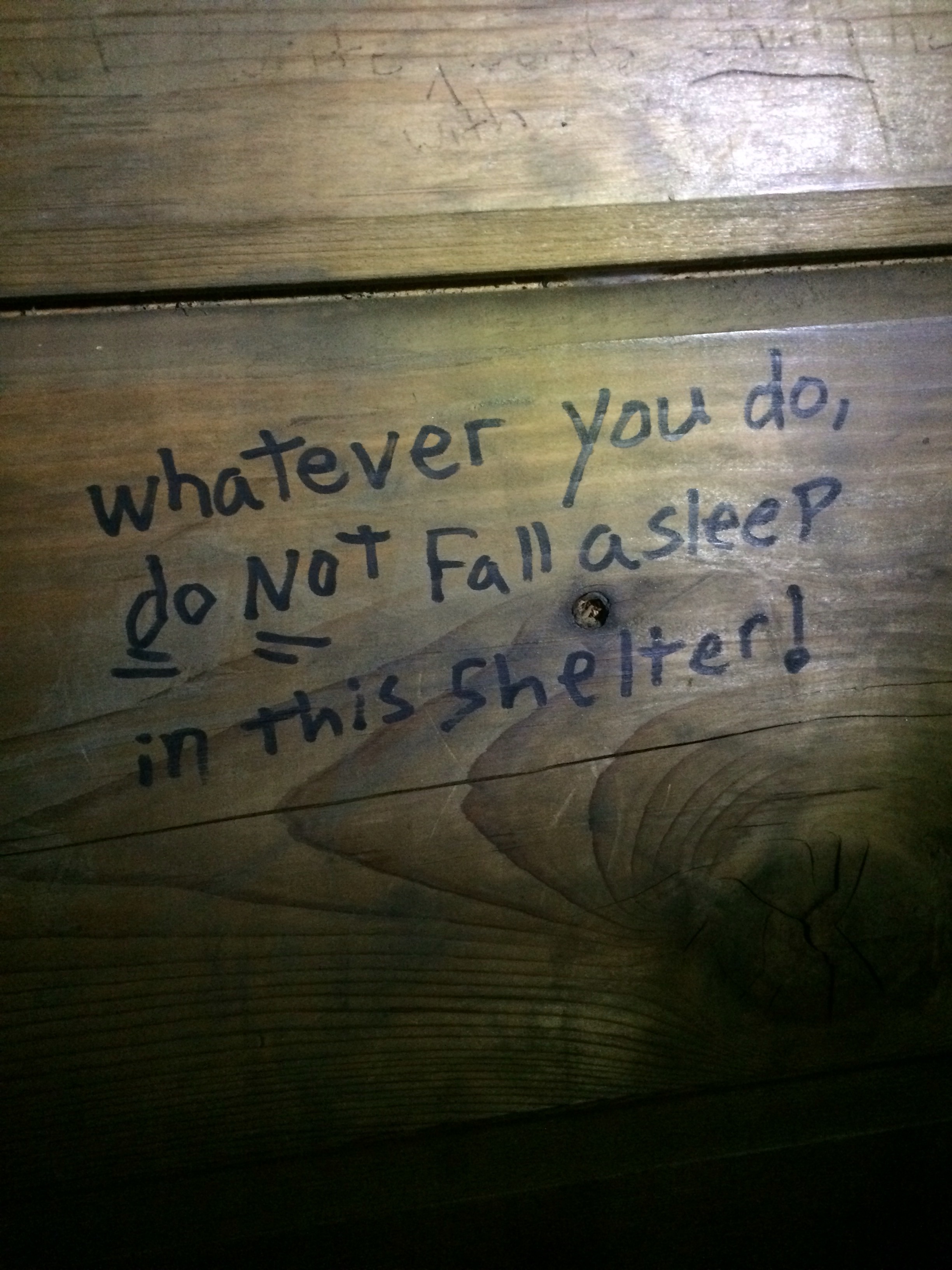
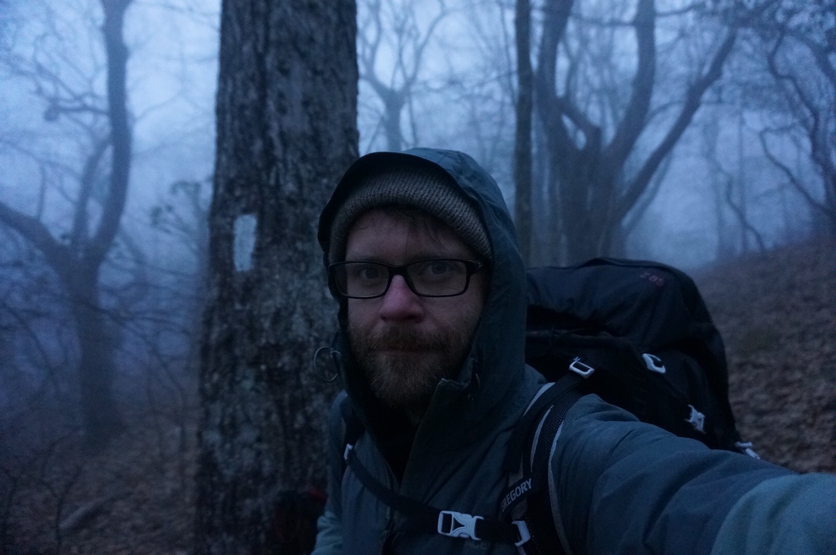
I woke up warm and cozy in the shelter – it really wasn’t that bad. As I visited the privy, Kool-Aid and Canuck backtracked a mile to the fire tower on Wesser Bald to watch the sunrise. I returned to the shelter to pack while Kodak slept.

The four of us had a lengthy breakfast and got started around 9:00. I wasn’t looking forward to the hike today. I’ve got two resources I use to check where I’m going, paying close attention to elevation changes.

I’ve got the A.T. Guide – a paperback book of elevation charts and trail town maps. This is what I was looking at this morning:


The two circled spots represent today’s start and finish. My dirty thumb is the N.O.C. I also use the Guthook’s AT Guide app on my iPhone. It is GPS enabled and tracks me – in this case, I’m the blue dot on the right (in my tent at Sassafras Gap), the N.O.C. is in the valley, and the orange icon on the left represents the shelter I woke up in this morning (at Wesser Bald).

  
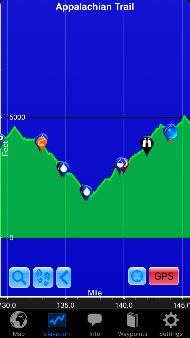
Note: The above screenshot looks huge using my WordPress app. Moving on.

So I use both of these resources to plan my day, look for water, prepare for tough hikes, etc. I was not looking forward to today’s hike – I feel like I may have said this a lot, but today was, by far, the hardest day yet.

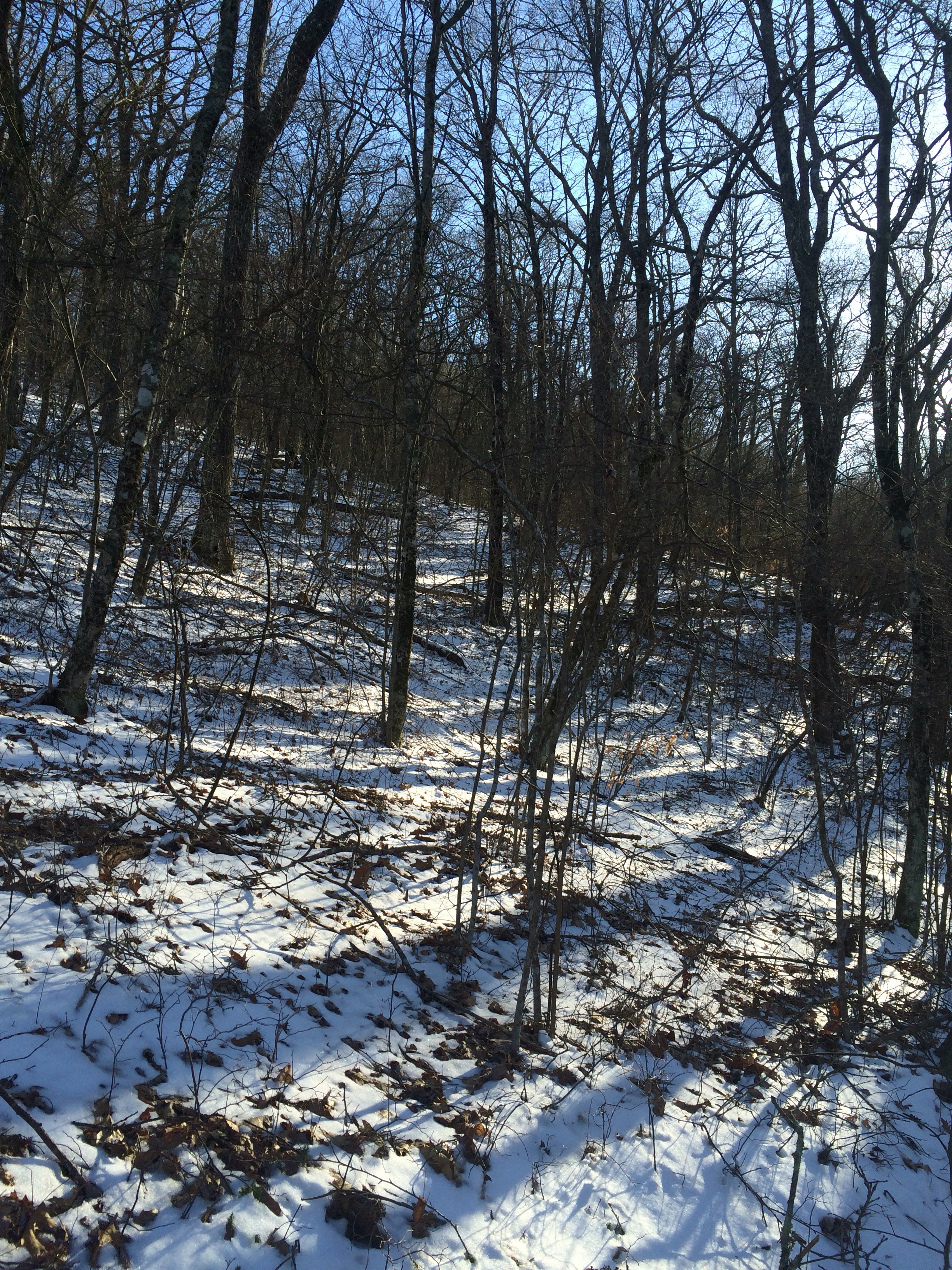
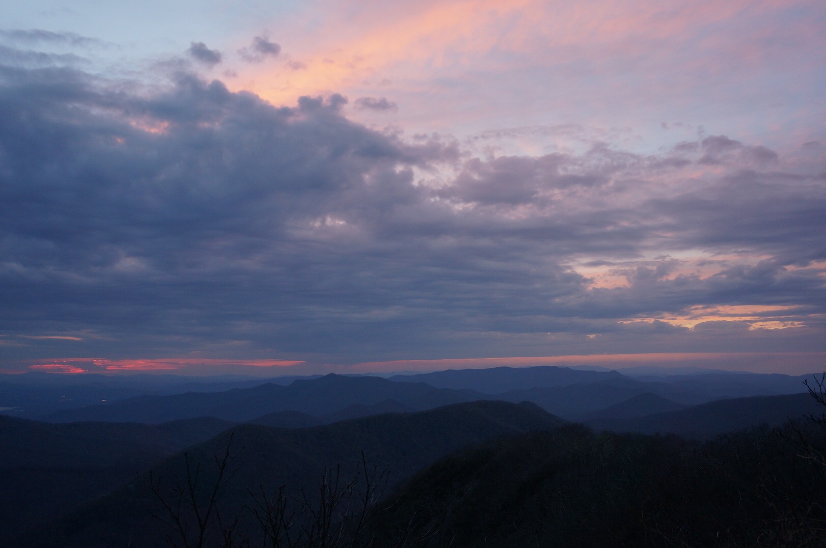
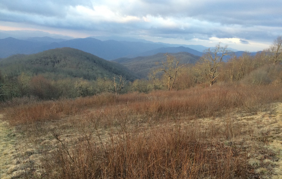
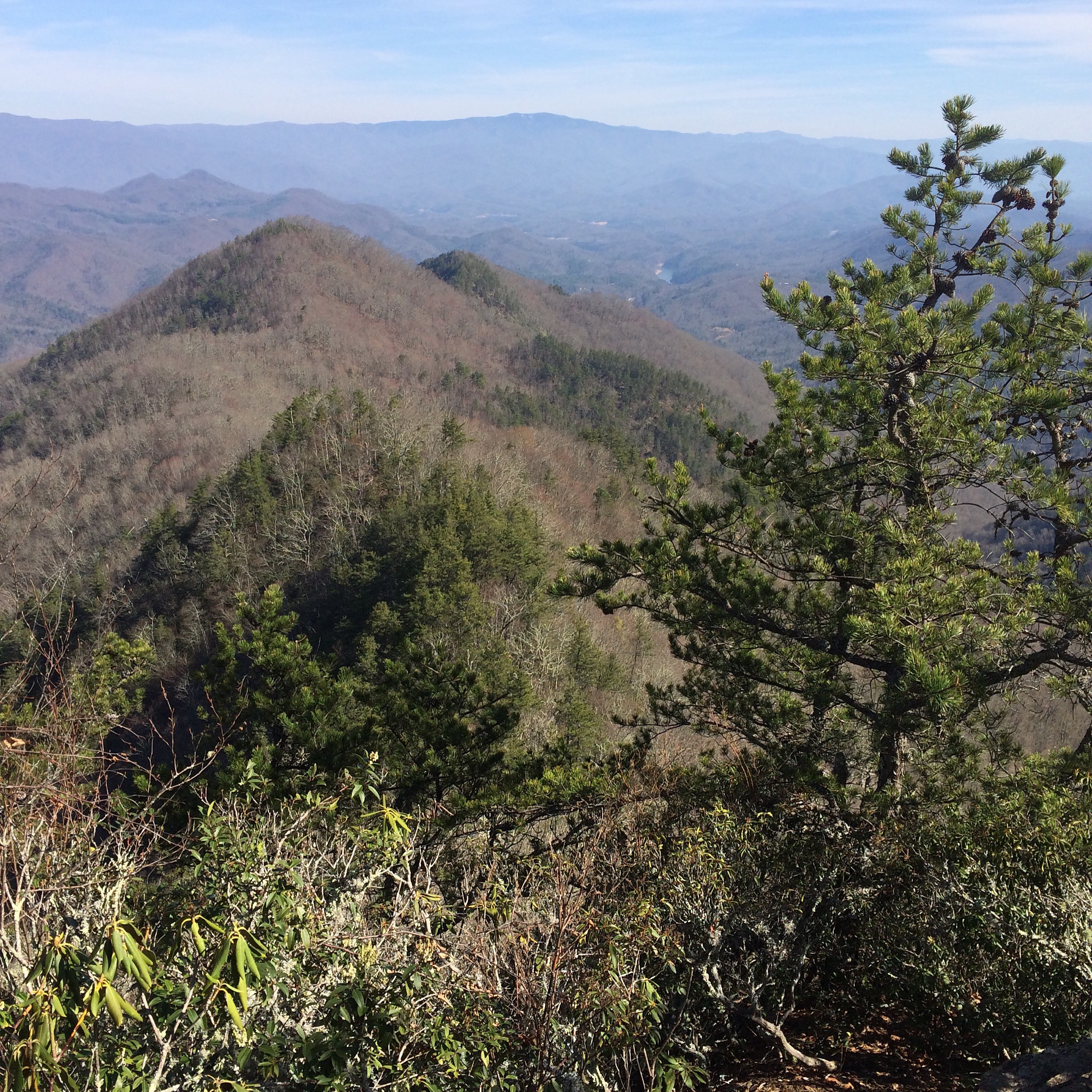
About a 1.5 miles from camp, I caught an amazing view of the day to come.


I’m camped somewhere on that ridge line in the background.
 
The descent into the N.O.C. was really hard on my right knee. I took it slow. In no time, I was passed by my hiking buddies and stayed at the end all day.

The N.O.C. itself was smaller than I imagined. I was able to have a hot lunch at the restaurant and buy some necessities at the outfitter. It felt good to scour the store and not come away with any major purchases.

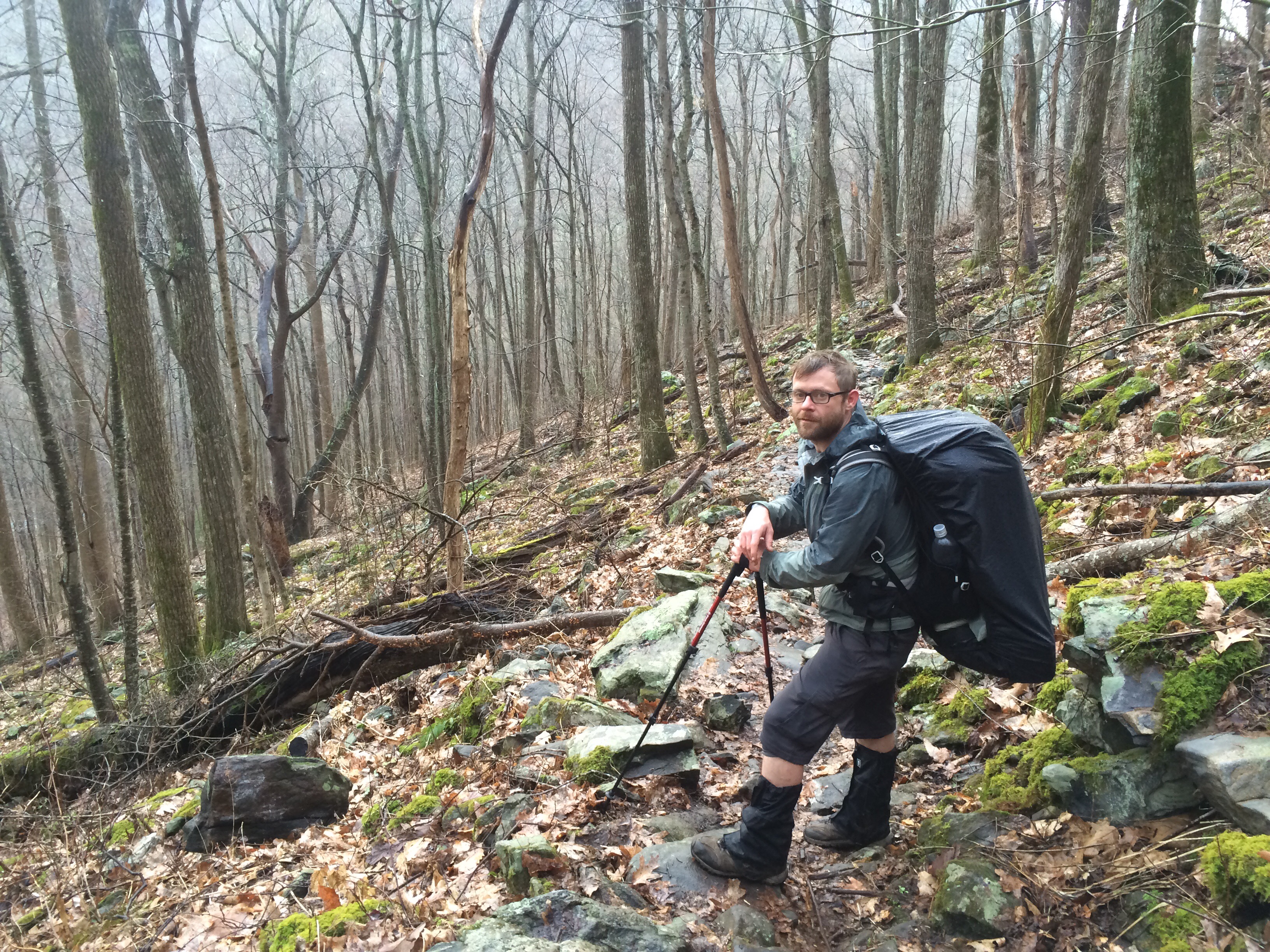
At 3:00, I started the 6.5 mile, 3000 foot climb up. There were few breaks in the terrain.


Straight up Cheoah Bald. The trail was rocky like this for a large portion of the hike.
 
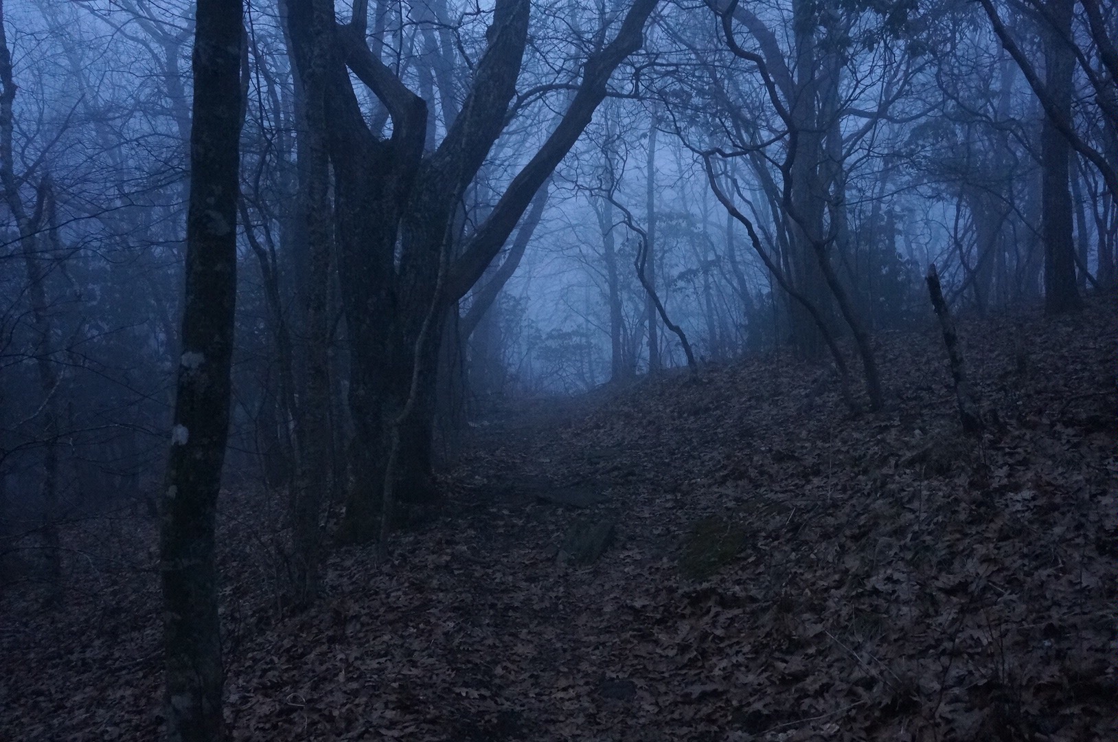
The sun was setting as I wound my way down into Sassafras Gap. It was packed. I seriously hadn’t seen this many tents packed into a campsite since that thunderstorm at Lance Creek, the day before I summited Blood Mountain.

Fitting then that I run into Alex, the hiker who attacked Blood Mountain in the dark, the fog and the rain at 5:00am with Savage and me about ten days ago.

It’s cool seeing a familiar face who shared a brief, but completely spectacular, experience. Apparently Alex saw Savage today, who’s now a good day ahead of us – she’s still planning on meeting us at Fontana though.

After my no-cook snack dinner, I hung out by the campfire with a group I had never met before – all good folks. I met a couple this morning, and again tonight, where he had to get off the trail because of knee problems last year. Really puts those early huge mile days into perspective.

Tonight, the four guys I’ve been hiking with are spread out all over this makeshift camp. I’m planning on waking early and hiking out a mile to have breakfast on the summit of Cheoah Bald to catch the sunrise.

It was a full moon tonight – an orange one at that. Folks have been catching a tandem moonset/sunrise combo lately. I’ve seen pictures – it looks amazing. I really hope I’m up early enough to see it for myself.

I had to set up my tent in the dark, on a hill, at the base of this big tree. The tree is preventing me from rolling downhill, you see. I’m kind of tacoed in here, but it works.

Breakfast: breakfast mix

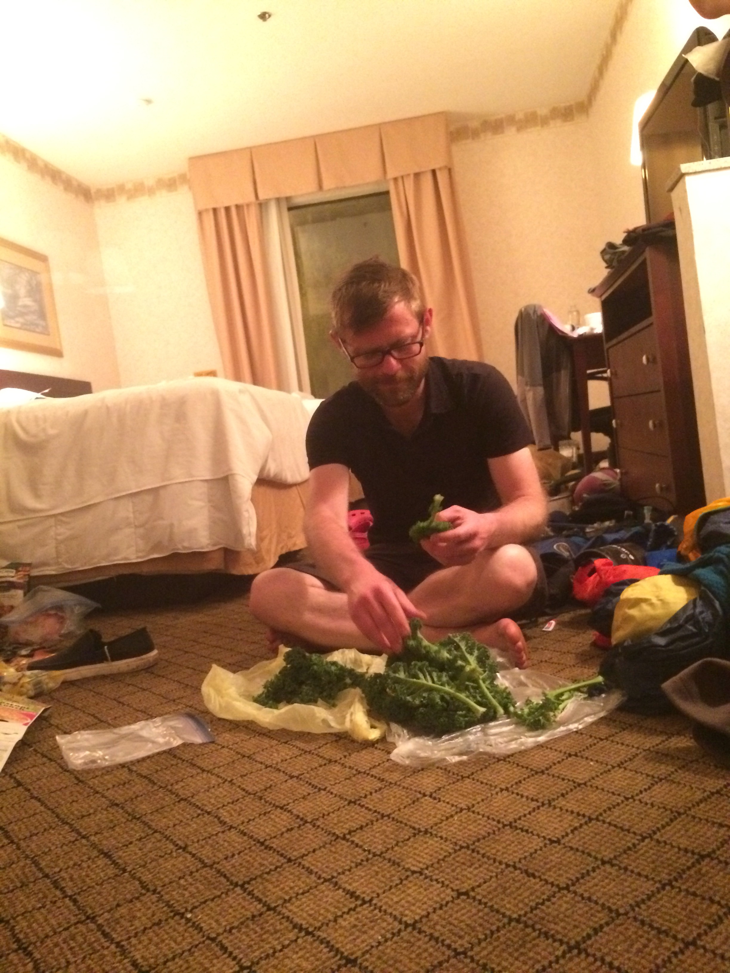
Lunch: The Sherpa with Chicken – rice, lentils, broccoli, mushroom, onion. It was awesome.

  
Dinner: too late/dark to cook so two bags of beef jerky, breakfast mix, the rest of the chocolate bunny, one bag of peanut M&Ms.

Money:

$9.95 plus $5.05 tip for lunch at the N.O.C

$44.43 for some stickers and a patch, a stabilizer for my fuel canisters, some Darn Tough hiking socks (A.T. Edition), some tiny soap sheets, and a pack of butt wipes.

Day 13 – Tuesday, March 22: Siler Bald Shelter to Wasser Bald Shelter, 17.4 miles, 131.4 total AT miles.

Note: I added a couple of pics to Day 12. Decent reception tonight, but still kinda slow on the upload.

I’m usually pretty efficient in the mornings when I want to be, but the fact that I slept with most of my gear last night to prevent it from freezing got me off to a slow start.

I ended up with what’s called a “yard sale” outside my tent. In order to get organized for the day ahead, I had to throw all of my gear out of my tent and repack it properly. Thankfully, nothing froze and I was able to stay very warm all night long despite the sub-freezing temperatures.

Leaving Siler Bald.

Today’s miles were ambitious, especially with the late start. I got on the trail ahead of the pack at 9:00. Even at that late hour, I still started out the day in full winter gear.

Today was pretty tough on my knees. I gained elevation rapidly and hiked at over 5000 feet for most of the day. The majority of the peaks I crossed today are known as balds – but not in the sense that they are naturally tree-free at the top. Most have a small, grassy clearing and a few have derelict fire towers perched atop.

My first stop of the day was at Wayah Bald, about six miles up trail. By this time, Canuck had caught up with me and we hiked to the top to find trail magic. Kicho, an older gentlemen who had thru-hiked the AT decades ago, set up a serious snack buffet. Despite the fact I already ate breakfast on the trail, I still stopped and had a few treats.

I was packing up to leave when Kool-Aid and Kodak wandered in. We confirmed our plan was still to meet at Wesser Bald and camp on the top. As I left Wayah Bald, I caught some amazing views from the stone observation tower located right on the AT.


The descent down Wayah Bald was fairly steep. It seemed like just as I was finally making good time, the ascent up Copper Ridge Bald slowed me down again. I followed the ridge for about a mile and hit Rocky Bald.

The views would have been nice, but the valleys were starting to fill with smoke – I could smell campfire in the air. After another steep descent, this time into Tellico Gap, I stopped a utility worker and asked what was going on with all the smoke. He told me the county was doing a controlled burn in the area.

My last two miles, that steep ascent up Wesser Bald, was tough. I knew there was an old fire tower at the top and was hoping for enough room to set up camp. It was Canuck, again, who caught up with me. We decided to press on to the shelter less than a mile away.

By the time we go there, it was already getting dark. I noticed the shelter was empty. I went for it. After all that talk of hating shelters, I found myself thankful that I didn’t have to set up my tent. I plopped right down and made a tasty dinner.

Kool-Aid and Kodak arrived at sunset and the four of us spread out on the wooden floor. I’m apprehensive about this. If I thought a mouse might enjoy it, I hung it in my bear bag. I’m sleeping with my water system again – not for fear of it freezing, but because I don’t want a mouse chewing on it.

It feels good to have finally figured out my water system. It’s a pretty simple setup. I put untreated water in the Platypus that sits in the brain of my pack. I cut the drinking tube and inserted my Sawyer Mini. So, as I drink, I’m drawing dirty water through the filter and into my mouth. There’s several ways to set up such a system – I just went for simplicity.

Pretty simple. Probably one of the most popular rigs.

Tomorrow looks tough. There’s a six mile descent to the Nantahala Outdoor Center (N.O.C.), a nature complex complete with river rafting, a restaurant, and an outfitter. I’m pretty sure I don’t need to buy anything. Maybe a little Thermarest folding cushion for my butt when I sit. We’ll see.

Upon leaving the N.O.C., there’s an eight mile ascent to Sassafras Gap Shelter and Cheoah Bald. I’m beginning to recognize that I need to slow my pace a little. While I’m still making good time, these mountains are too much for consecutive 15+ mile days.

I did a lot of thinking while hiking today. I didn’t figure anything out.

I’m looking forward to using the privy first thing to moron morning – one of the few benefits of sleeping in a shelter. I’m constipated.

Don’t worry.

Breakfast: Almonds, sunflower seeds, dried cranberries and granola. I’m calling this “breakfast mix” from now on. I purchased a Granite Gear accessory pocket for my hip belt. Now I can eat on the go. It was like two cups in all.

Lunch (trail magic): Little Debbie Raisin Creme Pie, two oranges, a banana, two fun size snickers.

Snack 1 and 2: beef jerky

Dinner: Parmesan Salmon couscous, 1/3 of a dark chocolate Easter Bunny (thanks Amanda!), coffee

Day 12 – Monday, March 21: Winding Stair Gap to Siler Bald Shelter, 4.2 miles, 114.0 total AT miles.

Note: Bad cell reception so no pics tonight. It’s a shame too. I ended up adding a few pics to Day 9 and 10 this morning at the hotel. That might have to become the norm until cell coverage improves.

I woke up in the hotel room to the strong odor of body funk. Despite the fact we had all showered and washed our clothes, the lingering odor of four days in the woods was all I could smell.

I uploaded pictures and handled my finances over breakfast. I went back to my room and started to pack up. Last night, Kodak gave me a “gear shakedown” to help me find ways to eliminate weight by getting rid of redundant items or gear I’m not using.

I had some tough decisions to make. I already did this in Hiawassee, GA, but still felt my pack was too heavy. After careful consideration, I had to say goodbye to my Alite chair among other things. I’m thankful I did – I sent a package home that weighed nearly three pounds.

It’s kind of crazy to think about the amount of knowledge I’ve gained in this short time with regards to gear and organization. Not that I know what’s best or anything like that, just that I now know what’s necessary versus what’s helpful. For example, backup water filter (Sawyer at a few ounces) – necessary. Alite folding camp chair (at just over a pound) – helpful.

Right now my pack weights 42 pounds – that includes three liters of water and a five day food supply. And I’m satisfied with that.

I’ve also learned that organization is key. What was once a ridiculously hyper-prepared first aid kit AND an over-stuffed toiletry kit have been condensed into one bag. I can now easily throw my toiletry/first aid kit into the food bag when I hang it at night.

Fun fact: Bears are supposedly attracted to the scent of lotion, deodorant, toothpaste, etc. This means they get hung with food at night.

Savage left at 10:00 to hit the post office and then start hiking. I hung around with Kool-Aid, Kodak and Canuck while waiting for a package from Seattle to arrive. The guys left at 1:00 to head to the post office and I relaxed in the lobby of the hotel. At 2:30, I got my envelope and immediately hit the road, taking a public transit van to the trailhead.

Today’s hike only called for just over 4 miles to Siler Bald Shelter. We decided last night that we wouldn’t push it today – there’s plenty of miles in the days ahead. Plus, the temp is supposed to drop into the 20’s tonight – I’d rather be tenting in a spot with a guaranteed fire ring.

I started hiking at 4:00 and made it to camp right at 6:00. I did get a surprise when I started ascending Siler Bald. What was a few flurries in Franklin was about an inch of snow at higher elevations. While I didn’t get a chance to hike in the falling snow, it certainly was a nice treat.


Nearing Siler Bald.
 
After a hearty dinner, I’m already in my sleeping bag. I didn’t sleep well in the hotel and am looking forward to a good night’s rest.

I just checked my thermometer – it’s 33, 34 degrees inside my tent. Speaking of which, I need to repair my tent tomorrow. One of the zippers broke on the rainfly. It’s still water tight, I just can’t use one of the doors. As soon as I have an opportunity, it’s going back to REI.


Tenting in the snow at Siler Bald. I’m freezing.
 
Over these next three days, I need to cover about 15 miles per day to reach Fontana Dam – the gateway to the Smokeys. This morning, I paid for my thru-hiking permit to gain entry to the Smokeys. Due to bears and the sheer volume of folks hiking and camping, the Smokies have some very strict guidelines – one of them being you must sleep inside a shelter, if possible.

This troubles me. I haven’t slept in a shelter for a few reasons – I enjoy the illusion of privacy my tent affords. Plus I can stay up late and write. I don’t have to worry about mice or snoring and so on.

There’s that, plus there’s been a norovirus outbreak among hikers in NC, so bad that the shelter rules have been relaxed in the Smokeys (according to rumor, so who knows).

I’m glad to be back on the trail. Going to town is nice, but it’s stressful. I’ve yet to stay in a hotel in a central location – Kool-Aid and I ended up walking four miles round-trip just to go to the outfitter and Walgreens. Throw in a couple trips to Ingles and we essentially spent our off-day doing a little urban hiking.

I’ve got (another) new water system. It’s pretty slick – I’ll try to take some photos of it.

Breakfast: blueberry waffle, OJ, coffee
Lunch: half a chicken sandwich from last night
Snack: almonds and beef jerky
Dinner: pasta with chicken gravy, salmon and bacon. I’ll admit, it sounds like a dog food flavor, but it was pretty tasty.

Day 11 – Sunday, March 20: Franklin, NC, Zero Day

I just did the usual town stuff – nothing special. It’s late and I still have to pack. I’ll add up my expenses after I find my receipts. Today went too fast y’all. I’m beat.

Most importantly, the 22 miles didn’t hurt my knee – it felt fine this morning when I woke up.

I have to go to the post office tomorrow morning and wait at the hotel for a package. I should start hiking again tomorrow afternoon and expect to make it 5 or so miles before camping for the night.

It’s about 55 miles from Winding Stair to Fontana Dam. I already have a reservation for a room at the Fontana Lodge for Friday.

Gotta go – it’s late and I’m tired.

Day Ten – Saturday, March 19: Standing Indian Mountain to Winding Stair Gap, 22 miles, 109.8 total AT miles.

I woke up early and cold again. In Hiawassee, I sent home the heavier of my winter clothes. I was a little worried I had done so prematurely, but to my surprise, I was plenty warm with all of my remaining gear on.

I retrieved our bear bags and quickly packed up. Similar to the drive to make Unicoi Gap last week, I set off in the early morning fog to hike 22 miles.

   
 Hiking alone in the morning is fast becoming one of my favorite things. While I’m not as fast as the other hikers in my group, I make up for it with early morning miles.

I finally decided to stop and have breakfast and then lunch 10 miles later in Betty Creek Gap at noon. I was making good time as the trail leaving Standing Indian was gentle, but that would soon come to an end.

The Albert Mountain ascent was easily the most difficult I’ve experienced on the trail. The trail literally went straight up the mountain. I put the trekking poles away for the first time and scrambled up the boulders. It was exceedingly difficult but a lot of fun.

At the top of Albert Mountain, I climbed an old fire tower for some amazing views. And the group still hadn’t caught up to me.


Just awesome.
 
North Carolina has been absolutely beautiful so far. The size of the mountains and valleys are so much larger in NC than in GA. I passed Long Branch Shelter and paused at Rock Gap. It was about 5:30. I had just under 2 hours to make the final 4 miles to Winding Stair Gap.


This photo doesn’t do this little gap justice.
 
I thought about bears. I thought about hiking in the dark. But I pressed on. I really wanted to complete my first 20+ mile day. And I wanted to be at Winding Stair when I went to bed so I could be one of the first in line to catch a ride to Franklin, NC.


Not what you want to see when hiking alone.
 
The hike to Winding Stair was surprisingly gentle. I emerged from the woods to find a gentleman in a Jeep waiting at the trailhead. I didn’t even have time to take my pack off before he asked me if I was looking for a ride to town.

Truthfully, I wasn’t. I was content waiting at the gap til morning. Plus, my hiking buddies were still miles behind and presumably meeting me here soon. I explained the situation and the gentleman told me he’d give me a ride back to the gap after buying snacks at the store in town.

I graciously accepted his offer and bought chips and Powerade for myself and my hiking buddies (if they made it all the way as we had planned).

As he was dropping me off at the trailhead, I noticed four headlamps standing in a circle. I hopped out of the Jeep and into the excited embrace of my hiking buddies. They were as shocked that I hiked the 22 miles by myself as I was.

We made an impromptu dinner buffet in the parking lot and set up camp on the side of the road.

I’m looking forward to a day off in Franklin tomorrow. I need to make a few gear purchases and mail some (more) unnecessary gear home. I’ll also need to buy some sort of a brace for my knee.

While my knee feels better than it did yesterday, I’m still using caution as it hurts from time to time. My feet, on the other hand, are doing great – no hot spots, no blisters.

Breakfast – The last of my almonds, dried cranberries and beef jerky.

Lunch – Couscous with spam, also the last of both.

Dinner – Powerade! Chips! Instant mashed potatoes!

Day Nine – Friday, March 18: Plumorchard Gap Shelter to Standing Indian Mountain, 13.7 miles, 87.7 total AT miles.

Note: No service again.
I woke up early, warm in my sleeping bag, but cold in my tent. Spotty cell coverage has prevented any of us from consistently checking the weather, but it looks like the rumors we’ve been hearing of an approaching cold from are true.

I retrieved our bear bags and packed up quickly in the early morning light. I needed to cover as much ground as possible today and tomorrow in order to make it to Franklin, NC on Sunday. I visited the privy one last time and took off.

After a quick up and over As Knob, the trail gradually starts gaining elevation. I paused about two miles before the GA/NC border and had a quick breakfast. I’d been thinking about crossing that border all morning now. As Savage put it, moving into another state makes you a “thru-hiker”.


One state down!
 
The three of us met at the border sign and had a quick break. North Carolina was impressive right out of the gate. The gradual ascent out of GA gave way to much steeper grade. In the 1.5 miles it took to reach the summit of Courthouse Bald, my first summit in NC, I had gained a thousand feet in elevation. And it was noticeably colder.

Another cool thing about leaving GA is I’m also leaving the Chattahoochee National Forest and entering the Nantahala Wilderness. Forestry service roads are still closed from winter. We’re pretty remote.


As seen after crossing the border.
 
I decided I was going to have lunch and get water 6 miles ahead at Deep Gap. It was another case of headphones in and moving on.

As I hiked today, I noticed a few things. First, the plants. Spring has still not come to higher elevations. The only green you see aside from moss and small patches of grass is from rhododendron, holly or pine trees – and they’re few and far between to begin with.

I also noticed that, as I was gaining elevation in NC, the mountains were getting larger in size. There seem to be fewer small peaks and much longer ascents and descents than I’m used to.

I started getting really hungry about a mile before hitting Deep Gap, but I rode it out. By the time I arrived, I was starving. I ate and ate and ate. It was great.

After about half and hour, Savage emerged from the woods with Kodak, a nice guy who’s also hiking with a camera. And soon after them, Kool-Aid joined us. While we had hoped to make it up and over Standing Indian Mountain, it was decided that we should camp on top. The timing was working out such that we should have plenty of time to set up camp on the summit and watch the sunset.

Man, I’m glad I did. I’m also glad I brought my camera – I finally put it to good use. I can’t wait to get some of the pics of the sunset up. It was truly incredible.


 Apparently, Savage, Kool-Aid and Kodak were able to convince Canuck to bypass the shelter and camp with us in the clouds. So there’s five of us tonight.
This’ll probably be one of the highest campsites I experience on the entire AT at 5400 feet. There’s a fair amount of wind and it is really cold outside – again, don’t know exactly, but I’d imagine close to freezing.

Today was a hard day hiking – by far the hardest I’ve had yet. We had a few small rock scrambles. It’s like the AT trains you, like the trail was designed to slowly give you skills in the beginning that you’ll need to master before moving on to the next harder section. Gone are the volunteers at the shelters. I guess the ATC assumes that, if you made it this far, you’re probably good to go.

Tomorrow’s gonna be all about covering ground. I do want to check out the fire tower on Albert Mountain. In all, it’s 21.9 miles to Winding Stair Gap, and a ride into Franklin, NC. That’s a lot of miles to cover. I may have to stop a few miles short, but at least I’ll be close to the road crossing on Sunday morning.

I am pleased with my right knee – seems to be doing a little better. The bandana brace is working. I met a doctor who confirmed I just need to slow down a little. My feet are looking great, too. I’ll prob skip on buying boots in Franklin.

I’m getting really tired – I’m hoping to be up at 5:30 to start hiking.

Breakfast – Laura Lynn Virginia Creeper trail mix (whole bag)

Snack – Handful of almonds

Lunch – about two cups almonds, half cup dried cranberries, the last of my beef jerky, 2 Little Debbie Nutty Bars.

Dinner – salmon and couscous with a creamy pesto sauce.

Day Eight – Thursday, March 17: Swag of the Blue Ridge to Plum Orchard Gap, 11.9 miles, 74.1 total AT miles.

Today started late as I woke up still sore from the day prior. My right knee was killing me as I shuffled to collect my bear bag. I borrowed a bandana from Kool-Aid and tightly tied it just below my kneecap for extra support. While my feet are doing great with the addition of the Superfeet insoles, I can’t say the same about my knee.

Cool sign for a dumpy campsite. I got had.

Savage was off to the races before I was even out of my tent. I took my time. Aside from the nagging knee pain, I was pretty constipated. Sorry to bring this up, but when life becomes as simple as eating and hiking, an irregular bowel movement is a big deal.

I finally starting hiking just after 9:00 knowing I had a 12 mile day ahead with lots of ups and downs. My first summit of the day was Kelly Knob. While it wasn’t the killer I remember it being from my youth, it was still difficult.

Kelly was the first of three summits today – up next was Powell Mountain. Powell wasn’t quite as steep, but it had elevation and views to match. I refilled on water shortly after Powell.

I’ve met a few folks who don’t purify water at all. They believe in the cleanliness of pure spring water and drink straight from the source. Most of the time my critical brain kicks in and I would never drink untreated, fresh water. I still didn’t, but today showed me why some think it’s okay. The spring I filled up at flowed directly from the base of a tree – one of the coolest things I’ve ever seen.

A spring emerges from the base of a tree.

Powell led me in a painful descent for over two miles to Dick’s Creek Gap. After emerging from the woods and crossing the road, I had lunch with a group of other hikers, most of whom I hadn’t met before. And all were taking advantage of the road crossing to hitch into Hiawassee.


View from Powell Mountain.
 
It was 2:00 and I still needed to hike 4.5 miles to Plum Orchard Shelter. I put on my headphones and quickly crossed Cowart Gap and the surprisingly difficult Buzzard Knob in about 2.5 hours for my third summit of the day.

For the last hour of hiking, one thought, and one thought only, had been occupying my mind – the privy. 

Privies are something special. So far in GA, the volunteer AT clubs have kept these backwoods outhouses immaculate. Because I’ve been camping mostly in the gaps between mountains, I haven’t had the opportunity to utilize facilities of any kind, however crude. Tonight was a treat.

Instead of tenting near the shelter, we decided to set camp near the trailhead. I made another disgusting dinner and we started packing up for the night.


It looked really good, but it wasn’t.
 
In order to make Franklin, NC by Sunday morning we’ve got to hike 35.7 miles – that’s two big days followed by a short hike into town. At least that’s the plan. I’m thinking an early afternoon check-in. We’ll see.

In 4.5 miles, we’ll cross the GA/NC border. The elevation profile looks rough for tomorrow morning – there’s a good six miles of steep climbs, followed by the gradual ascent and descent of Standing Indian Mountain. The tentative goal is to have an early dinner on the summit at 5400 feet and tent shortly thereafter.

Tonight is the coldest it’s been. I went from shorts and a t-shirt at noon to wearing my puffy jacket in my 20 degree sleeping bag. And it’s supposed to get colder, but I’m ready.

I didn’t really hike with anyone today. I successfully stayed in the middle of the pack. I enjoy the calculated isolation – I’m never more than 30 minutes from another hiker. Usually.

Because of this, I got to appreciate the stillness and utter silence of the deep woods. It was very cool.

Full moon’s coming and there’s talk of a night hike if the weather stays bearable.

Breakfast: handful of almonds

Snack: dried figs (hold on)

Lunch: 2 bags of beef jerky, the rest of the dried figs, two whole-wheat flat breads.

Snack: probably 2 cups of almonds, no joke.

Dinner: Oh man. This was the worst thing I’ve eaten since starting. A boiled stew of kale, dried cranberries, almonds, Spam and basil. I ate it as it was good for me, but it was foul.

Day Seven – Wednesday, March 16: Unicoi Gap to Swag of the Blue Ridge, 9.3 miles, 62.2 total AT miles.

Today was a rough hike. I’m not sure if it was the long, kind of indulgent day spent eating, shopping and napping in Hiawassee. I didn’t sleep well at all in the hotel, despite my best efforts. I’m happy to be back in the tent.
While Blood Mountain was a serious climb, the 17-mile stretch of mountains from Unicoi Gap to Dick’s Creek Gap contains some of the toughest climbs in the state. We were warned by multiple people that today was gonna be tough.

We arrived back at Unicoi Gap at around 11:30 and immediately started the difficult climb up Rocky Mountain. It was tough – you gain 1000 feet of elevation in just under a mile and a half. I was climbing slowly.

On top of being tired, by right knee began bothering me more than it had on Monday. The pain was particularly bad when the trail headed downhill. Descending Rocky was a struggle. When I got to the bottom of Rocky at Standing Indian Gap, I wasn’t surprised at all to learn I was only averaging just over mile an hour. And the usually speedy Savage and Kool-Aid weren’t faring much better. 

After a quick snack break, we headed off for the summit of Tray Mountain. This is another one of those hikes that brings up vivid memories of camping and backpacking as a Scout. And again, it was another brutal climb.

  
View north from Tray Mountain.

 The three of us met up again just before hitting the summit and shelter. We discussed our various aches and general lack of energy. It was decided that, instead of pushing ourselves as we had been, it might be best if we just eased off the gas a little. We agreed to reconvene four miles up trail at Swag of the Blue Ridge and camp for the night.

We made it Tray Mountain Shelter shortly there after. Aside from that first night at Springer Mountain Shelter (where I tented), I really don’t like camping near shelters. It’s my own personal preference – I like the quiet and privacy of camping in some dumpy gap a few yards off trail.

It was 2:30 and close to a dozen tents were up with hikers reading and cooking. The shelter itself was empty so I took the opportunity to stretch out and check the hot spots on my feet.

This morning at the hotel, I applied foot cream before covering the hot spots with athletic tape. I wore brand new socks and was anxious to see how the Superfeet inserts would help. Everything seems to be working. The hot spots are not starting to blister and the inserts give me a little more protection against the rocky terrain.

Kool-Aid went to the spring to get water and Savage ran into a hiker she hadn’t seen since day one. I was getting hungry and a little tired and decided to press on.

After the initial descent of Tray, the trail followed a gentle ridge line that made for easy hiking. I arrived at Swag of the Blue Ridge at 5:30. I’ll be honest – with a name like Swag of the Blue Ridge, I expected a little more. It’s obvious that this campsite is infrequently used. It was a little overgrown and the fire pit was buried in a season’s worth of leaves.


But it was good enough. Tonight wasn’t that exciting – quick dinner and straight to bed. I’m beat.

I weighed my pack this morning before adding a five-day food supply and water. My base weight is 32 pounds, not too bad. But throw in the food and 4 liters of water, and the weight shot up to 45 pounds.


Ultra-lightweight backpacking is becoming increasing popular. I’ve run into a few hikers with ridiculously small packs – one guy claimed his pack weighed a mere 21 pounds with three days food.

To some extent, every hiker I’ve run across utilizes ultra-lightweight methods and gear. For example, the most popular water purifier on the trail this year, the Sawyer, weighs only a few ounces. That’s a far cry from the nearly one pound purifier combo I was planning on bringing.

It’s cool to keep learning tricks and seeing how I can better my gear as the hike progresses. I did spend a lot of money in Hiawassee on things that I didn’t foresee needing. Thankfully, I don’t think I’ve got a lot more to buy.

I was actually impressed enough with the Superfeet that I may hold off on buying boots when I arrive in Franklin, NC this Sunday.

Tomorrow is going to be another low-mileage day. Two miles after leaving Swag, I’ll hit Kelly Knob. While it’s not a tall mountain, it is steep and instead of utilizing switchbacks, the trail goes straight up.

And even knowing that tomorrow will probably be painful, I’m actually really excited to be back in the woods. In two days, I’ll cross into North Carolina.

Rumor has it it’s going to get really cold soon. I’ve still been hiking in shorts and a t-shirt.

Breakfast: one and a half biscuits and gravy, coffee, OJ

Snack: Laura Lynn Virginia Creeper trail mix

Lunch: the other half of the Blimpie Best with extra meat

Snack: more Virginia Creeper, beef jerky

Dinner: Salmon pasta (I need to work on this one), almonds

Money: 2 nights hotel $50, tip for housekeeping $10, shuttle to Unicoi $7.

Day Six – Tuesday, March 11: Hiawassee, GA, Zero Day

Note: Just found out I can’t upload pics from my Sony while it’s charging.

Today I discovered exactly what backpackers do when they’re not backpacking – they resourcefully resupply and eat a ton of food.

I woke up, for no reason other than habit, at 6:00. Savage wanted me to check if breakfast was being served. Sure enough, it was. We ate heartily and I went back to sleep.

I awoke again at around 10:00 to start my day. Brandon, now Doc, (like from Back to the Future – he thought we looked like time travelers with all our neat gear) left at noon. Nice guy, I hope he’ll one day be able to take a long hike.

I guess the best way to describe my day is to follow the receipt trail from one store to the next. Here we go…

I started off at the Dollar General in desperate need of temporary camp shoes. I settled on a pair of cheap sandals. Hearing that the only outfitters in town had closed, I stopped by the ammo/bait shop and bought a new pair of socks.


Cool label. But not cool enough to warrant a purchase.
 
I dropped by the hotel and met with Savage and Kool to head towards the post office. I mailed about 3 pounds of gear home and Savage arranged to have a delayed package shipped to Frankin, NC, our next planned town stop.

While waiting outside the post office, we ran into two thru-hikers from Austrailia who informed us that there was a small backpacking store located near the hiker-friendly Budget Inn. What a lifesaver! I was seriously concerned about my feet, particularly hoping for a decent shoe store. I ended up buying Superfeet inserts. And having tried them out around the hotel this evening, I think I’ve delayed the need to purchase new boots.

I also upgraded to the larger Sawyer filter, holding on to my Sawter mini as a back up. I bought a dry bag for my toiletries and other assorted odds and ends (compression straps, blister cream).

We left the outfitter and headed to Blimpie for lunch. I ate half a foot long and promptly took a nap. An hour or so later, I woke up and made calls to family and friends.

The three of us then went to Ingles for a food resupply. We only needed three days worth of food as we’re going to make a quick stop back in Hiawassee when we hit Dick’s Creek Gap in a few days. At that point, we’ll resupply for three additional days to take us to Franklin, NC.

Already having enough carbs left over from last week, I went with the protein basics – beef jerky, salmon packets, granola and almonds. I also bought more fresh kale. I think it’s awesome for backpacking – it lasts 2 to 3 days in a Zip-lock bag and can be added to just about anything.


Getting my kale ready.
 
I then stopped by the Discount Pharmacy and bought athletic tape and a $2 mystery grab bag – hilarity ensued. Savage got earrings and Kool-Aid won himself a shell necklace. All was not lost – a roll of quality toilet paper was included (as was an Easter bunny party favor, now packed deep in my bag, just waiting).

And then dinner at the AYCE. This was the first meal I’ve had since starting this hike where I ate considerably more than I would normally eat without feeling over-full. I was stuffed, sure, but it felt good, like my body was already putting the food to good use.

After dinner, we headed back to the hotel room to ready ourselves for the week ahead. I booked a room for this coming Sunday in Franklin, NC, hoping our mail drops would be waiting for us when we arrived.

I’m now downstairs in the lobby of the hotel, typing away. Savage and Kool-Aid are passed out. I need to join them as the next few days bring some of the toughest hikes on the AT in GA.

I should briefly mention an encounter I had today with Ms. Janet, an AT legend. She pulled up in front of our hotel to get coordinates for her GPS. Ms. Janet dedicates her free time to helping thru-hikers as best she can all throughout the North Ga mountains. She was trying to figure out how best to get to Addis Gap near Tray Mountain to help out in the emergency extraction of a hiker.

I helped her figure out her new Garmin and, as she cranked up her conversion van, she asked if I had a trail name. I told her that folks had been calling me “Dad” (or “Cool Dad” when I was in a good mood). She smiled and confirmed that Cool Dad fit best.

It’s official. I’m in a club that hands out nicknames and a de-facto leader of this club gave my nickname the okay. I know how this must sound – pretty dorky and ridiculous, right? When I sat at home for years reading AT journals like mine, I always rolled my eyes at the trail name business. But I’ll be honest, it was kinda cool to know that, for as long as I do this thing and maybe longer, I’ll be known as Cool Dad (or just Dad in a pinch).

Breakfast: one biscuit with canned country gravy, 6 strips of paper-thin bacon, two cups O.J., two cups coffee.

Lunch: 6-inch Blimpie Best with double meat.

Dinner: Oh geez. Three porkchops (two deep-fried, one baked), one cup of gravy, plate full of raw broccoli and raw sliced green peppers, dinner roll, two serving of strawberry shortcake.

Money:

Dollar General (camp shoes, plus a phone charger for Savage): $13.00

Ammo Shop (really should pay more attention names): $11.95

Post Office: $13.45

Outfitters (at Budget Inn): $164.65

Blimpie:

Ingles (for food resupply): $67.15

Hiawassee Discount Pharmacy: $3.34

Daniel’s AYCE: $8.95

Note: I know I’m spending much more on gear than I expected. I’m okay with it – it’s only the result of trial and error. After this week, I’m not expecting any substantive purchases until I buy boots. I’m learning.

Day Five – Monday, March 14: Bag’s Creek Gap to Unicoi Gap, 17.0 miles, 52.9 total AT miles

After that amazing night camping on the saddle between two mountains at Bag’s Creek, the four of us got off to a fairly early start. 

We initially started the day envisioning a 12 to 14 mile day figuring it’d be easy to wake up tomorrow morning with a 3 to 5 mile hike into Unicoi Gap where we’d take a shuttle or hitchhike into Hiawassee, GA for a day off.

Today’s elevation profile called for everything, as did the weather report. While we were packing up, I mentioned the increasing chance of rain to Kool-Aid (official spelling). He shrugged his shoulders – bad weather has kinda become par for the course for us.

The four of us set off from Bag’s Creek at different times. Rarely do I, or anyone else I’ve met, hike with other people. It’s more like you hike between other people and expect to meet them at water sources or shelters.

I left first but was quickly passed by my comrades. I was purposely taking it slow due to the hot spots on my feet. It’s as if the soles of my boots are too thin for the jagged terrain. I’m not getting friction blisters, as is often the case – I’m getting what feels like impact blisters. They were forming on the points of my sole (the fleshy part behind my big toe) that made the most contact with rocky steps up or down.

I started the day on the summit of Cowrock Mountain. The view was amazing. It really put the North Georgia mountains into perspective – while they’re not as high or jagged as those I’ve become accustomed to in the Pacific Northwest, it was neat to witness this one point on the Earth where foothills became mountains, like some sort of landscaped crescendo.
 

Just awesome. I hung out on the summit for a good 15 minutes.
 

Today was all about moving. I hiked under the constant threat of rain. Thankfully, after the initial ascent of Cowrock, the elevation profile leveled off a bit. Not much, but just enough to put my headphones on and power through.

I ran into a few folks along the way, passing them and getting passed, but it was becoming increasing apparent that I was lagging a little behind my hiking buddies.

I’ve noticed this one thing about myself that I’ve come to rely upon while backpacking – sometimes, I can be a stubborn jackass. Today, it worked to my benefit. At some point early on in today’s hike, I decided I was going to make it to Unicoi. Damn the weather, damn my feet, I was making it to the road crossing at Unicoi no matter what.

The way I saw it, my gear was wet. I was down to one pair of hiking socks, having completely burned up a pair on a hot rock the night prior (Note: Hot rocks can both dry and destroy gear). I had nothing left in my food bag aside from pasta and couscous. If I wasn’t going to make it to town until Tuesday, I wanted to be sure that, when I woke up, I was as close as possible to that road crossing.

I put my head down and powered on for the next 10 or so miles, arriving at Red Clay Gap at 2:30. As I crested the ridge, I saw my three buddies having a quick snack, already readying themselves to move on. And by this time, the weather was getting dark again and the winds were picking up.

I think the one thing I’ve learned the quickest about backpacking is how to dress. For example, rain pants are hot. Sure they’re effective in a downpour, but for a brief shower, they’re severe overkill. The forecast wasn’t calling for anything severe, I left my Prana quick-dry pants in shorts-mode and strapped gaiters to my feet.

Sure enough, the 1.6 mile hike from Red Clay to Blue Mountain was all uphill and consistently rainy. It felt great to finally figure something out. The gaiters kept my feet dry and my rain jacket wicked the rain onto my quick-dry shorts – never enough to saturate them (and risk chafing), but just enough to keep them manageably damp. It was refreshing. I could now hike in the rain comfortably.
 

Cool Dad working it.
 

Having again relegated myself to the caboose in our hiking train, I approached the Blue Mountain Shelter knowing full well all three hiking buddies were somewhere ahead of me. As I passed a water source and made my approach, I noticed someone had conspicuously tied a bandana to the sign indicating the shelter trail veered left. I recognized the bandana from camp the night before. Smart move, guys.

I pulled into Blue Mountain wet but determined. Kool-Aid was making instant potatoes and Savage eating candy. I set my pack down long enough to to stuff the last remaining instant oatmeals into my pocket to eat as I pressed on. Out of necessity, I’ve come to rely upon eating instant oatmeal straight from the packet as a great energy source.


The jagged, mossy way up.
 
The sky was getting darker and it was getting wetter, but I truly didn’t care. I told my buddies that, after getting fresh water, I was pressing on towards Unicoi, only 2.4 miles away. Their strong affirmations only led me to suspect we were all on the same page from the beginning.

The problem was that those 2.4 miles were all downhill. It was a tough descent on my bruised feet. And I noticed that my right knee was starting to hurt a little. Again – trekking poles, folks. If you use them correctly, they’re lifesavers.

We emerged from the woods and rolled into Unicoi Gap at 6:30 and set about trying to find a place to camp. There really weren’t any good options – aside from backtracking a few hundred yards and camping on the trail itself.

Good use of tax dollars.

We were all in a pretty sad state. While we had already booked a room for Tuesday, Kool proposed getting a room for tonight as well. I was in instant agreement.

We called a shuttle and found ourselves at the Holiday Inn Express in Hiawassee in less than 30 minutes. The four of us gorged ourselves the AYCE (all you can eat) buffet next door before heading off to bed. I’m really looking forward to having tomorrow off. There’s a lot I need to buy in town. I’m exhausted.

Breakfast: bag of beef jerky, ramen noodles (I ate them raw)

Lunch: 2 bags of beef jerky, my remaining bacon bits, the last of my granola (about one cup).

Dinner: 2 chicken thighs, pile of raw broccoli and raw sliced green peppers, one roll, about one cup of brown gravy, two servings of strawberry shortcake.

Money: $10 shuttle to Hiawassee, $8.95 plus $3 tip buffet. Don’t know the hotel price as we’re staying two nights.