Day 33 – Monday, April 11: a spring (1.3 miles north of Sam’s Gap) to Nolichucky River (Erwin, TN), 23.5 miles, 342.4 total AT miles.

I woke up early and, for the first time in recent memory, warm. I was determined to make big miles today. With a few exceptions, the terrain looked only moderately difficult. I left camp at 7:00, (jealously) watching Shaggy eat cheese grits from his tent.
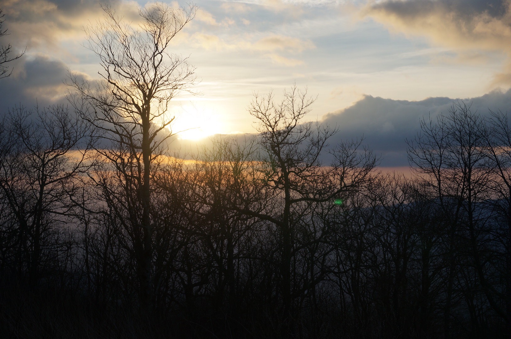
Less than a mile outside of camp, I crested a small rise and paused to watch the sunrise. Man, I was feeling really good today. I munched on breakfast in the early morning silence before pressing on.

  
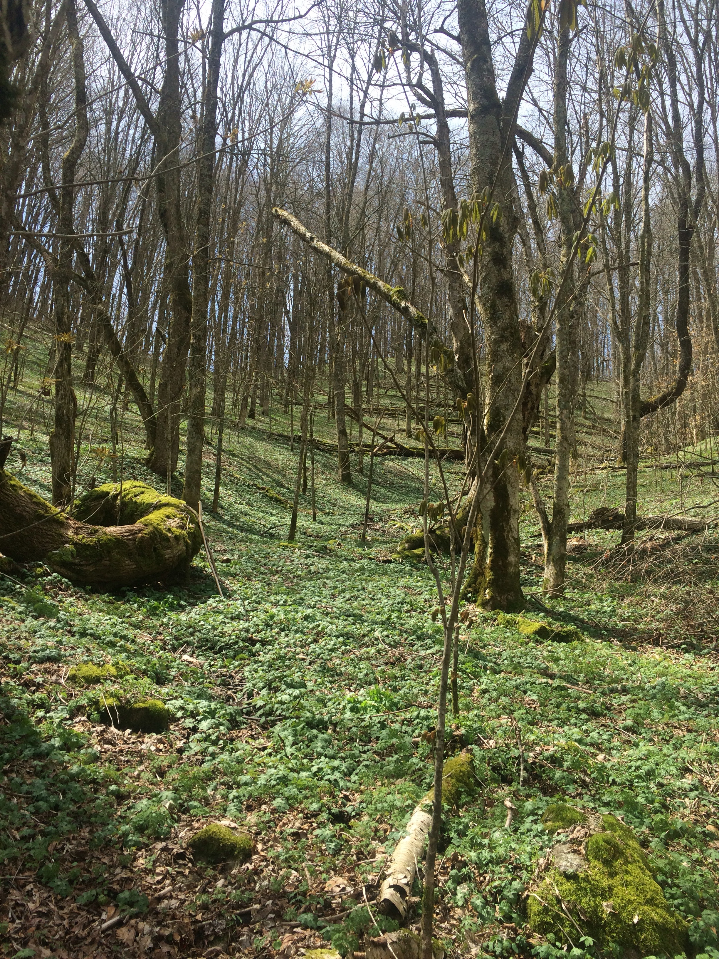
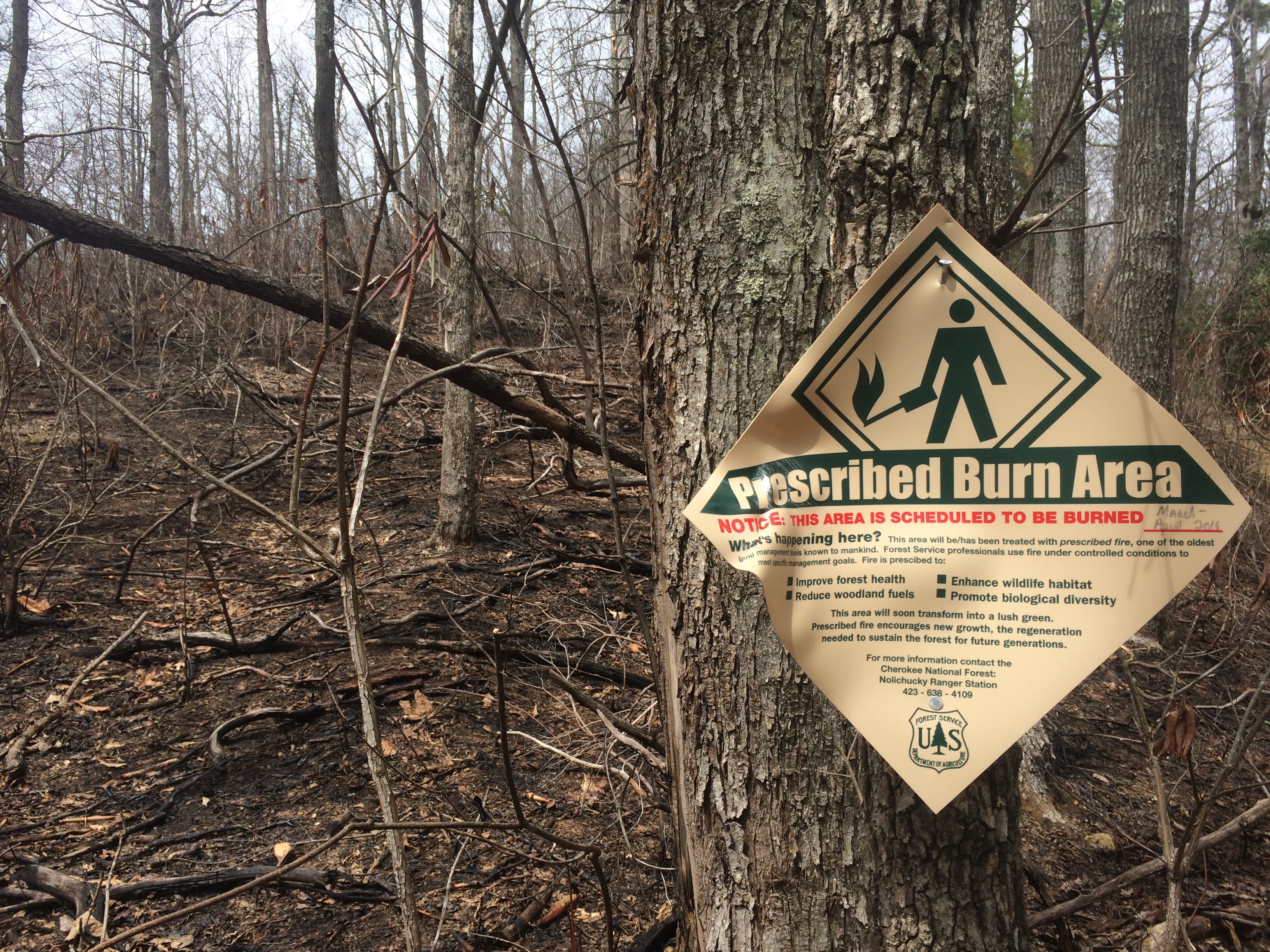
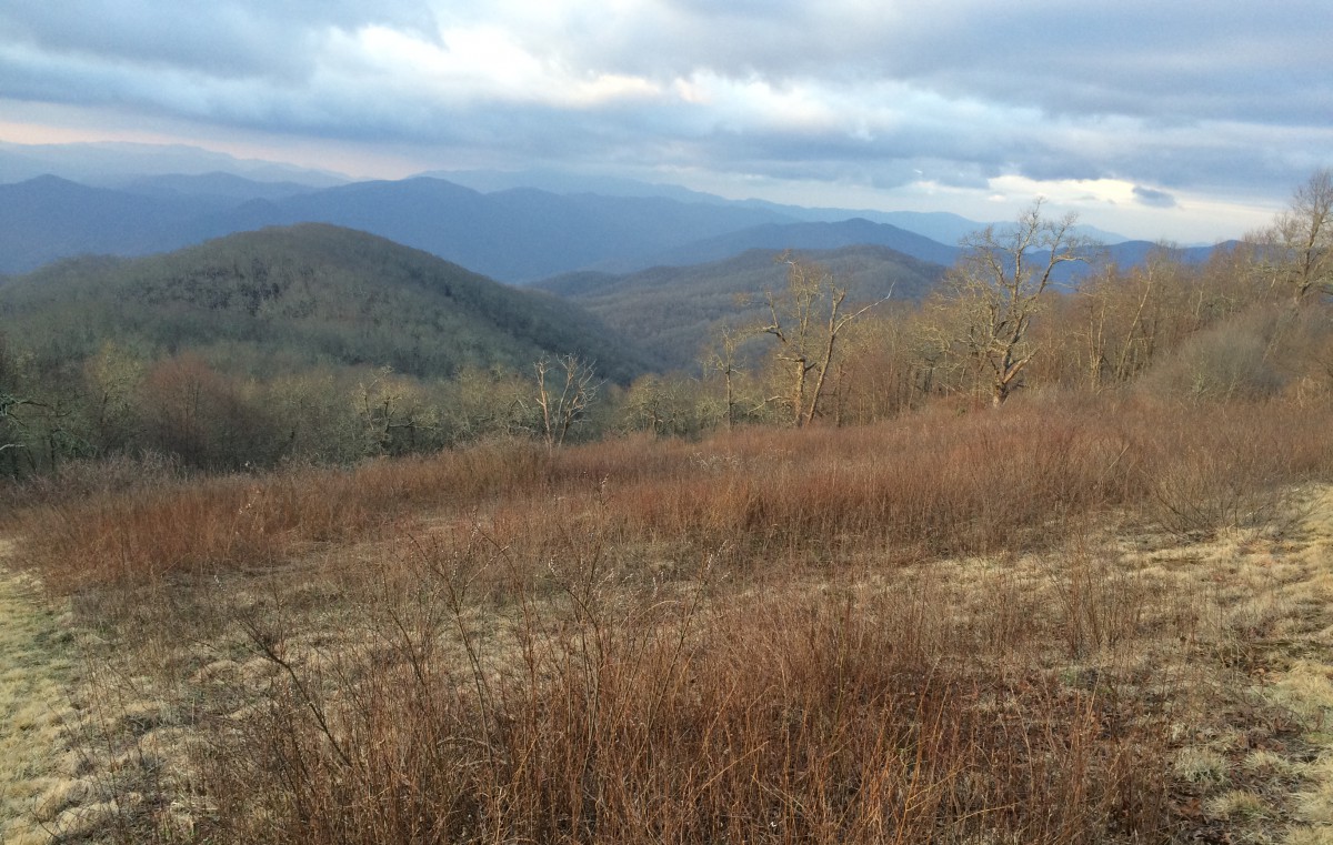
After a quick water refill at Low Gap, I started making the push up Big Bald – a mountain that’s been visible in the distance for a few days now. The ascent slowed me down, but I was really feeling good. I reached the summit at 10:00 and enjoyed the amazing views – not as beautiful as Max Patch, but still stunning nonetheless. As I was descending Big Bald, thought I could hear Moon Boots shouting from the summit, but I couldn’t be sure. Whoever it was, they sounded excited. I pressed on.

  
I stopped to have a quick snack at Bald Mountain Shelter and utilize the privy. I struck up a conversation with a few hikers – weather talk. Trail rumor had rain moving in tonight – light showers starting at 9:00pm and getting worse throughout tomorrow.

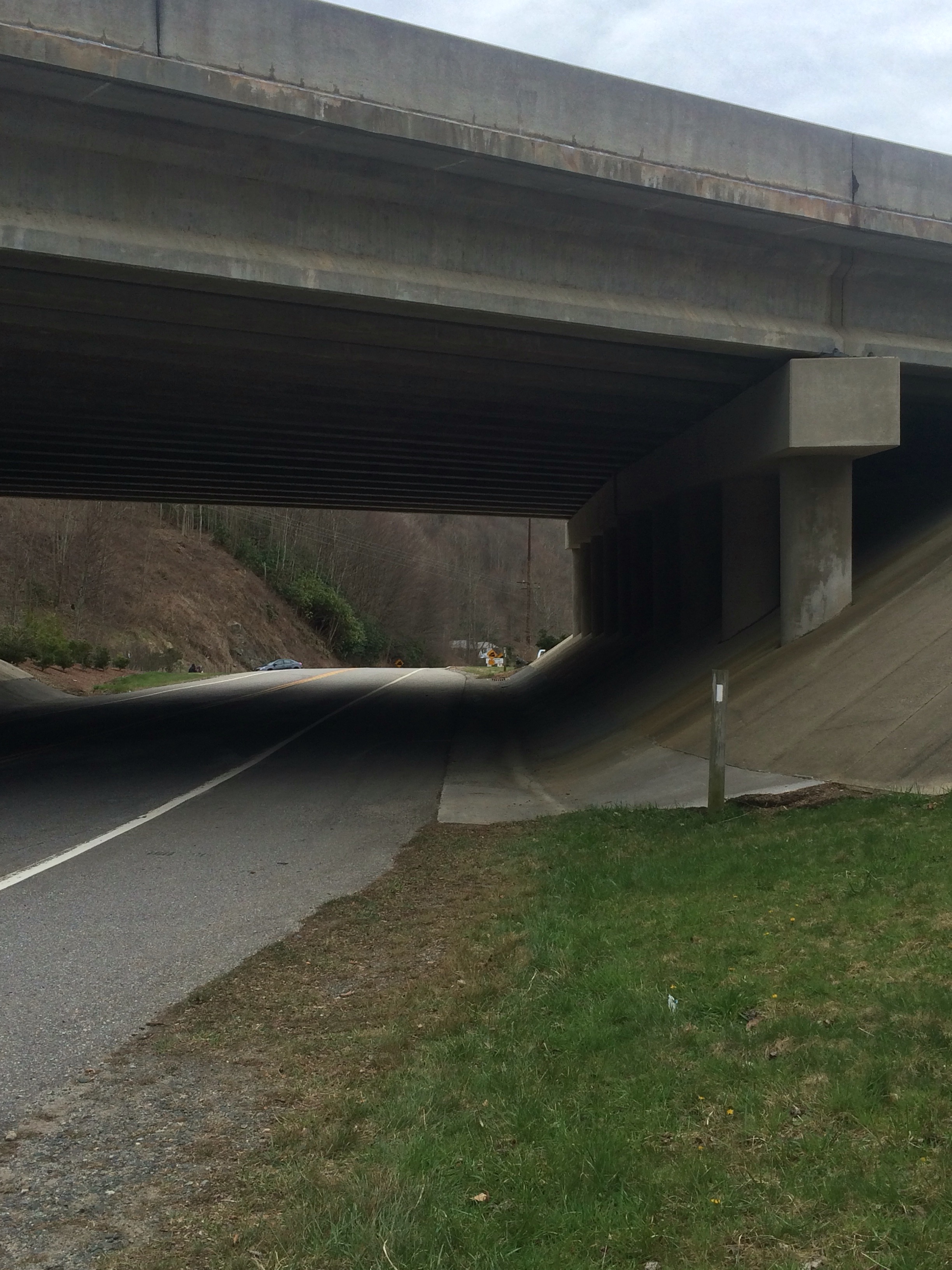
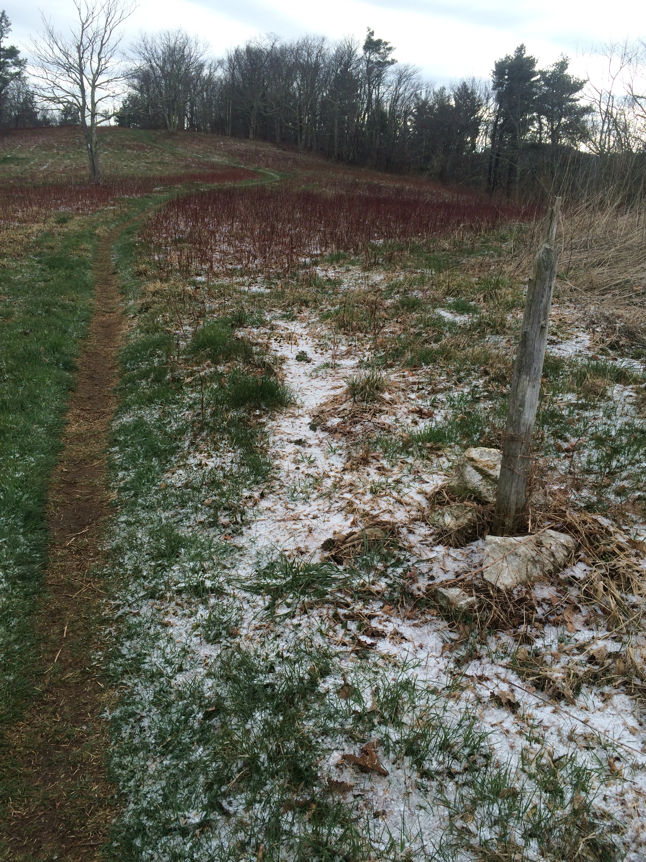
This was good news – I’d have plenty of time to make camp before the bad weather started. Still hiking alone, I enjoyed the easy walk to Spivey Gap, 14 miles north of where I started. I made it there at 2:30, now very hungry for lunch.

  
As I made my way up to the road, I saw a few people mulling around a white van. Good timing! A gentleman named Rob Bird was giving out trail magic to hikers. I enjoyed a soda and some cookies with my lunch.

As I sat and chatted with Rob and some other hikers, I was mindful of the time – if I wanted to keep up with the big miles today, I’d need to leave soon. My goal was to make it back to Erwin, TN and camp by the river. If I ran out of time or energy, I could stop at No Business Knob Shelter, a mere 4 miles way.

I heard them before I saw them, even warning Rob to get those sodas handy again, and watched as my hiking buddies emerged from the woods. I really wanted to hike all the way back to Erwin. I thought it’d be kinda cool to have covered the 33 miles back to town in a day and a half. Everyone was in agreement and we got started hiking again.

No Business Knob was the last water source before Erwin – I had over a liter left and decided to keep pushing. It’s funny – it doesn’t matter what time I leave, my hiking buddies catch up to me pretty quickly. I was passed by nearly everyone within an hour.

About 4 miles outside of Erwin, I had to stop. It was about 5:00 and I was starting to feel a little weak. I plopped down right next to the AT and went for my food bag, gobbling snacks to give me the extra energy to keep pushing. After about 15 minutes, I picked myself up and carried on. I decided to listen to music for the first time in about a week – I finally had decent cell reception again. I’m glad I did – good music really helps get down (or up) bad mountains.

The descent into Erwin was probably one of the most frustrating to date. And not for it’s difficulty – it was well-graded with numerous switchbacks. The problem was that there were too many nice views. Every ten minutes or so, the trail would cut back towards town and “reward” you with a great view. The first one was nice, but then they started teasing me – only serving to highlight my lack of progress.

  
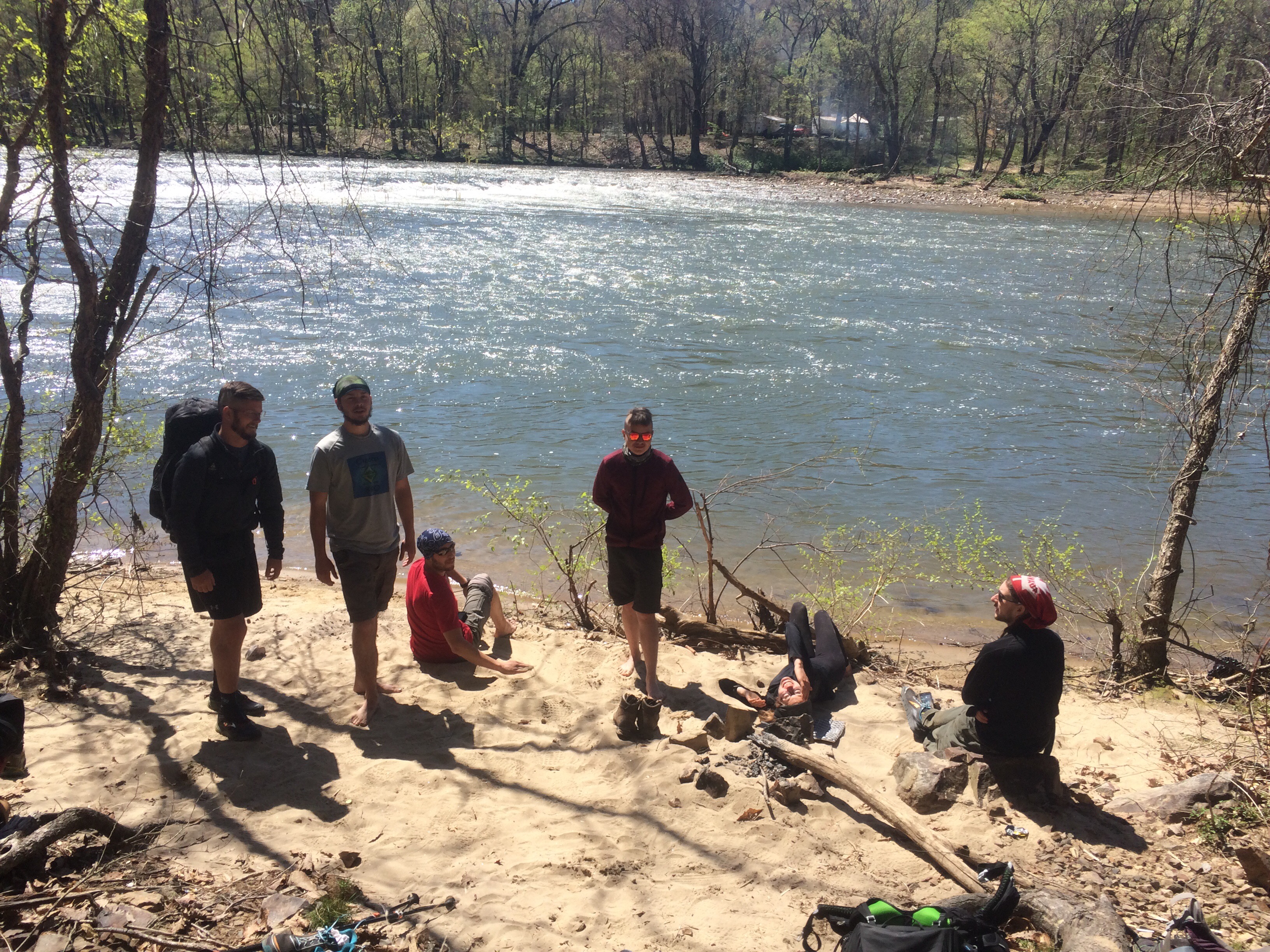
Our plan was to tent (for free) on the banks of the Nolichucky River, about a quarter mile from Uncle Johnny’s hostel. As I made my way down the road, I saw my buddies hanging out on the front porch, laughing with a large group of hikers. I walked over.

Moon Boots and Medicine Man were offered a ride into town as soon as they got there, maybe a half hour ahead of me. I decided to use the toilet (it flushed – huge score). I’m only gonna say this because it was so comical – but this cat just wouldn’t leave me alone, even as I sat there trying to do my business. He laid between my boots and clawed at my shoelaces. It was kind of funny.

It didn’t take long for Moon Boots and Medicine Man to get back. They were smiling and holding four huge bags of McDonalds. We made our way to the river and quickly set up camp as the sun set. Then the feast – it was great. We listened to music and ate burgers, congratulating each other on everyone’s biggest mileage day yet.

It’s 10:00pm and the rain still hasn’t come yet. I’m beat – I mean really beat. My legs are sore and my left big toenail is killing me.

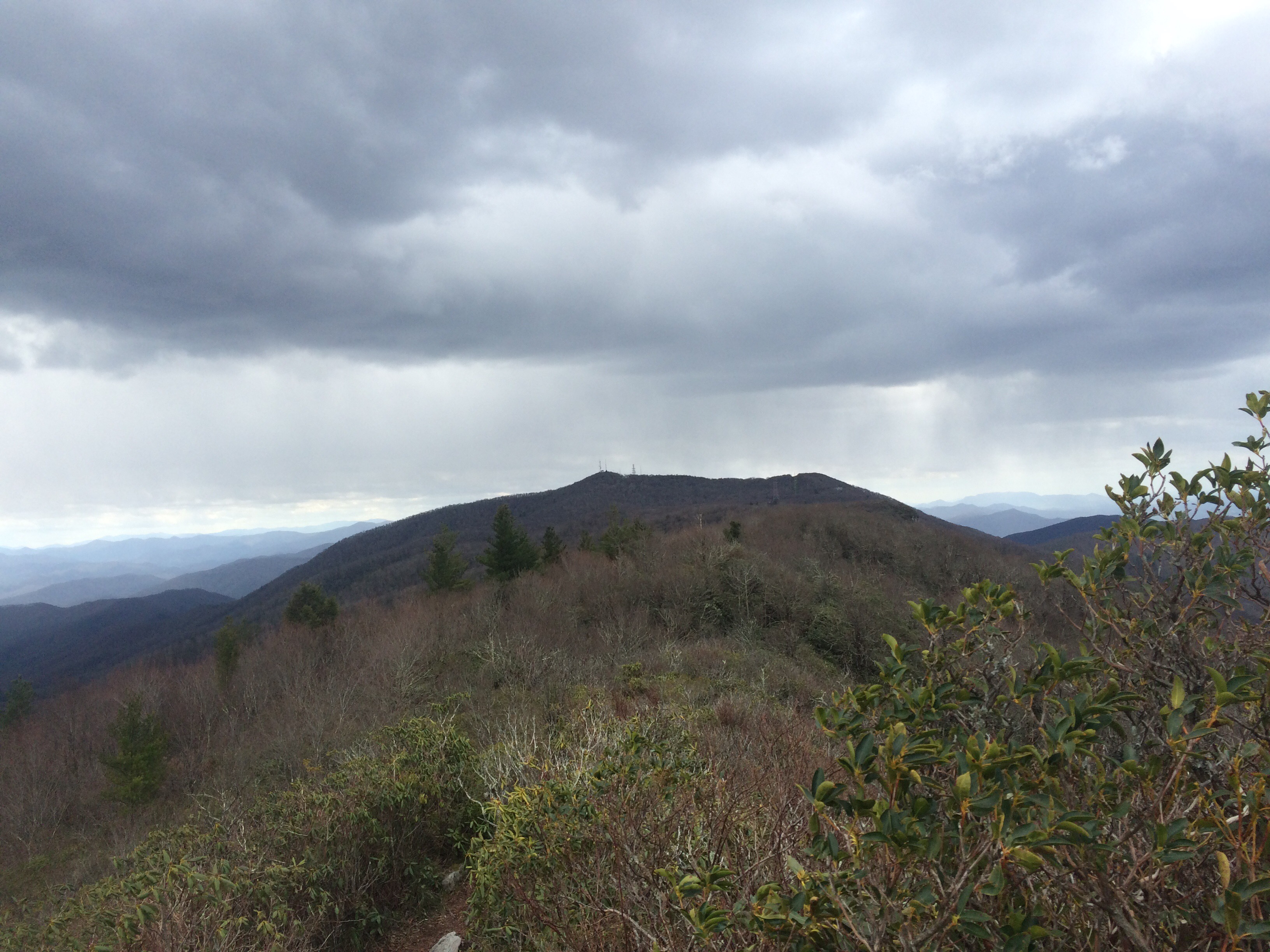
Damascus, VA is only 125 miles away – I still want to be there by next Tuesday. The terrain looks rough for the next two days. Tomorrow, I’ll rapidly gain elevation and stay there until I hit Roan Mountain. It’s supposed to be difficult but beautiful. I hope the weather holds out.

Breakfast: breakfast mix is back (almonds, peanuts, granola, apricots, raisins, prunes)

Snack: Little Debbie Raisin Creme Pie

Lunch: Mountain Lion (another Mountain Dew knockoff), a mini Moon Pie, three beef jerky tortilla wraps with yellow mustard, the rest of today’s breakfast mix

Snack: Bag of peach-flavored gummies, Little Debbie Frosted Brownie

Dinner: two double cheeseburgers

Day 32 – Sunday, April 10: Devil Fork Gap (Erwin, TN) to a spring, 1.3 miles north of Sam’s Gap, 10.0 miles, 318.9 total AT miles.

I woke up early and quickly headed to the lobby for a cup of coffee and a donut. I looked like my decision to stay and wait out the polar vortex paid off. Shuttles dropped off a few sets of hikers, only checking into the hotel to get out of the cold. Apparently it was in the low 20s all night at Bald Mountain Shelter, seven miles north of where I’m tenting tonight.

I returned to my room and started packing up. I grabbed a few extra meals (some real high-dollar stuff) from the hiker box on the way – this brings my food supply to 8 days (excluding tonight). I guarantee, my pack hasn’t been this heavy since walking through the stone archway at Amicalola Falls a month ago.

Eight days of food gives me a few options – Damascus, VA is only 150 miles away, an extremely doable trek for that size food supply. If I fall short, there’s a few small towns before hitting Damascus I can quickly resupply in.

I packed my bag and called the shuttle. I missed the window on the 10:00am departure and waited for the 11:30. We had to split the group – the shuttle couldn’t take us all. It was decided the slower hikers should start first, get a head start. I rode in the front seat.

We arrived at Devil Fork Gap at noon and hit the trail hard. We faced a steep ascent up Lick Rock. The trail was beautiful. For nearly a mile, I hiked alongside a series of springs, some significant, some mere muddy puddles, as they all slowly flowed down the mountain. It was very cool to hike with plants for the first time – they stood in stark contrast to the barren landscape I’ve become accustomed to.


After crossing Lick Rock (it’s a mountain), the trail leveled off. I decided to clock myself – see what this enormous pack did to my speed. I made the 2.8 miles to Hogback Ridge Shelter in just over an hour. It felt really good to move.

After a quick water refill, I hiked on toward’s Sam’s Gap – a significant road crossing. Here, the trail actually follows an underpass for I-26.

  
Savage had taken the lead from the start and the faster hikers eventually caught up with the 30-somethings (myself and Medicine Man). We all hiked into Sam’s Gap and found Savge waiting for us in the parking lot. It was nearly 4:00.

We all had a quick snack and decided to camp at the next available water source/tent site. The trail north gently rose and I found myself walking alongside an old barbed wire fence. I had noticed in earlier in the day, but as I left Sam’s Gap, the fence really started to stand out.

  
And I’m talking miles of this fence. For a while now, the AT has straddled the TN/NC border – this fence was an old private property demarcation line. The best we could figure, long ago, a property owner must have purchased a lot that stopped at the state line – so he put up a fence to mark what was his. Kinda cool.

About two miles outside of Sam’s Gap, we came across a spring and tentsite, one not officially marked on the map. The site was small, but there was a faint side trail heading uphill, away from the spring. At the top, we found a space enough for us all and a large fire ring (with pre-stocked wood pile). Awesome.

I made camp and ate a big dinner. After listening to some music around the campfire and a failed Jiffy-Pop experiment, we went to bed.

I want to start putting up some big miles. I feel great. The weather looks better in the coming days – I didn’t mind getting my hands wet in the spring this evening, for instance.

I want to be in Damascus in eight days.

We’re getting some really high winds tonight. It’s probably because I’m on a mountain top instead of in a gap.

One more thing – the little rise I’m tenting on is very close to the AT. While I was returning from gathering water, I noticed the old barbed wire fence runs right up the hill and through the middle of our camp – I found a piece of barbed wire about two feet from my tent.

  
According to the barbed wire fence, I’m on the Tennesee side.

Breakfast: coffee, donut

Lunch: prunes, raisins, dried apricots, beef jerky

Snack #1: Little Debbie Raisin Creme Pie

Snack #2: almond/peanut mix, beef jerky

Dinner: Mac and cheese with canned chicken and kale, Little Debbie frosted brownie

Money: $5.00 – shuttle

One month on the trail

Taking this break in Erwin, TN from the freezing weather has its benefits. For the first time since leaving Georgia, I’m staying in a hotel with decent wi-fi.
I’ve been keeping a photo diary of sorts – taing notes on every picture I take with my Sony NEX-5T. I’ve found that, while I’m able to update the website (infrequently at best), uploading the larger photos from my Sony takes a strong wi-fi connection.
Here we go.

  
– The AT approaching Woody Gap, GA. I fondly remember camping in these mountains as a kid. This winter landscape dominated the Georgia section of my hike. Day 3 – March 12, 2016

  
-Early morning view from Cowrock Mountain, GA, the first proper vista I photographed. Day 5 – March 14, 2016

  
-Sunset at the summit of Standing Indian Mountain, NC. I camped just shy of the summit. Day 9 – March 18, 2016

  
-View from the fire tower on the summit of Albert Mountain, NC. After one of the hardest days hiking to date, I was thankful to be rewarded with this view. Day 10 – March 19, 2016

  
-Leaving Albert Mountain, NC and hiking through the Nantahala National Forest. Day 10 – March 19, 2016


-Sunrise on Cheoah Bald. I’m so glad I left camp in the dark for this one. Day 15 – March 24, 2016

  
-A foggy trail on my first day in the Smokeys. Day 18 – March 27, 2016

  
-Charlie’s Bunion. Day 21 – March 30, 2016

  
-Higher elevations in the Smokeys remind me of hiking in the Cascades. Day 22 – March 31, 2016

  
-Ascending Max Patch, NC. It’s rarely this clear here (still windy and nearly freezing). Day 24 – April 2, 2016

  
-The French Broad River leaving Hot Springs, NC. Day 27 – April 5, 2016

  
-Being chased along a ridge line near Erwin, NC by an approaching storm. Day 29 – April 7, 2016

Day 31 – Saturday, March 9: Erwin, TN (Zero Day), 0.0 miles, 308.9 total AT miles.

I woke up this morning feeling good and enjoyed a continental breakfast while uploading the past few days worth of journals and pictures to the site. The lobby was full of hikers, a few arriving in from the cold, but most mulling about, waiting to leave for the trail.

This morning’s weather report called for high winds (30+ mph) with temps dropping to the mid 20s at night – and that’s for Erwin. I’d be hiking 2000 feet up – that puts the low at 6 to 8 degrees cooler.

There was an actual discussion, a real caucus, with both camps giving their views as to whether it’s best to stay or go. I voiced my opinion for staying – while I’m sure I’d be fine, I wouldn’t make good time and would start tomorrow worse for wear.

While I’m not very pleased about being held back by weather, I think I’m making the right move. I tentatively scheduled a 10:00am departure with a shuttle service for tomorrow morning.

After breakfast, I did laundry and called for a shuttle to Uncle Johnny’s – the same hostel/outfitters I was supposed to be hiking into today. I purchased a new stuff sack for my sleeping bag and caught a ride back to the Super 8.

I went back to my room to organize my food supply. I decided to hike with 7 days worth of food – Hampton, TN is about 115 miles ahead and with good weather, I should be there in a week.

  
I’m currently waiting for a shuttle to take me (and half the hotel – they’re making two trips) to a Mexican restaurant a few miles away. It’s totally worth the $5 round-trip considering the weather.

So it’s been a month on the trail. Where am I at?

I still haven’t figured much out, except that cursing at the top of my lungs into the driving wind won’t stop it from blowing.

I’m beginning to relax for the first time in my life – I’ve always been an anxious person, attempting to control every detail. Out of necessity I’ve been forced to abandon that perspective. I don’t like it, but am beginning to see the merit in being a little less uptight.

Patience – I’m still the worst at this. Needs improvement.

I’m surprised at how receptive I’ve become to new ideas and perspectives. I’m a little more forgiving – a little less jerk. Maybe.

Money:

Super 8 – $25.00

Shuttle (both times): $16.00

Uncle Johnny’s (Granite Gear compression sack): $34.95

Day 30 – Friday, April 8: Jerry Cabin Shelter to Devil Fork Gap (Erwin, TN), 8.8 miles, 308.9 total AT miles.

I woke up at 7:00 and gathered the courage to emerge from my tent fifteen minutes later. It was cold, but the skies were clearing – the sun was starting to peek through. It only took an hour to pack up and hit the trail.

As I gained elevation leaving Jerry Cabin – the weather was for the first few miles. I even stopped to zip my legs off and put my puffy coat away. Things were looking good. The trail and surrounding landscape were still covered in the frozen precipitation (mini snowballs) from the night prior.

  
As I summited Big Butt Mountain, the temperature noticeably dropped. The sky, once clearing, was now clouding over. The wind was picking up again. I quickly suited back up and hiked on.


The summit of Big Butt Mountain.

I kept up with Medicine Man for most of the day. About an hour later, I took a brief privy stop at the Flint Mountain Shelter before pressing on. It was 10:45 and I had already covered 6 miles – I was moving well today.

Medicine Man and I pushed hard and found Moon Boots at Devil’s Fork Gap. He was concerned. He heard from another hiker that Savage was having chest pains and needed to call her doctor. As luck would have it, she emerged from the woods just as a shuttle pulled into the parking lot.


Lunch at Devil’s Fork Gap before heading into Erwin, TN.
 
I rode with her into town. I was down to one day of food and still a day and a half from physically hiking into Erwin, TN. While I was sure Savage would be staying the night, I hadn’t made up my mind about what I would do – the weather forecast helped me decide.

I had been hiking and camping in driving rain and freezing temps for two days – and tonight and tomorrow was going to get worse. The forecast is calling for snow and rain in the mountains with another high wind advisory. Apparently the polar vortex had descended accounting for the severe drop in temps.

The shuttle dropped Savage and I at the Super 8 – she called her doctor and I waited for the rest of our group to arrive. When the gang reassembled, we were all on the same page. We booked two rooms, deciding to wait the storm out and potentially start fresh tomorrow.

I plugged in my battery and camera and headed to Hawg n Dawg for a quick lunch. Clutch and I decided to head to the Food Lion for a full resupply – my first trip to a REAL grocery store in over two weeks.

During the walk home, the skies opened up and I got hit with freezing rain. I made it back to the Super 8 drenched and cold. I spent the evening chatting with family and organizing my resupply before heading to bed.

Tomorrow doesn’t look promising. I don’t want to stay in Erwin, but after the last few days, I’m don’t want to start hiking in more high winds and freezing temps. The forecast for tomorrow doesn’t look good – apparently the low will be in the 20s with more high winds.

It’s tough. I haven’t made much progress since leaving Hot Springs. But I’ve got four plus months to go and will have plenty of opportunities to make up for lost time. I’ve never been good with patience. Or acknowledging when something is truly out of my control.

Having resupplied, if I decide to stay another night to avoid the weather, I’ll spend my time tomorrow contacting gear manufacturers, specifically REI, and try to get a new tent shipped to me. My Dash 2 still doesn’t leak, but the rainfly is battered – broken zipper on one side and a gnarly tear on the other. I’m hoping they can send a replacement to me in Damascus, VA.

Savage is doing okay. She thought her chest pains might be related to a heart condition she’s dealt with her whole life. Thankfully, her doctor believes it’s a muscle sprain near her ribs. She’s on an ibuprofen regimen and seems to be doing fine.

Note: I will be staying another night – a shuttle driver just dropped off some hikers at the hotel as I was having a pizza delivered. The weather will hover above freezing all day before plunging into the teens at night.

Breakfast: one strawberry Pop-tart

Snack: the last of my nut mix, handful of prunes

Lunch: three beef jerky tortilla wraps

Lunch #2: half rib dinner with baked beans and macaroni and cheese: Hawg n Dawg $13.99 plus $4.01 tip.

Dinner: small chicken pizza with 12 wings: Primo $28.89 plus $5.11 tip.

Money:

Food Lion: six day resupply – $105.60

Walgreens: beef jerky sale – $21.41

Super 8: $25.00

Day 29 – Thursday, April 7: Allen Gap to Jerry Cabin Shelter, 11.6 miles, 300.1 total AT miles.

Note: Still no cell coverage – will try to upload tomorrow as I hike.

Note: And still enjoying a continental breakfast at the Super 8 – almost done uploading.

Shortly after I finished writing last night, the rain began to fall, gently at first – then proceeding to a steady downpour at midnight.

I was restless all night – matters only made worse by the occasional late-night driver laying on his car horn as he drove past. This happened frequently and at all hours. I woke again at 7:00 and the rain had finally stopped.

I sat up in my tent – I felt pretty good this morning. I’ve got a packing routine in the mornings and it starts with stuffing my sleeping bag into its dry bag and strapping it to the bottom of my pack.

My clothes (also in a dry-bag) are the first thing to go into the pack itself – they rest at the bottom and mold against the sleeping bag pressing against the bottom of the pack. If I know it’s going to be a rainy day, I’ll pack extra socks (in a zip-lock) in the outside pocket.

After that, I pack my cook set, toiletry bag and tech bag on top of my clothes, all in a neat row. At this point, the only two things left to pack are my tent and food. I can pack in a hurry if necessary.

So, there I sat, ready to perform this routine I’ve tried my best to perfect after being on the trail for a month. I started stuffing the sleeping bag into its stuff sack and the thing split wide open at the top. This was the bag I bought from Mountain Outfitters at Neel’s Gap after that crazy ascent up Blood Mountain back in GA some 220 miles ago.

I came up with a quick back up plan. I remembered grabbing a trash bag from a hiker box in the Smokeys – I found it rolled up in the brain of my pack. I put my sleeping bag into the trash bag and crammed it into the very bottom of my pack – where my clothes usually go. Then everything else went on top.

My pack rides a little high now, but it’ll work until I can get another compression sack – I think I might have to wait for Damascus.

I went to the bathroom, barely out of view (sort of) from the side of the road – I was in a hurry. No one honked at me so I guess I was fine.

I had a mishap trying to poop today. I chose a log that was balanced funny, sort of like a hidden see-saw. Right as started to put my full weight on it, pants already around my ankles, it shot down a good foot, sending me toppling backwards.

By the time I got everything right again, it was nearly 9:00. While both the guidebook and the app claimed Allen Gap has a water source, all we could find was what looked like a ditch that ran along the road.

We walked up to Mom’s. That’s the name of the store I saw last night. But it wasn’t really a store – more like a piece of family property that had been converted into a place to sell snacks to hikers. I bought water and a snickers and moved on.

The ascent up to Camp Creek Bald was surprisingly well-graded. I started the day hiking strong and making very good time. I stopped at Little Laurel Shelter four miles in and had a quick lunch. I left at 11:30 for the top.

It’s always that last mile that gets you. The ascent was rough. Just shy of the top, many of us stopped to put on rain gear. I chose to only wear my rain jacket and gloves. It wasn’t raining yet, but it was getting dark, cold and very windy.

I was excited to finally summit – for starters, it was the first real view I’ve seen since leaving Max Patch. I had been hiking with Medicine Man, Savage and Shaggy for most of the day. The four of us left for what appeared to be an easy ten mile ridgewalk.

About two miles in, I came across a sign advising the AT split – I could either take the Bad Weather path or the Exposed Ridgewalk. I chose wisely.


This section rivaled that first ridgewalk in the Smokeys. The views weren’t nearly as beautiful, but the terrain was much more rugged. At many points, I was scrambling up and down piles of boulders trying to follow the white blazes. And the weather was just as windy as in the Smokeys, now with storm clouds on the horizon.


About 1.5 miles the later, the ridgewalk ended and I began a much easier hike toward Jerry Cabin Shelter – it was only 2:00 and the shelter was four miles way

I started hiking north and began to feel precipitation hit my jacket. It was hail, but not exactly. It was the size and consistency of a Dippin-Dots – sort of like a mini snowball. I stopped and put on my rain pants and pack cover.

I moved as fast as I could, still making good time, but the wind and frozen precipitation were getting worse. It was becoming increasingly evident that I was getting caught by an approaching storm.

I finally made it Jerry Cabin Shelter at 4:00 and was happy to see my hiking buddies had already made camp. I found a spot and started to pitch my tent. At about that time, the storm started up in earnest – it deposited a collection of mini snowballs on my foot print right off the bat.


I was eventually able to get my tent up and get everything inside as the first wave of the storm hit. Some of the guys resorted to cooking in their vestibules to escape the rain and mini snowballs.

I opted to wait for a break and quickly boiled water in the shelter. Dinner tonight was disgusting.

Everyone was in their tents tonight by 6:00. For a good hour, we got some thunder and lightning, nothing too close, and a heavy dusting of the frozen precipitation followed by rain.


I have no idea what the weather forecast is for tomorrow. Last I heard, it will be more of the same starting first thing tomorrow. The temperature has dropped noticeably -it’s 9:00pm and about 41 degrees in my tent. I can hear the wind still whipping the tree tops.

Erwin, TN is now 41 miles away. I’m still in good shape for a Sunday morning arrival, more than likely tenting the night at Uncle Johnny’s just outside of town.

This weather is getting absurd. I’m ready for spring.

Breakfast: Snickers and water from Mom’s – $4.50

Snack: Honey bun

Lunch: nut mix, bag of beef jerky, probably about 2 cups of raisins and prunes

Snack: Moon-Pie

Dinner: I was saving a Backpacker Pantry Pad Thai for a special occasion. I’ve heard they are good. I added salmon and Sriracha. It was terrible. I’ve made some pretty bad stuff, but at least I could eat it. I gave the last bit to Shaggy. Peanuts, 3 Starburst.

Day 28 – Wednesday, April 6: French Broad River (campsite) to Allen Gap, 13.8 miles, 288.5 total AT miles.

Note: Still no cell coverage. Sorry ya’ll.

Note: Still enjoying continental breakfast at the Super 8 – time to play catch up.

I woke up first at 7:00 and decided to take the to-go trash we accumulated from last night’s dinner to town to throw away. I wisely stopped at the gas station to use the bathroom before heading back to camp.

Everyone was up and packing by the time I got back. I started packing as well. I finished last and hit the trail at 9:00. I hiked alone for the first couple of hours. I felt off this morning.

The ascent from Hot Springs, NC to Rich Mountain gains 2,000 feet of elevation gradually over about 7 miles. I hiked as hard as I could, but I was still bothered. The truth is that I was mad I was still in Hot Springs. I eventually caught up to Savage who also shared the same feelings.

Lesson learned I suppose – two days off is too long. We tried to reassure ourselves that, in the real world, two days off would be welcome – but not on the AT and not this soon into the hike. It felt a lot like it did when I took that second day in Fontana.

Savage, Canuck, Clutch and I had lunch on the top of Rich Mountain at the base of an old observation tower. As Canuck and I were descending, I started feeling these little flecks hitting my shins and ankles. I bent close to the ground. The trail was covered with thousands of baby crickets – each barely bigger than the head of a pin. I had never seen anything like it.

And about a mile up trail, I encountered my first bit of wildlife – a small black snake with a orange ring around its neck was sunning itself in the middle of the trail. It barely moved as I passed.

  
Medicine Man and Moon Boots had been hiking ahead all day. By the time I rolled into Spring Mountain Shelter, I found out they had just left for Allen Gap four miles away. On the way, I ran across a controlled burn area – the AT actually formed the south-eastern border of the burn zone.

  
I stopped for a full water fill-up before making my final descent into Allen Gap at 4:30. I was beat. The seven of us set up our tents at the entrance to the Cherokee National Forest and began making dinner.

  
I’m looking forward to another good night’s sleep. I’m full and warm. Trail rumor calls for rain from 8:00pm to 8:00am tonight. It’s 9:00 now and the rain hasn’t started yet, but the winds have picked up substantially – it hasn’t stopped being windy ever since I entered the Smokeys in fact.

I assumed that tenting by an entrance to a national forest would assure cell coverage – I was wrong. There is a little country store up the road that sells biscuits starting at 9:00am. If it does end up raining, I’ll probably start my day from there – if not, I’d like to be on the trail early.

Tomorrow looks to be an easy hiking day, weather permitting. After a gradual ascent, I should have a good 15 miles of relatively flat trail at the very manageable elevation of 4,500 feet. It should be a big day.

I neglected to mention Owl hiked ahead. He’s concerned about his abbreviated window of time to finish this hike. He claims he needs 20 mile days from here on out to finish in time.

Regarding some of my new purchases, I think the Z Seat is, perhaps, my favorite new piece of gear. It’s an accordion-style butt cushion made from the same material as my mattress pad. I pull it out every time I stop to rest, eat, filter water, whatever. It weighs next to nothing and is very comfortable.

Breakfast: one honey bun

Snack: peanut/almond mixture

Lunch: more nuts, three beef jerky tortilla roll ups (with yellow mustard and Sriracha), a handful of prunes, 3 cookies

Dinner: more nuts, taco-seasoned mac and cheese with bacon bits and salmon, three tortillas, 3 cookies

Day 27 – Tuesday, April 5: Hot Springs, NC to French Broad River (campsite), 1.0 miles, 274.7 total AT miles.

Note: Zero cell service on the French Broad. I know it seems I have it bad, but a lot of hikers haven’t had a reliable signal since leaving Georgia.

Note: It’s Saturday, April 9th – I’m having a continental breakfast at the Super 8 in Erwin, TN. Time to take advantage of wifi.

I woke early and with strong appetite. It didn’t take long to convince Savage and Canuck to join me at the Smoky Mountain Diner for breakfast. The three of us leisurely ate and discussed the day ahead.

I still needed to go to the post office and Canuck needed to purchase food from the Dollar General. I made my way back to the Alpine Court for a final shower.

I then hung out on the bench in front of the library and updated the blog for a solid hour. After hitting the post office and checking out of my room, I walked downtown to wait for the rest of the group to assemble.

Leaving Hot Springs.
 
The Spring Creek Tavern had just opened for the day. I walked in and grabbed a table on the patio. I ordered light – my real interest was in the free wi-fi.

Over the course of the hour, more in our group started to arrive, ready to leave Hot Springs. Twice I left to shave more Mohawks (18 total). Just as the seven of us were gearing up to hit the trail, Kool-Aid and Koday strolled into town.

It was nice to see those guys – and they were hungry. We sat around for at least another hour and caught up while they ate. They have been very content with their slower pace – and they seemed to enjoy the Smokeys as much as we did.

I was getting anxious – it was starting to get late. The seven of us left Hot Springs at 2:00, still with the goal of reaching Spring Mountain Shelter about 10 miles away. I took the lead.

The trail ascends quickly after crossing the French Broad River through a series of quick switchbacks. The French Broad is a beautiful river, very wide and peaceful. I walked out onto a rock slab to take one final picture of the river. I just happened to glance down at the shore and saw a very tiny Canuck and Shaggy waving their arms up at me. I couldn’t tell what they were saying.

Setting up camp on the French Broad.

I made my way a back down the AT to see what was going on. By that time, the group had reassembled. The idea was very similar to what happened at the Fontana Hilton – an extra day off to rest and relax by the river.

I wanted to move on, but did not want to make camp 10 miles away in the dark. And it really was a lovely campsite. I gave in and immediately set up my tent mere feet from the river bank. I laid out my mattress pad and sleeping bag and relaxed by the river.

I told myself that, if I was going to take this second zero day, I was going to put it to good use. I’ve been keeping photo notes in this little waterproof notepad that was given to me before I left (yet another awesome present that I end up using much more than I imagined).

It took some time, but I was able to delete a lot from my camera and write down where each picture was taken in the notepad – now an accurate photo diary of sorts.

At around 6:00, Moon Boots and Medicine Man hiked into town for one last dinner. By 7:00, Savage and I decided to make the quick hike back as well.

I left my phone to charge back at camp and went to town for, yes, more wings and cake. We decided to get it to go. After a nice dinner around the campfire, I returned to my tent to check my phone. While it had charged fully, I noticed my external battery was only 60% charged – it must have had a bad connection at the Alpine Court.

This could be a problem in the coming days. My plan was to breeze through Irwin, TN for a quick resupply in four days – similar to how I approached Gatlinburg. With rain, then snow, in the coming forecast, I have the option to tent at Uncle Johnny’s hostel. This would give me the opportunity to utilize the shuttle services to get to a Wal-Mart for a proper resupply AND recharge my external battery. I could even do laundry if needed.

I’ll probably do a similar four more days up trail before taking my next zero in Damascus, VA (in about 10 to 12 days).

Tonight we all expressed the desire to get back on trail first thing tomorrow. We sat around the campfire and ate, discussing life and philosophy before Moon Boots, Clutch and I climbed up to a prominent rock ledge to get a good look at the stars. I saw two satellites – pretty neat y’all.

I’m in my tent a little later than usual tonight, but feeling good about the weeks ahead. I’m looking forward to Virginia – some 200 miles away. Damascus is another famous “trail town”, host to Trail Days – an AT hiker festival that takes place in mid-May.

I’m really hoping to get some better cell coverage soon. When I’m on the trail, I really don’t mind being a little cut off. But when I’m in town, it’s a little hard not to get homesick – for both Atlanta and Seattle.

Breakfast – three pancakes, side of bacon, side of grits, 2 cups of coffee: $6.99 plus $3.00 tip

Lunch – side of waffle fries and a Dr. Pepper: $6.50 plus $3.00 tip.

Dinner – two beef jerky tortilla wraps (with Sriracha), one hotdog (with Sriracha), 6 chicken wings, chocolate cake, one orange.

$12.00 for the wings and cake from the Spring Creek Tavern. I gotta say, this place was the first restaurant I’ve eaten in that truly caters to hikers.

Day 26 – Monday, April 4: Hot Springs, NC (Zero Day), 0.0 miles, 273.7 total AT miles.

Note: There is ZERO cell coverage in Hot Springs. I’m sitting outside the library uploading posts before I head north again.

Hot Springs is one of the few true “trail towns” on the AT. Here, the AT literally runs right through the heart of downtown. We booked a second night at the Alpine Court – itself located in the center of a two block radius of all the stores/restaurants I would frequent today.

8:00am – I woke super early and was surprised everyone wanted breakfast at the the Smoky Mountain Diner. Two biscuits and gravy, side pork tenderloin, half order of French toast – $12.25 plus $4.00 tip.

9:00am – I headed to the laundromat. I wore my rain pants and rain jacket (nothing else) as I washed everything I own. One wash, one dry, dryer sheets (a nice guy gave me some soap) – $4.00

9:30am – With my clothes in the dryer, I headed across the street to Bluff Mountain Outfitters, probably the best outfitter I’ve run across since starting out. 2 Sawyer Mini water filters, gloves (I’m sick of being “ultralight” and using socks as mittens), and a new Mountain Hardware hiking t-shirt. – $78.80

11:00am – With clean clothes in tow, I finally took a long shower.

11:30am – Lunch at the Spring Creek Tavern next to the laundromat. 6 wings, fried chicken sandwich – $14.00 plus $4.00 tip. I can’t seem to stop eating hot wings when I’m in town.

1:00pm – I found out the only barbershop in town had closed over the winter. I really needed a haircut so I walked down to the Dollar General and bought hair clippers and some Little Debbie Nutty Bars – $19.75.

2:00pm – Back to Bluff Mountain Outfitters. I need to buy a new pack. I still like my Gregory, but I’ve maxed out how tight I can clinch the hip belt. I bought a Granite Gear 55 liter Blaze, took it to the hotel and began trying to fit all my gear in this smaller pack. It wouldn’t work.

As I was returning the pack, I realized the post office was about to close. There wasn’t enough time to send my small box of extra gear home to Seattle – it’ll have to wait for tomorrow morning.

I did end up purchasing a Thermarest Z seat and 5 packets of salmon – $22.18.

4:30pm – And this is where things started to get weird/awesome. I recruited Savage in helping me with the back, but I managed to give myself an pretty good haircut. It’s really short on the sides and long and floppy on top.

I gave myself a Mohawk and it looks great (I think).

It looked so good, apparently, that Moon Boots, Medicine Man, Clutch and Owl also wanted one. Somehow, word got out that I bought clippers and was shaving Mohawks into hiker’s skulls for free.


Cool Dad (aka The Barber).
 
It took about two hours, but I managed to add 14 Mohawks to the AT (including my own). I’m bringing the clippers with me – gotta do touch ups along the way.

5:30pm – Back to the Spring Creek Tavern for dinner. It was hilarious watching all the Mohawks eating and drinking as they moved around the pub. I ate tavern bites (boneless wings) and fish and chips (sub waffle fries) – $16.99 plus $5.01 tip.

7:00pm – Back to the Alpine Court to start cleaning up for tomorrow’s hike. I took a second shower. After chatting briefly with friends and family, I fell fast asleep.

I’m excited about the week ahead. I’ll be stopping in Irwin, TN for a quick resupply in about 5 days – I’m not planning on staying in town.

The weather forecast is calling for snow Thursday and Friday. But by that time, I’ll be 50 or so miles north of Hot Springs, so who knows what will happen.

In this upcoming stretch, I’ll really be testing the limits of my tech gear. I’ve been able to go 5 to 6 days before needing to recharge my external battery – I’ll probably be stuck without the opportunity to recharge for about 10 days. We’ll see how this goes.

Day 25 – Sunday, April 3: Roaring Fork Shelter to Hot Springs, NC, 17.0 miles, 273.7 total AT miles.

I finished writing at around 8:30 last night and quickly fell asleep. At 2:00am, I woke to the sharp snap of wood buckling. The high winds had just felled a tree close to our camp – so close that we all felt the earth shake when it came down. I can’t remember the last time I heard the wind howling like this.

Owl quickly abandoned his hammock and sprinted for the shelter. I tried to wait the wind storm out, but 15 minutes later Shaggy’s tent got hit with a huge branch. And that was enough for the both of us. While Medicine Man and Moon Boots decided to sleep on, Shaggy and I packed up and quickly left camp. As we hiked out of Roaring Fork at 4:00am, I noticed a huge limb had fallen near the bear cables. It was some pretty rough weather.

And to top it off, it was freezing outside. My thermometer read 28 degrees as I left camp. So cold, in fact, I resorted to wearing socks over my gloves. I sipped water as I hiked, not wanting my Sawyer to freeze – I figured if I could keep a steady stream of water flowing through my external water filter, it wouldn’t freeze.

Shaggy and I stopped at Walnut Mountain Shelter for a hot breakfast at sunrise. We sat on the calm side of a breezy bald and shivered as we ate. As I was packing up to go, I tried to take a quick sip of water. The drinking tube, and my Sawyer, were frozen solid. That truly stunk – if you freeze a Sawyer, it essentially becomes obsolete. And considering I kept my back-up Sawyer in an outside pocket, I was fairly sure that one was frozen too. 

Thankfully, Shaggy tucked his Sawyer into his jacket to keep it warm and we hiked on.

We cleared branches from the trail as we walked. While the sun was finally starting to rise, it was still very cold. It wasn’t until our summit of Bluff Mountain that we started to shed layers.

After 6 hours of steady hiking, we emerged from the woods into Hot Springs, NC at 1:30pm.

The only picture I took today.

We decided to take advantage of our early entry into Hot Springs by renting a cheap room at the Alpine Court. After quick showers, we ate a late lunch at Hot Springs BBQ located just across the street.

So what do hikers talk about while on the trail? Shaggy and I had never hiked together before. Up until this morning, the only thing we shared was a mutual desire to not get crushed by a falling tree.

As we left camp, we talked about things that would make our hike in this dark, windy night MORE creepy. It was decided that wandering across a weeping child (by headlamp) would be about the creepiest thing that could happen.

As we descended Bluff Mountain, we talked about our “real” lives – including our fears, desires, etc. Pretty intimate details, for sure, but it was a very natural conversation, assuredly – the bond formed by two people doing something ridiculous and kind of scary.

We took a break at 12:30 at the Deer Park Mountain Shelter and discussed food. Specifically, what we wanted to eat once we got to Hot Springs. I accurately predicted we’d find a pimento cheeseburger on the menu in town. But I really wanted hot wings.

And as we began our steep descent into Hot Springs, we wondered how far behind everyone else was. We tried to predict when and in what order our friends would arrive in town. It had become a running joke that Canuck (who literally runs down the trail) would have somehow found a way to beat us there.

Fast forward to Shaggy and I thoroughly enjoying our lunch. We’d been in Hot Springs for maybe an hour and a half when, out of nowhere, Medicine Man walked up. He apparently left Roaring Fork at sunrise and didn’t look back. He was hungry and exhausted. The three of us ate and waited for the rest of the group to arrive.

After a successful resupply at the Dollar General, the others started trickling into Hot Springs. The eight of us ate dinner at the same restaurant we had lunch in and fell fast asleep. It was a rough day for all, no matter what time they left camp.

Today was the first time the weather truly scared me. It reinforced my understanding that I’m not really in control of much in this life. I’m thankful no one got hurt. We found out later that a tree nearly crushed a hiker, tearing her rainfly as it came down.

I’m calling this an early night. I’m looking forward to taking the day off tomorrow. I need a zero day. There’s a lot to accomplish and I’ve yet to really get started. I’m excited to check out Bluff Mountain Outfitters – I hope they carry Sawyer water filters.

Breakfast: instant mashed potato burritos, sugar cookies
Lunch: fried chicken sandwich, fries
Dinner: 12 hot wing, Philly cheesesteak (sub pimento cheese), no fries, sub beef chili.

Money:

Alpine Court: $15.o0

Dollar General: $61.65 (5+ days of food)

Hot Springs BBQ (lunch): $12.00 plus $4.00 tip

Hot Springs BBQ (dinner): $18.00 plus $6.00 tip