Day 143 – Saturday, July 30: Stratton Motel and Hostel (Stratton, ME) to Avery Memorial Campsite, 8.1 miles, 2,009.0 total AT miles.

We woke up late, stiff and sore. We still needed to get to the post office to pick up bounce boxes, head over to the town market to finish our resupply, return to the post office to mail off new bounce boxes – and get this all accomplished before our 11:00am checkout.

I walked across the street and purchased a couple cups of motivation coffee for myself and Greyhound before heading down to the post office. I picked up my bounce box, and a nice care package from my mother, and headed back to the motel. Greyhound was working on her journal and talking to her mother when I returned.

We started organizing our food and making lists. I had too much beef jerky and way too many protein bars, both items I’d lately been having a very difficult time choking down – no matter how hungry I was. I shared my rations with Greyhound before we both headed across the street to the market to finish our resupply.

I tried to buy exciting foods, like turkey pepperoni and mini-swiss cheese wheels, anything to spice up my trail menus. We returned to the motel and finished packing, dropping off the key at 11:00 on the dot. I carried my bounce box (full of beef jerky, protein bars and rice sides) down the street to the post office to send it up trail.

We were both hungry and decided to stop at the Looney Moose for lunch. We both had amazing burgers and Greyhound slammed a milkshake. (She talks about missing “malts” – I think I know what she’s talking about.)

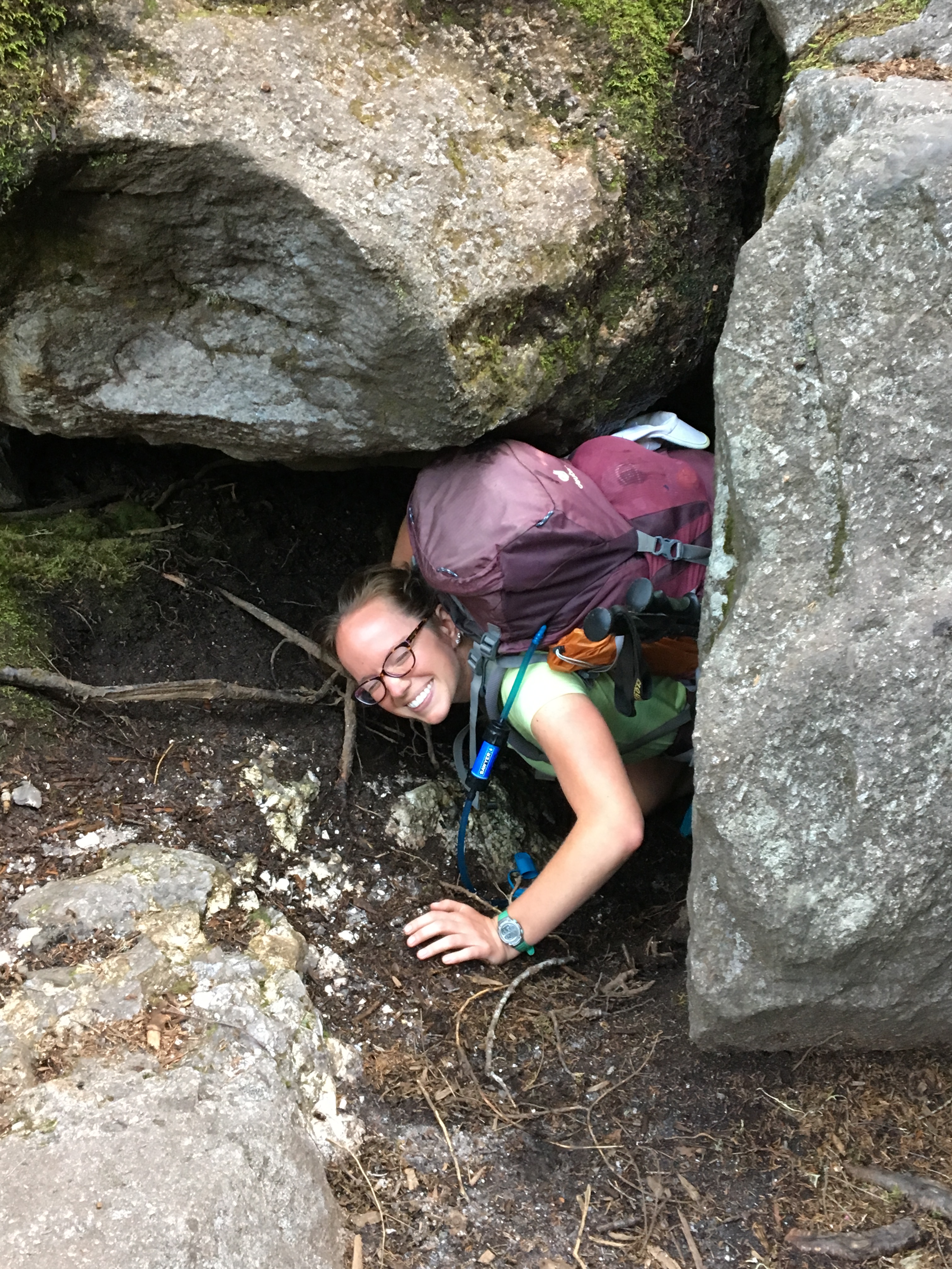
After a delicious and polite lunch, we caught a hitch back to the trailhead. And sit there. It was 12:30pm and neither of us felt like hiking. We were both exhausted, having not taken a zero since Hanover, NH. But that’s the pace we set for ourselves. It took some doing, but we finally got started hiking up the “last big mountain chain” in Maine – the Bigelow’s.

img_0768

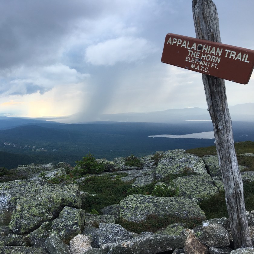
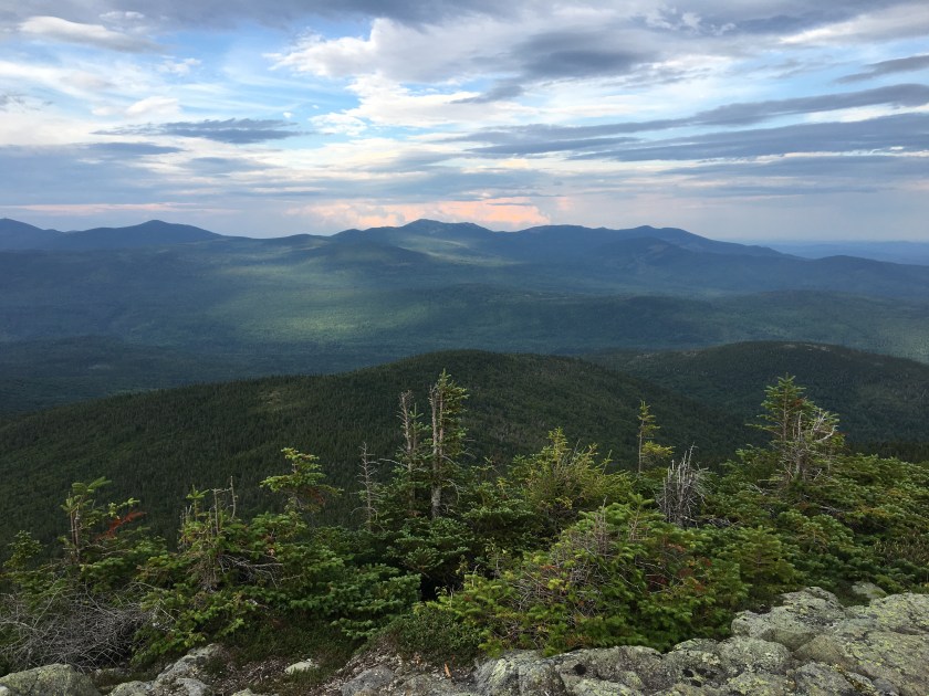
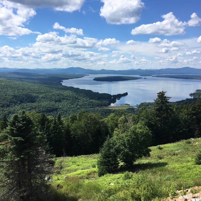
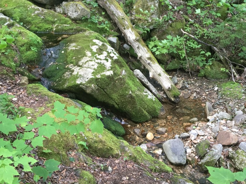
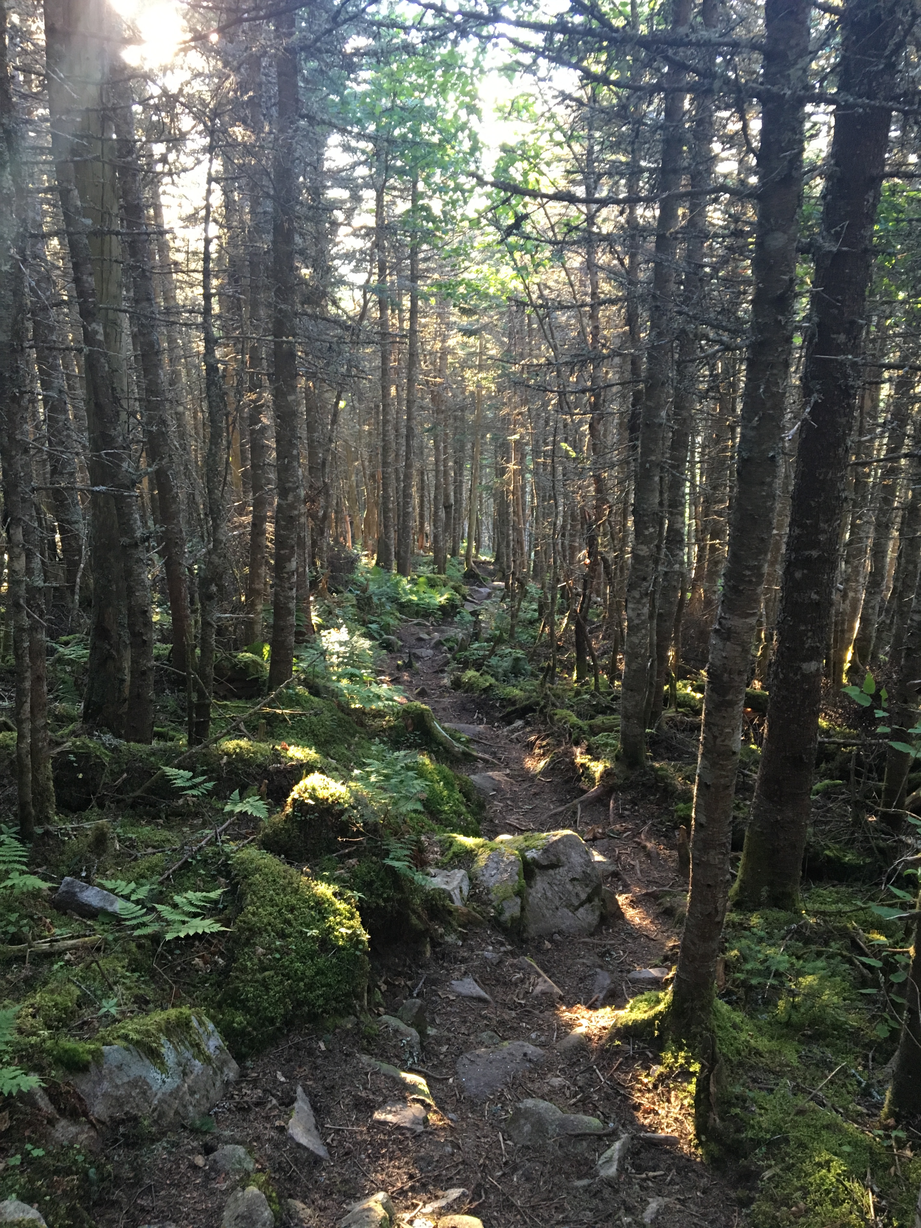
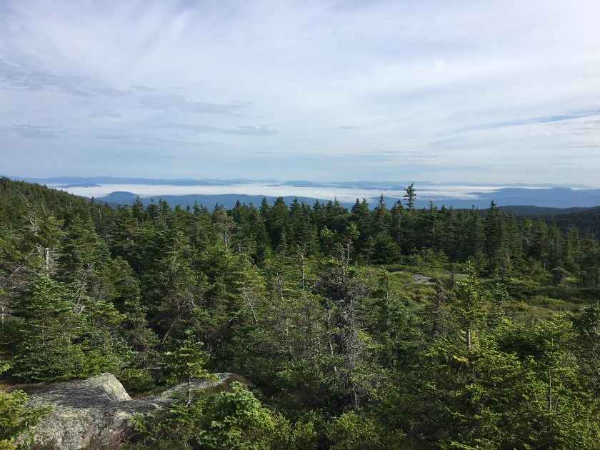
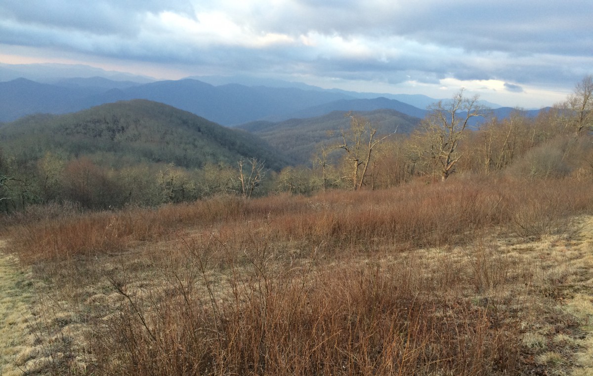
After a few miles of flat trail, we began gradually ascending the South Horn of Bigelow Mountain. The trail, despite being steep, was very pretty. We caught views the entire way up.

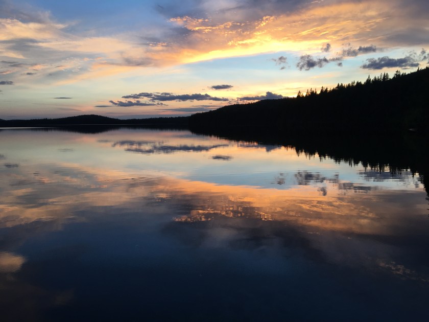
It culminated in us eating snacks, enjoying a great sunset from the top of South Horn at 7:15pm.

img_0779img_0780img_0781

We started hiking faster, covering the three miles to the Avery Memorial Campsite in the waning light – we summited the west peak of Bigelow Mountain at 8:30 and booked it into camp. I listened to Bernie Sanders DNC speech as I hiked.

IMG_0782.JPG

We quickly set up our tents amidst the maze of campsites and loud Southbound hikers. We both cooked dinner quickly and went to sleep without saying much. We were exhausted – this schedule was more difficult than we imagined.

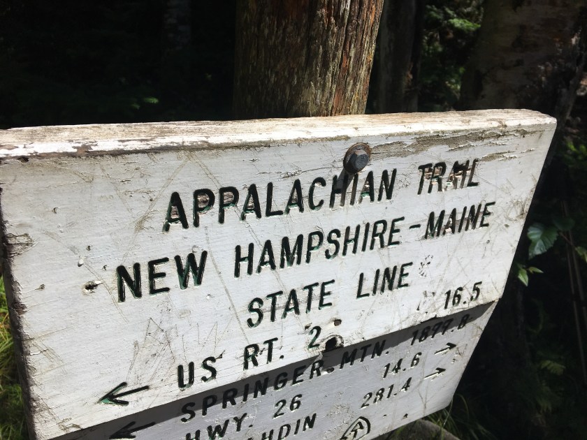
When we wake up tomorrow morning, we’ll only have ten days left before officially calling ourselves thru-hikers. Katahdin is just a heartbeat away. I can’t wait to be finished.

Day 142 – Friday, July 29: Stealth Camp (Poplar Ridge) to Stratton Motel (Stratton, ME), 21.5 miles, 2,000.9 total AT miles.

We woke up at sunrise and started packing up. You’d be surprised how much faster I am at packing in morning when I don’t have to worry about a tent. I ate a quick breakfast – Greyhound and I were ready to go by 6:00am. I ran over to the side of the cliff to find a privy and returned quickly. And just in time too – two southbound hikers joined us for sunrise as soon as I had finished.

Greyhound and I scattered. We had just enough food for one, maybe two, days hiking. And the promise of a hotel room, with laundry and a shower, lay only twenty miles ahead. The elevation profile said we could do it – we took off.

We were flying down the trail when I ran into a giant toad – he was climbing up a log to escape.

IMG_0754.JPG

We paused to take a break at a plaque commemorating the completion of the last segment of the AT – it was only 11:00am and we had hiked ten miles. We ate quickly (I privied again) and took off towards Stratton.

IMG_0755.JPG

We summited Sugarloaf Mountain at 12:45pm and kept cruising.

The hiking certainly wasn’t all easy – in fact, there wasn’t anything easy about today. We just kept pushing each other. We both wanted a night in a hotel room badly – I wanted chicken wings more than ever before. We ate snacks and joked as we tore down the mountain. And we collected more moose poop for Greyhound’s mom.

At 6:00pm, we passed the 2,000 mile mark. Not only was Stratton a mere mile away, but we were crossing the final mileage milestone before reaching the end. Katahdin lay only 189.1 miles away.

We quickly made our way to the trailhead at ME 27 and got picked up fairly quickly by the caretaker, a former thru-hiker himself. We checked into the Stratton Motel and raided the loaner clothes box so we could get laundry started as soon as possible. We were hungry – we wanted to get our chores done quickly.

With clothes in the dryer, we headed next door to the Wolf Den restaurant and grabbed two seats at the bar. We didn’t want to sit in the dining room – we still hadn’t showered and our loaner clothes looked ridiculous. We both ordered too much food – I ordered sautéed fiddlehead ferns. I had seen them sprouting up in North Carolina early in the hike and knew from experience they were tasty if prepared right. These things were awesome. We also order mussels and sandwiches. I feasted.

After dinner, we gathered our laundry and went to take showers back in the motel room. We both found a bunch of food in the hiker box in the lobby (thanks Southbounders!) and returned to the room to go to sleep. We both literally crashed – it’s been a hard couple of days.

Day 141 – Thursday, July 28: Stealth Camp (Sabbath Day Pond) to Stealth Camp (Poplar Ridge), 20.6 miles, 1,979.7 total AT miles

We woke up early, close to 5:30am. Our sleeping bags, our packs, everything, was covered in a thick dew. We packed quickly – I ran across the AT to find a suitable privy before packing up. Pad thai.

Today’s elevation profile looked nice and flat – we were ready to move. We hiked strong in the clear, crisp weather. The trail was wonderful – full of green moss and ferns. We kept our heads down and hustled – we saw an opportunity to make up lost time.

IMG_0741.JPG

We crossed ME 4, the road crossing for Rangeley, just before 11:30am and stopped to have a snack – we had already hiked almost ten miles on the day. We left quickly and started the difficult ascent of Saddleback Mountain. It took us nearly four hours, but we summited just before 4:00pm and were awarded with some great views of what lay ahead.

IMG_0742.JPG

We hiked down into a small sway and then straight back up to The Horn, summiting at 5:00pm. We decided to take another long break. We sat and watched as a thunderstorm in the distance moved in and pummel Rangeley with showers. We stayed dry by at least ten miles. It was pretty cool.

img_0745img_0752

We decided to press on and find a campsite near Poplar Ridge. We ascended Saddleback Junior, gathered water from a stream, and found a suitable spot on a ledge near the peak. We were both initially concerned about rain, but decided to risk it. The sunset brought clearer skies and, as we cooked dinner, we talked about getting another early start.

IMG_0753.JPG

Day 140 – Wednesday, July 27: Stealth Camp (Unnamed Gap) to Oquossoc, ME to Stealth Camp (Sabbath Day Pond), 12.6 miles, 1,959.0 total AT miles.

We broke camp early and were on the trail by 7:30am – for once, it didn’t rain and we started our day with deep blue skies overhead. The trail ahead looked easy – just a gradual descent down ten or so miles down to Oquossoc, ME. We wanted to make it there by lunch.

IMG_0692.JPG

As we summited Bemis Mountain at 11:00am, we ran across a huge patch of wild blueberries. We paused and picked a fresh snack for about half an hour. We also gathered moose poop for Greyhound’s mom.

IMG_0723.JPG

About that – we had actually been gathering moose poop for quite some time. Her mother read online that dried moose poop, once dipped in paraffin wax, made excellent firestarters. And they were apparently quite expensive. Greyhound thought it’s be nice to send her mom a box packed full of moose poop. I helped.

We left Bemis Mountain with another gallon-size Ziplock full of flammable feces. We hurried towards Bemis Stream, some five miles up trail. The blueberries made for a great snack, but we were both nearly out of food and running low on water. And Rangeley was still many miles away.

We were about half a mile away from the stream when we saw a small sign inviting thru-hikers to trail magic at the next road crossing. We spilled out onto the gravel road at 12:30 to find a very nice couple grilling burgers and hotdogs for hikers. What a treat! We initially didn’t let on that we were nearly out of food – I think they could tell by the rate we were consuming everything they put in front of us. Right time, right place.

We were anxious to leave, we were already falling behind schedule, but stayed and chatted for a while. We really had a great time. The couple told us that, if we needed to get to town, catching a hitch was very easy. The AT crossed ME 17 at Height of Land, a well-known vista.

We profusely thanked our hosts and headed off for the road crossing. We reached Height of Land just before 3:00pm – the views were truly stunning. But we didn’t waste our time – we quickly set about trying to get a hitch into town.

IMG_0732.JPG

After about fifteen minutes, we were picked up by a nice gentleman and driven into town. The driver dropped us off at the town market – we ran inside and grab all sorts of food. I bought shrimp, broccoli and peanut sauce – I was gonna try and cook trail pad thai tonight. We made sure to buy more than enough food to get us Stratton, ME, now two and a half days away.

After getting picked up from the market and driven back to the trailhead by a hilarious mother/son duo, we began making our way to Sabbath Day Pond. The trail was initially difficult, but we made it. We approached the pond at sunset and decided to cowboy camp on the gravel beach rather than hike closer to the lean-to.

The sunset was amazing – and so was dinner. My trail pad thai was a success. I slept a few feet from the water’s edge and listened to loons screaming as I dozed off.

img_0734img_0736

I got a text from Black Santa – he made it Rangeley.

Day 139 – Tuesday, July 26: Stealth Camp (behind the Red Hen, Andover, ME) to Stealth Camp (Unnamed Gap), 14.5 miles, 1,946.7 total AT miles.

I woke to rain. It was a little chilly – I slowly started packing up. I was still tired. Greyhound was up. We both chugged Mountain Dew and Starbucks Iced Coffees purchased from the market the night before.

We finished packing up, I left my tent to dry in the rising sun, and we walked our packs over to the Red Hen. For a small town, this place was legit. We enjoyed pancakes and sausages, fresh fruit, juice, coffee – I even bought a loaf of bread to go. We reviewed the AT Guide as we ate. We wanted to make it to Rangeley, ME in two days. The mileage would be tough, but we had enough food to get us there.

We also both bought plane tickets leaving Bangor, ME on Aug 11th. We were summiting Katahdin on the 9th, now just over two weeks away.

After breakfast, we walked over to the stop sign hoping to catch a hitch back to the trailhead – and it didn’t take long. A nice mom and her two kids thoroughly enjoyed entertaining us as we made our way back to the AT.

Despite our late start, we hiked as hard as we could. The trail was substantially easier than it had been in a while. We ran across some huge shelf mushrooms as we neared the Hall Mountain Lean-To (shelters are now called lean-to’s in Maine) We were both getting grumpy and decided to have a quick lunch at the shelter – we stopped at 11:00am having hiked six miles on the day.

img_0673img_0674

After a brutal descent into Sawyer Notch, and an equally difficult ascent back out, we paused at Moody Mountain before heading down to South Arm Road. We finally reached the trailhead at 5:00pm and immediately received trail magic – of sorts. The MATC had recently built a privy a couple hundred yards from the trailhead. Greyhound jumped at the opportunity.

IMG_0677.JPG

At 6:00pm, we summited Old Blue Mountain and enjoyed the views.

IMG_0680.JPG

We quickly descended down a mossy, rocky trail towards an unnamed gap listed in the AT Guide – we were hoping we could find a stealth spot. The sun was starting to set when, out of the corner of my eye, I noticed a clearing in the woods to my right. I walked through the trees and found a hidden campsite – it was big enough more multiple tents and came with a pre-existing fire ring. While we didn’t enjoy a campfire, we did cook a nice hot dinner before retiring for the evening.

IMG_0684.JPG

We’re both worrying about making it to 22 miles to Rangeley, ME for a resupply tomorrow night.

Day 138 – Monday, July 25th: Stealth Camp (north end of Mahoosuc Notch) to Stealth Camp (behind the Red Hen, Andover, ME), 17.3 miles, 1,932.2 total AT miles.

We woke up early and started packing quickly. As is often the case when cowboy camping, daylight often reveals you’re closer to the trail than you think you are. We were ready to go by 7:10am. We hiked strong, as if in spite of last night’s mutual rants.

We climbed hard and fast – the terrain was still pretty steep. We topped the Mahoosuc Arm at 8:15 and summited Old Speck by 9:00. We had already hiked nearly four miles.

img_0652img_0654

We attacked the 2,500 foot descent towards Grafton Notch – the AT Guide promised trash cans and privies. We reached Grafton Notch at 11:30 and ate a big lunch. The weather was great and we were cruising. A little after noon, we resumed hiking.

img_0663img_0664

On our way up Baldpate Mountain, we met a couple of day hikers – Greyhound actually struck up the conversation. We told them of our plans to hitch into Andover, ME and camp behind the town diner. While they were familiar with hikers being allowed to do this, they cautioned us against relying on a hitch from East B Hill Road. Apparently, it was a little-used, private-access, gravel road eight miles away from.

This was disheartening. We both really needed a mini-resupply quite bad. But we really had no option – I’d walk to town if I had to. After a few minutes, the couple gave us their number. They lived close to the trailhead and would be happy to give us a ride – good job Greyhound!

We continued our ascent of Baldpate reaching the west peak at 3:00pm. We were treated to some extraordinary views.

And blueberries.

IMG_0669.JPG

We stormed down Baldpate, bypassing the Fry Notch Lean-to and cruising towards the road. About a mile before we reached East B Hill Road, my back thing flared up again. I had to strip down, right in the middle of the AT, and throw on the only clean thing I had left – my baselayer. I was miserable.

We passed two pretty waterfalls and followed a stream towards the trailhead.

IMG_0671.JPG

But I had cell service – I called the couple Greyhound met and we soon found ourselves on the way to town. They dropped us off at the town market, basically a glorified convenience store – but it had everything we needed. Greyhound bought a “crab roll” (it was gross) but quickly redeemed herself by eating two ice creams.

We met a few hikers staying at a hostel a few blocks away. We briefly considered joining them but figured, what’s the point in paying for a bunk this late at night? We gathered up our purchases and headed across the street to the field behind the Red Hen, the town diner. We set up in the dark and quickly went to sleep. I remember a light rain falling.

Day 137 – Sunday, July 24: Gentian Pond Campsite to Stealth Camp (north end of Mahoosuc Notch), 12.3 miles, 1,914.9 total AT miles.

I woke up at 6:30am to the sound of a light rain hitting my tent. Not again, I thought. I rolled over and went back to sleep. I woke up at 7:00 and decided to start packing up. I wasn’t a happy camper. I ate snacks in my tent waiting for the rain to subside. At 7:30, I left to use the privy – it was cold and damp, but at least it wasn’t raining.

I made my way back down to the campsite and took down my tent. Greyhound and I were ready to go at 8:15. We began a steep ascent of Mount Success – the trail was actually a stream in places.

IMG_0567.JPG

We neared the summit at 9:00am – the rain had stopped and we enjoyed some excellent hiking weather.

IMG_0568.JPG

Greyhound and I followed a family of grouse down the trail.

IMG_0575.JPG

And at 11:20am, we crossed into Maine – the last state on the AT. We stopped and reflected a bit. This last leg of the trail had been rough – and I’m talking about before I met Greyhound. While I’ve had moments where I was hiking strong, I really haven’t regained the same Virginia speed that I apparently lost in northern Pennsylvania.

img_0577img_0578

It’s been tough. I certainly didn’t intend to outpace Savage – or potentially get outpaced by Black Santa. It’s just the way it happens – it’s hike your own hike.

I do know that I’m thankful to have met Greyhound. She’s become an ally, a partner and a close friend.

And if Black Santa needs to finish ahead of me, he already knows I wouldn’t be where I’m at right now, making the decisions I’m making, without his months-long support, guidance and true friendship. Black Santa – you son of a bitch. I love you brother.

And here we were, about to enter the last state on the AT. We were 281.8 miles away from Katahdin. We felt great – we felt truly motivated. We were ready to finish this thing.

We took a quick lunch on Mount Carlo and headed for Goose Eye Mountain. We faced some steep climbs with more rebar rungs sunk into rock. But the weather was beautiful.

IMG_0595.JPG

And we were awarded with views the entire way.

IMG_0580.JPG

Then we hit the Mahoosuc Notch. It was 6:00pm and we had hiked ten miles on the day. Not bad considering the terrain. The Mahoosuc Notch is famous – it’s widely considered “the most difficult mile on the AT”. The trail runs over, under and around house-sized boulders jumbled about in a very narrow, but very steep, valley. It was fun at first, there was still ice from winter (It’s July 24th) hidden under some of the boulders.

IMG_0622.JPG

We were forced to climb through small caves – and it wasn’t out of choice or just to have extra fun. We were required to squeeze through small opening to navigate the Mahoosuc.

img_0623img_0626

We finally navigated the entirety of the notch at 7:45pm – it took us nearly two hours to cover a mile. At first it was fun, but after a while it became infuriating.

IMG_0635.JPG

I just wanted to find a place to camp. (Notice my tone – I’m starting to get really whiny here – just ask Greyhound) Unfortunately, the Bull Branch campsite is over-full.

We press on and cross the stream up trail from camp. There was a bit of a ledge – just large enough for two people to sleep and not be on the AT. I had had enough.

I was having this embarrassing problem with the skin on my back. After a long day of hiking, at some point, the sweat on my shirt would have this reaction with my back – I’d break out in a million tiny red dots that itched like you wouldn’t believe. I’d have to throw my pack down at times and rub my back against a tree. I couldn’t figure it out.

But this time, the burning was bad. I threw my pack down, ripped my shirt off, and started bathing right in the middle of the creek. I was cussing and half-crying – it was awful. I scrubbed my back and put on a clean shirt – it somewhat helped. I then apologized to Greyhound for throwing a temper tantrum.

But it seems as if my crappy mood had struck a nerve – she joined right in. She was just as miserable right now. The trail was difficult, we were on semi-aggressive timeline. The weather. Beef jerky and tuna packets. Her busted Brooks trail runners. It all came out.

We sat on the edge of the creek and made dinner. Maybe it was good we voiced the resentments we’d been building up towards the AT, the hike, everything. It felt cathartic.

I didn’t clean my pot. I didn’t pack up my food. I just fell asleep on the ledge next to the creek.

Day 136 – Saturday, July 23: White Mountains Hostel (Gorham, NH) to Gentian Pond Campsite, 11.8 miles, 1,902.6 total AT miles.

We woke up late and hung out in our room waiting for breakfast, which was included in our stay. By 8:00am we were enjoying French toast and bacon – it was delicious. After eating, Greyhound and I returned to our room to finish packing. My food bags were overflowing again.

We left the hostel with Black Santa at 10:30am after slowly packing all morning. I weighed my pack on a hanging scale in the garage before departing – 47 pounds! I couldn’t believe it!

We hiked up Mount Hayes – Black Santa spotted some moose poop on the trail. We also found wild blueberries – they were very tasty! We kept stopping to munch on blueberries – but we had to get going. Storm clouds were moving in. Black Santa took off ahead – Greyhound and I eventually lost him in the distance.

IMG_0565.JPG

We hiked on in the rain for the rest of the afternoon. It was cold and miserable. The trail wasn’t exceptionally rough, just more of the same slow-goings. It was impossible to stay dry. At one point, I slipped on a boardwalk and fell backwards onto the planks. I stuck my hand out to pick myself up (and avoid getting more wet), when my arm sunk deep into the mud. I almost lost balance and fell in! I got lucky and righted myself – we took off for the next shelter at Gentian Pond.

We arrived at 7:00pm, thoroughly soaked and both of us unwilling to hike any further. We quickly set up our tents – it had briefly stopped raining and put on dry, warm clothes. Man, I’m getting really sick of being cold and wet out here! We walked up to the shelter to cook dinner and saw that Ralphie was bunking there for the night.

We hadn’t seen him in a while – but he saw Black Santa today. As we cooked, we wondered as to how far Black Santa was going to hike. We thought there was a very good possibility that the rain knocked Black Santa off the trail and we passed him trying to get to Gentian Pond. After consulting with Ralphie, Greyhound and I were nearly sure of it – Black Santa was somewhere behind us.

After dinner, the sun set and the temperature dropped. Greyhound and I said goodnight to Ralphie and headed over to our campsite. We stayed up discussing our plans moving forward for the better part of an hour and came up to a few conclusions.

First, there’s no way we can summit Katahdin on August 7th like Black Santa wanted to. We could theoretically push ourselves and potentially make it, but choosing that date leaves zero room for error. We were already in a position where we couldn’t take any more zero days – we simply needed more cushion, more time.

Second, August 9th not only marked my last day to finish the AT in less than five months, it marked Greyhound’s 150th day on the AT. Suddenly, that date became much more meaningful.

We decided to do our best to keep up with Black Santa’s timeline, but acknowledged we may not be able to keep up with his ambitious pace. I sent him a text explaining my situation at 9:00pm, dozing off to sleep not too much after that.


Day 135 – Friday, July 22: Stealth Camp (Middle Carter Mountain) to White Mountains Hostel, Gorham, NH, 10.5 miles, 1,890.8 total AT miles.

We woke up at 4:45am primed to have get to the hostel. We both needed showers and clothes laundered – I needed to pick up my mail drop and do a major resupply. We briefly enjoyed a gorgeous sunrise while we quickly ate breakfast and packed up.

img_0556img_0559

We hit the trail pre-dawn. We both stopped at the Imp Campsite to gather water. It was only 8:00am and Black Santa was nowhere to be found – I guess he wanted to get to the hostel as bad as we did.

After a tough climb up and over Mount Moriah, the trail got very nice. We were cruising, we did the last three mile stretch in an hour, spilling out onto US 2 at 11:00am – we covered almost eleven miles on the day.

IMG_0561.JPG

We entered the hostel and dressed in loaner clothes. Greyhound and I were given a room (with our own bathroom) and we both took quick showers. I borrowed a pair of hair clippers and trimmed my beard off – it was getting to be a little too much to handle again. (Greyhounds been starting at me all night – I think my lack of a beard freaks her out).

We decided to hitch into town and grab lunch – Black Santa had already taken the shuttle and was running errands by now. We found and open restaurant and sat in the bar to eat lunch. We both pulled out our AT Guides while we waited for our food and attempted to plan out the next week of hiking.

A nice guy at the bar introduced himself to us as a past thru-hiker and marked all sorts of things to look out for in Greyhound’s book. We ate lunch and quickly left, stopping at the outfitter so I could buy a new pair of trail runners – and the only thing they had were the same blue pair of Merrells I had just gotten rid of in Manchester Center, VT. I bought them, but I wasn’t happy about it.

We made our way over to the gas station to buy some snacks and take them back to the hostel. We quickly got a ride from a couple pumping gas and soon found ourselves back at the hostel.

After relaxing with Black Santa and eating leftover pizza, Greyhound and I take the shuttle to Walmart for a proper resupply.

Upon our return, I hang out with Black Santa outside while Greyhound relaxed in the room. While we’re talking, he expresses his desire to summit Katahdin no later than the 7th of August. I explained I didn’t see how I could finish in that timeframe and enjoy myself in the process. But I didn’t make up my mind just then – I decided to sleep on it.

Day 134 – Thursday, July 21: Stealth Camp (Pinkham Notch) to Stealth Camp (Middle Carter Mountain), 10.5 miles, 1,880.3 total AT miles.

I woke up and decided to eat my leftover chicken before even getting out of my sleeping bag. I was still delicious. I slowly started packing up, calling out to Black Santa to see if he was up. I stuck my head out of my tent – he was nearly ready to go. Apparently, there was an all you can eat breakfast buffet back at the Pinkham Notch Visitor’s Center.

IMG_0515.JPG

Greyhound and I were soon up, packed and ready to eat as well. I left my tent up and we threw our packs in it so we wouldn’t have to bring them to breakfast. We walked the short distance back down the AT and entered the visitor’s center. I quickly bought my ticket for breakfast and grabbed a tray of food. I ended up going back for seconds. And thirds. I ate bacon, sausage, pancakes, muffins, fruit, baked beans. More bacon and sausage.

The three of us left an hour later completely stuffed. We shuffled back to our campsite grab our packs. Black Santa was ready to go (sort of), Greyhound and I were in serious food comas. I decided I needed a short nap before pressing on – Greyhound thought it was a good idea as well. Just as I was about to nod off, I heard a familiar voice talking to Black Santa outside. I stuck my head out of my tent.

It was Monster! I hopped up and ran over to him, I hadn’t seen him in a long time – honestly, I thought I never would again. We chatted for a while. He had been taking time off from the trail in bits and pieces, but was now ready to begin the final push to Maine and beyond. After saying goodbye, Monster took off northbound with Black Santa on his heels.

It was 9:00am and I finally settled down to take that after breakfast nap. I woke up at 10:30am and called out to Greyhound. She was awake, I think. I exited my tent and finished packing up. By 11:00am, Greyhound and I were back on track. We caught a nice view of Mount Washington as we climbed north out of Pinkham Notch.

IMG_0520.JPG

The trail up Wildcat Mountain was extremely steep and rocky – it took us nearly two hours to summit and make it to the ski gondola. The subsequent ridgewalk stayed rocky – it looked like today was already shaping up to be a one mile per hour kind of day.

IMG_0522.JPG

Black Santa stayed ahead all day. At 4:30, Greyhound and I stopped in at the Carter Notch Hut and drank three glasses of lemonade each before heading outside to take a break. I hung out at the pond and enjoyed the surrounding views.

IMG_0542.JPG

The weather was beautiful – a far cry from the 30-degree temps we suffered a few days ago on Mount Washington.

IMG_0530.JPG

We crossed Carter Dome and Mount Hight at 7:00pm, just as the sun was starting to set. It was beautiful outside. We hiked on finally finding a nice stealth spot on the top of Middle Carter Mountain at dark. While we both wanted to hike further and catch up with Balck Santa at the Imp Campsite three miles ahead, we had plenty of water for dinner and clear skies ahead.

IMG_0551.JPG

It was windy outside so I used our packs and stuff sacks to build a wind break. We unrolled our sleeping bags in a natural depression and cooked dinner. Greyhound fell asleep quickly and I watched the night’s sky. I can’t remember the last time I saw the Milky Way that vividly. I eventually fell asleep late.

Tonight, we decided to head into Gorham, NH and stay at a hostel right near the trailhead – Black Santa’s planning on meeting us there.